SANSA Airlines is an airline based in San José, Costa Rica. It operates scheduled passenger services as part of the TACA Airlines regional airline system, and is a subsidiary of Avianca Costa Rica. Its hub is Juan Santamaría International Airport.

Tobías Bolaños International Airport is one of four international airports in Costa Rica, and the secondary airport serving the city of San José, after Juan Santamaría International Airport. It is located in downtown San José, in Pavas District, San José Canton.

Barra del Colorado Airport is an airport serving the Barra del Colorado Wildlife Refuge in Limón Province, Costa Rica.
Golfito Airport is an airport serving Golfito, a port town on the northwest end of Golfito Bay, an inlet off the Gulf of Dulce in the Puntarenas Province of Costa Rica. The airport is owned and managed by the country's Directorate General of Civil Aviation (DGAC).
Coto 47 Airport is an airport serving Coto 47, a community among the oil palm plantations in Puntarenas Province, Costa Rica. The runway is 16 kilometres (9.9 mi) from the Panama border.
Palmar Sur Airport is an airport serving the adjacent towns of Palmar Norte and Palmar Sur in Osa Canton, Puntarenas Province, Costa Rica.
Puerto Jiménez Airport is an airport serving Puerto Jiménez, a Gulf of Dulce coastal town in Puntarenas Province, Costa Rica. The airport is just east of the town. It is owned and managed by the country's Directorate General of Civil Aviation (DGAC).
Tambor Airport is an airport serving Tambor, Costa Rica. The airport also serves tourist destinations like Mal Pais, Santa Teresa, Montezuma, and the Cabo Blanco Absolute Natural Reserve.

Bahía Drake Airport is an airport serving Bahía Drake, a Pacific coastal district with a long tradition as a tourist destination in Osa Canton, Puntarenas Province, Costa Rica. The airport is also known as Drake Bay Airport.

Palmar Sur is a town in Costa Rica, located next to Palmar Norte in the Osa region of Puntarenas Province of Costa Rica. Palmar Norte and Palmar Sur are separated by the Rio Terraba. Palmar Sur has a regional airport that has daily flights arriving from San Jose on two regional airlines.
Finca 63 is a town nearby Río Claro, Costa Rica, located 2 miles south on Costa Rica Highway 14 in Puntarenas Province. The airport in Finca 63 serves the city of Río Claro.
Finca 63 Airport is an airport that serves the town of Finca 63 and the city of Río Claro, Costa Rica. The airport is located 2 mi (3.2 km) south of Río Claro.
Plymouth Municipal Airport is a county-owned, public-use airport located two nautical miles south of the central business district of Plymouth, in Washington County, North Carolina, United States. According to the FAA's National Plan of Integrated Airport Systems for 2009–2013, it is classified as a general aviation airport.
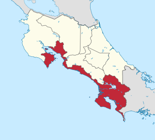
Southern Zone International Airport is an airport planned for construction in Osa Canton, Puntarenas Province, Costa Rica. The airport will be located in the region known as Southern Zone, where several national parks and other touristic attractions are located. The airport was a promise of former President Laura Chinchilla to boost the economic development of the region, and its construction was slated to start during her term, which ended in 2014.
SANSA Flight 32, a CASA C-212 Aviocar on its way to Palmar Sur Airport crashed into the Cerro Cedral, a mountain in Costa Rica after takeoff from Juan Santamaria International Airport in San Jose on January 15, 1990. All 20 passengers and 3 crew on board died in the crash. Pilot fatigue was determined to be the cause. At the time, it was the worst accident involving a CASA C-212 Aviocar and is currently the fifth worst accident. It is also currently the second worst accident in Costa Rica.
Nicoya Airport is an airport serving the city of Nicoya in the Guanacaste Province of Costa Rica. The airport is owned and managed by the country's Directorate General of Civil Aviation.
Dieciocho Airport is an agricultural airport serving Finca Dieciocho and other oil palm plantations in Puntarenas Province, Costa Rica. The airport is 7 kilometres (4 mi) southeast of Palmar Sur and 1 kilometre (0.6 mi) off the Pan-American Highway. The runway lies alongside an unpaved field access road.
Las Piedras Airport is an airport serving the agricultural region southwest of Cañas in Guanacaste Province, Costa Rica. The nearest town is Bebedero, 1.6 kilometres (1 mi) north-northeast.
Palmar Norte is a town in Costa Rica, located next to Palmar Sur in the Osa region of Puntarenas Province. Although small, the town serves as a major agricultural center and as an important transit point for travelers to the Palmar Sur Airport. It is also home to the stone spheres of Costa Rica. Palmar Norte and Palmar Sur are separated by the Rio Terraba. The river overflowed during Tropical Cyclone Nate in October 2017, sweeping away houses and leaving 200 residents homeless.