Oberlichtenau | |
|---|---|
 Coat of arms | |
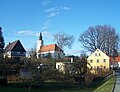
 Location of Oberlichtenau | |
 Oberlichtenau  Oberlichtenau | |
| Coordinates: 51°13′15″N13°59′30″E / 51.22083°N 13.99167°E | |
| Country | Germany |
| State | Saxony |
| District | Bautzen |
| Town | Pulsnitz |
| Area | |
• Total | 10.03 km2 (3.87 sq mi) |
| Elevation | 270 m (890 ft) |
| Population (2006-12-31) | |
• Total | 1,472 |
| • Density | 146.8/km2 (380.1/sq mi) |
| Time zone | UTC+01:00 (CET) |
| • Summer (DST) | UTC+02:00 (CEST) |
| Postal codes | 01936 |
| Dialling codes | 035955 |
| Vehicle registration | BZ |
| Website | www |
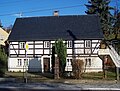
Oberlichtenau (Upper Sorbian : Hornja Lichtenawa) is a village and a former municipality in the district of Bautzen, in Saxony. Since 1 January 2009, it has been part of the town of Pulsnitz. [1]