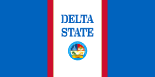
Delta State is a state in the South-South geopolitical zone of Nigeria. Named after the Niger Delta—a large part of which is in the state—the state was formed from the former Bendel State, on 27 August 1991. Bordered on the north by Edo State, the east by Anambra and Rivers states, and that south by Bayelsa State while to the west is the Bight of Benin which covers about 160 kilometres of the state's coastline. The state was initially created with 12 local government areas in 1991, but was later expanded to 19 and now has 25 local government areas. Its capital city is Asaba which is located along the River Niger on the northeastern end of the state, while the state's economic center is the city of Warri on the southwestern coastline.
Atani is a city on the eastern bank of the Niger River in Anambra State, Nigeria. Atani is the headquarter of Ogbaru Local Government Area, a Local Government in the Northern Senatorial District of Anambra State. It is one of the communities in Ogbaru situated in Igboland. Her political relations differ not so much from what obtains in other communities in the Igbo enclave. Disparities however exist in terms of geographical location and tradition. The political structure in Igboland begins from the family- Umunna as the smallest unit, and extends to community – Obodo, which is the largest unit. It was a town populated by early fishermen and migrant settlers. Atani is still the rice, fish, yam and cassava basin of Anambra state, producing most of the food sold in many markets in Delta and Anambra States. Atani people are Ukwuani.

Igbo land, east is the indigenous homeland of the Igbo people. It is a cultural and common linguistic region in southeastern Nigeria. Geographically, it is divided into two sections by the: an eastern and western.Its population is characterized by the diverse Igbo culture
The Anioma people are Igbo groups predominantly indigenous to present day Delta State, Nigeria, along with communities in Edo State. The Anioma people encompass and are native to the nine northeastern Local Government Areas of Delta State and the Ika-Igbo communities of Edo State. Politically, the Anioma occupy the Delta North Senatorial District where they are the majority group.
Abagana is a town in Nigeria. It is the headquarters of Njikoka Local Government Area Anambra State and lies approximately 20 kilometers from Onitsha along the old Enugu-Onitsha Trunk A Road that divides the town into two halves.
Nkpor is a town in Idemili North local government area of Anambra state. The town of Nkpor had an estimated population of 109,377 in 2007. It is attached to the much larger city of Onitsha to the west, Oze to the north, Ogidi and Umuoji to the east, and Obosi to the south. The name 'Nkpor' is derived from the adulteration of the Igbo word nkpogha meaning 'repositioning'.Nkpor is known for its farming prowess. There is a maize known as ‘akpu aka Nkpor’ because of its robust yield and is reminiscent of Nkpor men who are often muscular. In ancient times, a rich man is known in Nkpor for his rich yam barn and the number of animals in his pen. An average Nkpor indigene does not buy foodstuff in the market and does not deny his visitors food. Nkpor is a traditional Community that worshiped the God of their ancestors before the advent of Christianity.
Igbuzo is an Igbo community in Delta State, Nigeria, founded c. 1450. The community is in Oshimili North. It has an estimated population of 566,310 people in 2009. The people speak the Enuani dialect of the Igbo language. The name of the community is more commonly and officially known and written as Ibusa. The movements forming the process of Ibusa can be linked to the first and second waves of the movement of Igbo migrants into the West Bank of the Niger River. The first adventure was led by Edini from Nshi (Nri) and the second of the two waves of migrations was led by Umejei from Isu resulting in the formation of Igbuzo.
Enuani is an Igbo dialect spoken in Nigeria by the Anioma people of Delta State, Onitsha, Obosi and Ogbaru in Anambra State, Mgbidi in Imo State, Ndoni in Rivers State and some parts of Ibaji in Delta state. Enuani is tonal like the rest of Anioma dialects and is particularly related to the standard Igbo pronunciation in many regards. The Enuani dialect is the dominant Anioma dialect in Delta State.
Ogba–Egbema–Ndoni is a Local Government Area of Rivers State, in South-South Nigeria under Rivers West Senatorial District, with its headquarters at Omoku. With about 258,700 People according to 2006 Census. It is bounded by Imo, Delta, Bayelsa, and Anambra States and also by Ahoada West, Ahoada East and Emohua Local Government Areas of Rivers State. They are part of the Igboid speaking Areas of Rivers State with three Tribes starting with Ogba as the dominant tribe with 12 legislative wards, the Egbema and Ndoni people who are also found in Ogbaru L.G.A and Ukwuani L.G.A both with 2&3 legislative wards respectively. It is majorly upland and home to the highest upstream Oil and Gas exploration/exploitation activity in the State since the early 1960's with about 12 mining/producing fields operated by AGIP, Total Energies and Shell/NPDC with many other reserve/untapped fields. It is part of the Ogba / Egbema / Ndoni / Ahoada West constituency of the Nigerian House of Representatives. Hon. Vincent Job is the Executive Chairman of ONELGA.
Aniocha North is a Local Government Area of Delta State, Nigeria, with its headquarters in Issele Uku. It comprises the subgroup of Anioma and towns. The National Youth Service Corps (NYSC) permanent orientation camp for Delta state is located at Issele Ukwu town.
The Urhobos are people located in southern Nigeria, near the northwestern Niger Delta.
Ase is a coastal community on the shores of the Ase River, off River Niger in Ndokwa East Local Government Area of Delta State, Nigeria. Ase River derives its name from Ase town. Ase is an idyllic countryside with a spectacular and breathtaking natural beach, evergreen rain-forest vegetation rich in flora and fauna which overhangs the Ase Creek. Ase is a serene natural tourist resort still waiting to be explored. Ase shares common boundaries with Ibedeni, Onyah, Aviara, Uzere, Patani and Trofani.
Iyede-Ame, derived its name from Iyede, an upland town in Isoko South Local Government Area in Delta State, Nigeria.
Onikwu is a community in Rivers State, Nigeria. Onikwu is self-contained district or community within Ndoni town, distance is about 6.4 km from Ndoni to Onikwu. The name "Oni-kwu/Nd-oni, Ndoni also pronounce Nde-Oni means Oni people while Oni-ukwu meaning the elder of Oni people. In Ukwuani-Aboh-Ndoni language (Igboid) ukwu means elder, and Nde means people of. Onikwu and Ndoni are of same ethnic group located in Ogba Egbema/Ndoni Local government of Rivers State. The community alongside them have other neighboring villages which include Ase-Azaga, Isukwa, Odugiri. Agwe, Ugbaja, Isala Ase-Imoniteh and Ogbe-Ogene. All of the said communities are located in the Central Niger Delta region, south-south Nigeria.
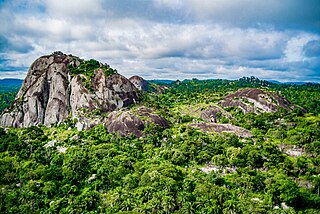
Ugbo is one of the few aborigines east of the River Niger, Nigeria, and has existed in its current location dating back to the Ancient History. The town is known for its natural habitat, including serene hills, caves, large rocks and stones, rivers, forests, wild animals, and fertile lands. Ugbo is the ancestral home to many towns in Igboland. Ogulugu is the oldest son of Ewa, the original progenitor of nearby communities, including Amoli, Agbudu, Isu-Awaa (Ewa), Ituku, and Ogbaku. The Ewa (Awaa) kindred, together with Ntuegbe, make up what is known as Mbanabor clan in Awgu LGA of Enugu State. Based on 2006 census, the population of Ugbo is projected to be about 32,000. Ugbo comprises three autonomous communities, namely, Ugbo-Okpala, Ugbonabor, and Ngene Ugbo. Ugbo-Okpala is made up of three major villages, namely, Umuebem, Uhugwu, Umuonaga.
Ogwashi Ukwu, sometimes spelt as Ogwashi-Uku, is an Igbo town in Delta State, Nigeria. Located west of the state capital Asaba, it is the headquarters for the Local Government Area, Aniocha South. The population of Ogwashi-Ukwu is about 50,234.. However, its number has increased vastly and keeps increasing. It is an Anioma region of Delta State which is home to the Igbo-speaking people of Delta State. Its natives are the Enuani people, who are predominantly farmers and fishers. The villages in Ogwashi-Ukwu include Ikelike, Umu Dei, Azungwu, Agidiase, Agidiehe, Ogbe Akwu, Ishekpe, Ogbe Onicha, Ogbe Ubu, Ogbe Ani and Umu-okwe.

Idumuje Unor is a town situated in the Aniocha North Local Government Area of Delta State, Nigeria, lying between 6020’ 01.4’’ N and 60 22’ 06.5’’ N and between 60 25’ 01.4’’ E and 60 27’ 06.6’’ E. It is located 5 kilometers from Issele-Uku, the headquarters of Aniocha North and has a growing land area of 16sq km and current estimated population of about 20,000 inhabitants. It is bordered to the west by Onicha-Ugbo, to the North by Idumuje-Ugboko and Ewohinmi in Edo State, to the East by Onicha-Uku and Ugbodu and to the south by Issele-Uku. The name Idumuje in the Esan language could be translated to mean; Idumu - Community/Quarters and Oje - King/Royal. In other words, Idumuje means Royal Quarters or Kings' Quarter. Worthy to note: Another Idumuje named location could be found at present in Benin. The suffix "Unor" is an inclusion to the town's name so as to differentiate it from the breakaway community Idumuje -Ugboko; by a man called Nwoko and his supporters some 300 years ago. Ugboko is translated to mean "Ugbo" - Farm & "Oko" - a shortening of the name Nwoko.
The South South is one of the six geopolitical zones of Nigeria. It designates both a geographic and political region of the country's eastern coast. It comprises six states – Akwa Ibom, Bayelsa, Cross River, Delta, Edo, and Rivers.

The Olukumi are an ancient Yoruba subgroup indigenous to the Aniocha North area of the Delta State, Nigeria. They originate from Yoruba people and settled in this area long ago. They trace their ancestry to Owo and Akure. The Olukumi occupy eight communities west of the Niger River, and are together known today as the Odiani Clan in Aniomaland. Ukwu Nzu town is the historical headquarters of the Olukumi people and is traditionally headed by the Obi of Ukwu Nzu, Agbogidi. The present Obi is H.R.M. Obi Ogoh 1. Olukumi villages select leaders through the Okpala Obi system, which is the Okpala (gerontocracy).
Awah, or Avba, is a town in Delta State, Nigeria. Located on the shores of the Ase River in the Ndokwa East Local Government Area, it is one of the Isoko speaking communities found in the Old Aboh political division. Until the creation of Delta State in 1991, it was formerly with the Ndoshimili Local Government Area with headquarters located in Kwale, in the defunct Bendel state.
