
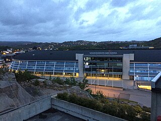
Lund is a borough and district in the city of Kristiansand in Vest-Agder county, Norway. It is the second largest borough in the city after Vågsbygd. In 2015, the population was about 30,000. Lund is divided into 4 districts: Lund (centrum), Gimlekollen, Justvik, and Ålefjær.

Bråvann is a neighbourhood in the city of Kristiansand in Vest-Agder county, Norway. The neighborhood is located in the borough of Vågsbygd and in the district of Voiebyen. The neighbourhood is located in the western part of the district at the top of a hill and consists mostly of large households. It lies to the west of Rådyr and northwest of Skutevika.

Møvik or Møvig is a neighbourhood in the city of Kristiansand in Vest-Agder county, Norway. The neighborhood is located in the borough of Vågsbygd and in the district of Voiebyen. It's located in the southeast part of the borough along the shore. It lies north of Spinneren and Krooden, southwest of Ternevig, and south of Voie.

Rona is a neighborhood in the city of Kristiansand in Vest-Agder county, Norway. It is a part of the Oddernes borough and the district of Søm. The neighbourhood is next to European route E18, and spans the Indre Rona strait between Drangsvatna lake and the Topdalsfjorden. The neighborhood of Strømsdalen lies to the north and Strømme lies to the south. The closest school is Strømme Elementary school. All local bus lines goes through Rona.

Tømmerstø is a neighbourhood in the city of Kristiansand in Vest-Agder county, Norway. It's located in the borough of Oddernes and in the district of Randesund. The neighborhood of Odderhei lies to the northwest, Holte and Frikstad lie to the northeast, and Kongshavn lies to the southeast.
Marvika or Marvik is a neighbourhood in the city of Kristiansand in Vest-Agder county, Norway. The neighbourhood is located in the southeast part of the borough of Lund and the district of Gimlekollen. The neighborhood of Oddemarka lies to the northwest of Marvika.

Bjørndalssletta is a neighborhood in the city of Kristiansand in Vest-Agder county, Norway. It is located in the borough of Lund in the district of Gimlekollen. The neighborhood is located next to the European route E18 highway and the lake Vollevannet. There is a large garden store at Bjørndalssletta. The neighborhood of Oddemarka lies to the southwest, the neighborhood of Presteheia lies to the west, Gimle lies to the north, and the Topdalsfjorden lies to the east.
Fiskåtangen or Fiskå is a neighbourhood and small peninsula in the city of Kristiansand in Vest-Agder county, Norway. It is located in the borough of Vågsbygd and in the district of Slettheia. The islands of Svensholmen and Bragdøya lie to the southeast off the coast of Fiskåtangen. The neighborhood is located to the west of Kjerrheia and north of Lumber. Fiskåtangen has the only junior high for the district of Slettheia. Fiskåtangen has a large industrial area serving Vågsbygd and Kristiansand. The local newspaper Fædrelandsvennen was headquartered at Fiskå before it relocated to Kvadraturen in the summer of 2015.
Kartheia is a neighbourhood in the city of Kristiansand in Vest-Agder county, Norway. It is located in the northern part of the borough of Vågsbygd and in the district of Slettheia. The neighborhood lies southwest of the junction of the European route E39 highway and the County Road 456. The district of Hellemyr lies to the north. Kartheia contains residential areas as well as a large industrial area. Gislemyr lies to the south, Trane lies to the west, and Hannevika lies to the east.
Voie is a neighbourhood in the city of Kristiansand in Vest-Agder county, Norway. The neighborhood is located in the borough of Vågsbygd and in the district of Voiebyen. Voie lies along Norwegian County Road 456 and County Road 457. The only road to the island of Andøya goes past the neighborhood of Voie. It lies northwest of Møvik and northeast of Steindalen.

Kjøita or Kjøita Park is a neighbourhood in the city of Kristiansand in Vest-Agder county, Norway. It's located along the eastern shore of the Otra river in the borough of Lund. The neighborhood of Oddemarka lies to the east, Gimle lies to the north, and the centre of Lund lies to the southeast. Kjøita Park is an industrial park.

Gimle is a neighbourhood in the city of Kristiansand in Vest-Agder county, Norway. It's located in the borough of Lund. It is located near the neighborhoods of Oddemarka and Presteheia. The neighborhood of Kjøita lies to the southwest and the neighborhood of Marvika lies to the southeast.

Auglandsbukta is a neighbourhood in the city of Kristiansand in Vest-Agder county, Norway. The neighborhood is located in the borough of Vågsbygd and in the district of Vågsbygd. There is a large marina harbour and park located in the cove of Auglandsbukta. There is also a gas station and some real estate offices at Auglandsbukta. Auglandsbukta is next to Norwegian County Road 456. Augland lies to the west and Skyllingsheia lies to the north.
Frikstad is a neighbourhood in the city of Kristiansand in Vest-Agder county, Norway. It's located in the borough of Oddernes and in the district of Randesund. Randesund Church is located at Frikstad. The neighborhoods of Holte and Tømmerstø lie to the southwest and the neighborhood of Kongshavn lies to the southeast.
Kongshavn is a neighbourhood in the city of Kristiansand in Vest-Agder county, Norway. It's located in the borough of Oddernes and in the district of Randesund. The neighborhood of Frikstad lies to the north and Tømmerstø lies to the northwest. Kongshavn Pier is a large harbor with connections to islands outside of Randesund.

Odderhei is a neighbourhood in the city of Kristiansand in Vest-Agder county, Norway. It's located in the borough of Oddernes and in the district of Randesund. The neighborhood is located northwest of Tømmerstø and Holte. The nearby district of Søm lies to the north.
Holte is a neighbourhood in the city of Kristiansand in Vest-Agder county, Norway. It's located in the borough of Oddernes and in the district of Randesund. The neighborhood of Tømmerstø lies to the south and Frikstad lies to the east. Holte Junior High is the only junior high in Randesund.
Åsane is a neighbourhood in the city of Kristiansand in Vest-Agder county, Norway. The neighborhood is located in the borough of Vågsbygd and in the district of Vågsbygd. The Åsane Elementary School serves the neighborhood. Åsane is north of Bråvann, south of Nordtjønnåsen, and west of Bjørklia.
Dalane is a neighbourhood in the city of Kristiansand in Vest-Agder county, Norway. It is located in the borough of Grim and in the district of Grim. The neighborhood lies along the Norwegian National Road 9, north of Tinnheia and Krossen and south of Strai.

Gillsvannet or Gjelsvannet is a freshwater lake in the municipality of Kristiansand in Vest-Agder county, Norway. The 1.05-square-kilometre (260-acre) lake is located about 5 kilometres (3.1 mi) northeast of downtown Kristiansand, along to County Road 452. The lake lies about 300 metres (980 ft) west of the Topdalsfjorden, at an elevation of about 1 metre above sea level. There is a practice range for kayaking on the lake as well as many areas used for swimming during the summer season. The Gimlekollen district lies on the southern shore of the lake and the village of Justvik lies just north of the lake.


