
The Guadiana River is an international river defining a long stretch of the Portugal-Spain border, separating Extremadura and Andalusia (Spain) from Alentejo and Algarve (Portugal). The river's basin extends from la Mancha and the eastern portion of Extremadura to the southern provinces of the Algarve; the river and its tributaries flow from east to west, then south through Portugal to the border towns of Vila Real de Santo António (Portugal) and Ayamonte (Spain), where it flows into the Gulf of Cádiz. With a course that covers a distance of 829 kilometres (515 mi), it is the fourth-longest in the Iberian Peninsula, and its hydrological basin extends over an area of approximately 68,000 square kilometres (26,000 sq mi).

Salamanca is a province of western Spain, in the western part of the autonomous community of Castile and León. It is bordered by the provinces of Zamora, Valladolid, Ávila, and Cáceres, and on the west by Portugal. It has an area of 12,349 km2 and in 2018 had a population of 331,473 people. It is divided into 362 municipalities, 11 comarcas, 32 mancomunidades and five judicial districts. Of the 362 municipalities, more than half are villages with fewer than 300 people.

Faro District is the southernmost district of Portugal. The area is the same as that of the Algarve region. The administrative centre, or district capital, is the city of Faro. It borders Spain.

Vila Real de Santo António is a city, civil parish, and municipality in the Algarve, Portugal. The population in 2011 was 19,156, in an area of 61.25 km2. It is one of the few municipalities in Portugal without territorial continuity: its territory comprises two parts, with the municipal seat located in the eastern part. Vila Real de Santo António was founded after the 1755 Lisbon earthquake, and largely expanded in 1774 using the same architectural and construction techniques employed in the reconstruction of Lisbon after the disaster.

The Rio Balsemão or Balsemão River is a small stream that originates in the mountain range of Serra de Montemuro. It passes through narrow canyons before it reaches the major city Lamego.

El Peñol is a town and municipality in Antioquia Department, Colombia. The population was 16,223 at the 2018 census. It is part of the subregion of Eastern Antioquia. The town is nationally known for the nearby monolith known also as El Peñol, which is a tourist attraction.
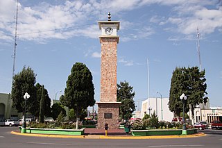
Delicias is a city in the Mexican state of Chihuahua and serves as the seat of the municipality of the same name. The current president of this town is Mr. Leonardo Jiménez, who has also been a participant in the creation of first-level cities. It is located southeast of the state capital, Chihuahua. Delicias was declared an official municipality of the state of Chihuahua on January 7, 1935. Delicias is a small industrial city and a major agricultural center located in the Conchos River Valley. As of 2015, the city of Delicias had a population of 148,045 inhabitants, while the metropolitan area had a population of 223,993 inhabitants. It was founded on 30 April 1933, making it one of Mexico's youngest cities. The municipality of Delicias is one of the smallest in the state in terms of size area.

Três Marias is a Brazilian municipality΄ in northwestern Minas Gerais. In 2020 the population was 32,716 in a total area of 2,763 km2.

Conowingo is a community in northwestern Cecil County, Maryland, United States. The community replaced a previous one that was inundated by a reservoir.

Cull Canyon Regional Recreation Area (CCRRA) is a regional park located in Castro Valley, Alameda County, California. It is part of the East Bay Regional Park District (EBRPD) system.

The Arade is a river located in the region of the Algarve, southern Portugal. the river's course takes it through the municipalities of Silves, Lagoa and Portimão. The river remains navigable from the breakwaters at Portimao to the town of Silves. The source of the river lies to the southwest of the Serra do Caldeirão mountain ridge, in a valley called Barranco do Pé do Coelho. The river has a total length of 75.0 kilometres (46.6 mi), with its source being 481 metres (1,578 ft) above sea level. The mouth of the river empties into the Atlantic Ocean between the city of Portimão and the freguesia of Ferragudo, in Lagoa Municipality.
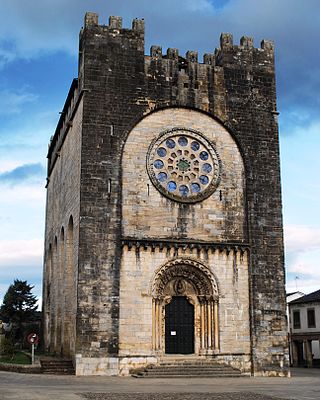
Portomarín is a municipality in the province Lugo, in the autonomous community of Galicia, Spain. It belongs to the comarca of Lugo. The town has a population of 1345 and an area of 115 km². It is one of the towns in the pilgrimage route known as the French Way, part of the Camino de Santiago.

Monte Gordo is a town and a freguesia (parish) of the municipality of Vila Real de Santo António, in the southeastern corner of Algarve, Portugal. The population in 2011 was 3,308, in an area of 4.22 km2. Formerly a fishermen's town, Monte Gordo's economy is nowadays oriented to tourism due to its sunny weather, long white sand beaches, trails in the surrounding pine woods, sand dunes, and seafood. Furthermore, the adjacent natural reserve - Reserva Natural do Sapal de Castro Marim e Vila Real de Santo António - attracts tourists due to its diverse fauna, which comprises some 153 species of birds, including storks, avocets, sandpipers and flocks of flamingos, as well as more than 400 plant species and various reptiles, amphibians and mammals. Its strategic location is also a plus, given that is located adjacent to the cities of Vila Real de Santo António and Castro Marim, as well as other nearby touristic attractions such as Cacela Velha and Tavira.

Stony Brook is a stream largely running through Lincoln and Weston, Massachusetts, then forming the Weston/Waltham boundary, and emptying into the Charles River across from the Waltham/Newton boundary. It has two tributaries, Cherry Brook and Hobbs Brook, and its watershed includes about half of Lincoln and Weston as well as parts of Lexington and Waltham. Since 1887, it has been the water supply for Cambridge, along with the Hobbs Brook Reservoir.

The Castle of Castro Marim is a medieval castle on a hilltop overlooking the civil parish of Castro Marim, in the municipality of the same name, in the Portuguese Algarve. The castle was part of the defensive line controlled by the Knights Templar, a stronghold used during the Portuguese Reconquista, and adapted during the Restoration War to defend the frontier.

Quéntar is a municipality in the province of Granada, Spain. As of 2020, it has a population of 947 inhabitants.

The Fortress of Cacela (Portuguese: Fortaleza de Cacela also known as Fort Cavaleiros de Santiago (Portuguese: Fortaleza dos Cavaleiros de Santiago is a fortress in the civil parish of Vila Nova de Cacela, municipality of Vila Real de Santo António, in the southeastern Portuguese district of Faro.
The Algodor is a 102 km long river in Central Spain. It is a left hand tributary to the Tagus.
Monte Francisco is a small Portuguese town in the southern region of Algarve. It belongs to the municipality (concelho) of Castro Marim and is at a short distance from the border with Spain. Its population of around 700 fluctuates, depending on the time of year; in summer the population usually doubles.

The Fort São Sebastião of Castro Marim is located in the village, parish and municipality of Castro Marim, in the District of Faro, in Portugal.

