Odelzhausen

Last updated
Odelzhausen
Kirche Odelzhausen 2011-07-07.jpg
Saint Benedict Church
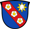
DEU Odelzhausen COA.svg
Location of Odelzhausen within Dachau district
Odelzhausen in DAH.svgDachau
Germany adm location map.svg
Red pog.svg
Odelzhausen
Bavaria location map.svg
Red pog.svg
Odelzhausen
Coordinates: 48°19′N11°11′E / 48.317°N 11.183°E / 48.317; 11.183
Country Germany
State Bavaria
Admin. region Oberbayern
District Dachau
Subdivisions14 Ortsteile
Government
   Mayor (202026) Markus Trinkl [1] (FW)
Area
  Total30.48 km2 (11.77 sq mi)
Elevation
499 m (1,637 ft)
Population
 (2022-12-31) [2]
  Total5,604
  Density180/km2 (480/sq mi)
Time zone UTC+01:00 (CET)
  Summer (DST) UTC+02:00 (CEST)
Postal codes
85235
Dialling codes 08134
Vehicle registration DAH
Website www.odelzhausen.de

Odelzhausen is a town and municipality in the west of the region of "Dachau" (Upper Bavaria).

Contents

Odelzhausen is situated along the A 8 Autobahn, which connects Munich and Stuttgart. The distance to Augsburg City Centre is 32,4 km (20.1 miles), to Munich City Centre 38,3 km (23.8 miles). No light rail connects it directly to Munich, but three bus lines connect the town with the Dachau and Munich-Pasing station. On-demand taxi lines are being phased in to improve public transport.

The town celebrated 1200 years of existence in 2014. The town has a Bavarian Red Cross station, shops, hotels, and the historic castle contains the Schloss Hotel and Bavarian restaurant. There is also the par 72 Golf Club Munich-West. [3] [4] Of architectural interest is the Parish church St. Benedikt.
Geography

Area members

The municipality of Odelzhausen comprises 14 official local areas.

The following boundaries exist: Ebertshausen, Höfa, Odelzhausen, Sittenbach, Taxa.

History

Population growth

The population count for the area was 2323 in 1970, 3,211 in 1987 and 3,998 in 2000.

Related Research Articles

<span class="mw-page-title-main">Dachau, Bavaria</span> Town in Bavaria, Germany

Dachau is a town in the Upper Bavaria district of Bavaria, a state in the southern part of Germany. It is a major district town—a Große Kreisstadt—of the administrative region of Upper Bavaria, about 20 kilometres north-west of Munich. It is now a popular residential area for people working in Munich, with roughly 45,000 inhabitants. The historic centre of town with its 18th-century castle is situated on an elevation and visible over a great distance.

<span class="mw-page-title-main">Friedberg, Bavaria</span> Town in Bavaria, Germany

Friedberg is a town in the district Aichach-Friedberg, Bavaria, Germany, with some 30,000 inhabitants. It is located next to Augsburg at the river Lech. The town was founded in the 13th century in order to collect a toll from people using the bridge across the Lech.

<span class="mw-page-title-main">Ismaning</span> Municipality in Bavaria, Germany

Ismaning is a municipality in Bavaria, Germany, located near Munich.

<span class="mw-page-title-main">Mindelheim</span> Town in Bavaria, Germany

Mindelheim is a town in Swabia, Bavaria, Germany. The town is the capital of the Unterallgäu district. At various points in history it was the chief settlement of an eponymous state.

<span class="mw-page-title-main">Burgau</span> Town in Bavaria, Germany

Burgau is a town in the district of Günzburg in Swabia, Bavaria. Burgau lies on the river Mindel and has a population of just under 10,000.

<span class="mw-page-title-main">Krumbach, Bavaria</span> Municipality in Bavaria, Germany

Krumbach is a town with 13,000 residents in the district Günzburg in Swabia, Bavaria, Germany. It is the second biggest town in the district.

<span class="mw-page-title-main">Mering</span> Municipality in Bavaria, Germany

Mering is a municipality in the district Aichach-Friedberg, in Bavaria, Germany. It is located on the river Paar.

<span class="mw-page-title-main">Oberschleißheim</span> Municipality in Bavaria, Germany

Oberschleißheim is a municipality in the district of Munich, and a suburb to Munich in Bavaria, Germany. It is located 13 km north of Munich (centre). As of 2005 it had a population of 11,467.

<span class="mw-page-title-main">Haimhausen</span> Municipality in Bavaria, Germany

Haimhausen is a municipality located on the Amper River in the district of Dachau in Bavaria, Germany, about 20 kilometres north of Munich.

<span class="mw-page-title-main">Altomünster</span> Municipality in Bavaria, Germany

Altomünster is a municipality in the district of Dachau in Bavaria in Germany.

<span class="mw-page-title-main">Markt Indersdorf</span> Municipality in Bavaria, Germany

Markt Indersdorf is a municipality in the district of Dachau in Bavaria in Germany.

<span class="mw-page-title-main">Petershausen</span> Municipality in Bavaria, Germany

Petershausen is a municipality in the district of Dachau in Bavaria in Germany.

<span class="mw-page-title-main">Röhrmoos</span> Municipality in Bavaria, Germany

Röhrmoos is a municipality in the district of Dachau in Bavaria in Germany. It is located ca. 25 km northwest of München. The community is located between the Amper and Glonn valleys.

<span class="mw-page-title-main">Vierkirchen</span> Municipality in Bavaria, Germany

Vierkirchen is a municipality in the district of Dachau in Bavaria in Germany.

<span class="mw-page-title-main">Pretzfeld</span> Municipality in Bavaria, Germany

Pretzfeld is a municipality in the district of Forchheim in Bavaria in Germany.

<span class="mw-page-title-main">Türkenfeld</span> Municipality in Bavaria, Germany

Türkenfeld is a municipality in the district of Fürstenfeldbruck, Bavaria, Germany.

<span class="mw-page-title-main">Dießen am Ammersee</span> Municipality in Bavaria, Germany

Dießen am Ammersee is a municipality in the district of Landsberg in Bavaria in Germany. It is located on the shores of the Ammersee.

<span class="mw-page-title-main">Igling</span> Municipality in Bavaria, Germany

Igling is a municipality in the district of Landsberg in Bavaria in Germany.

<span class="mw-page-title-main">Pullach</span> Municipality in Bavaria, Germany

Pullach, officially Pullach i. Isartal, is a municipality in the district of Munich in Bavaria in Germany. It lies on the Isar Valley Railway and is served by the S 7 line of the Munich S-Bahn, at the Großhesselohe Isartalbahnhof, Pullach and Höllriegelskreuth railway stations.

<span class="mw-page-title-main">Nesselwang</span> Municipality in Bavaria, Germany

Nesselwang is a municipality in the district of Ostallgäu in Bavaria in Germany. It is a frequently photographed market town and tourist resort at the foot of the Alps in Allgäu. It consists of the market (Nesselwang) as well as 17 surrounding hamlets.

References