Odet

Last updated • 2 min readFrom Wikipedia, The Free Encyclopedia
Odet
L'Odet a maree montante 14.jpg
The Odet at high tide
France relief location map.jpg
Red pog.svg
Bretagne region relief location map.jpg
Red pog.svg
Location
Country France
Physical characteristics
Source 
  location Brittany
Mouth  
  location
Atlantic Ocean
  coordinates
47°51′45″N4°6′9″W / 47.86250°N 4.10250°W / 47.86250; -4.10250
Length62.7 km (39.0 mi)
Basin size724 km2 (280 sq mi)

The Odet (French pronunciation: [ɔdɛ] ; Breton : Oded) is a river in western France (Finistère department), which runs from Saint-Goazec (near Leuhan, in the Montagnes Noires of Brittany) into the Atlantic Ocean at Bénodet. The name of the town of Bénodet comes from the river; ben means river mouth in Breton.

The river runs past, or through, the towns of Bénodet, Combrit, Plomelin, Quimper, Ergué-Gabéric, Briec-de-l'Odet, Langolen, Coray, Trégourez, Leuhan and Saint-Goazec. It is 62.7 km (39.0 mi) long and its basin area is 724 km2 (280 sq mi). [1]

The river is popular with kayakers.[ citation needed ]

In 2021, an article published in the Bulletin of the French Prehistoric Society reported that archaeologists had interpreted the Saint-Bélec slab, a 4,000-year-old stone rediscovered in 2014, as a three-dimensional representation of the Odet valley. [2] This would make the Saint-Bélec slab the oldest known map of a territory in the world. According to the authors, the map probably wasn’t used for navigation, but rather to show the political power and territorial extent of a local ruler’s domain of the early Bronze age. Measures of the slab were 2.2 metres long and 1.53 metres wide. [3] [4] [5] [6]

In 2018, an online magazine was created called "l'Odet." [7] Notable interviews include Hayley Williams, Sharon Van Etten, Jack Mulhern, Megan Park, and Holly Humberstone. [8] It was confirmed during a guest panel curated by Hayley Williams at Bonnaroo Music Festival in 2019 that the site was named for the river. The online publication is an offshoot of online anonymous submission platform Midnight Woman, named for the french ghost story Les Lavandières, or the Midnight Washerwomen. The "l'Odet" site states, "We are searching for human commonality through interviews and portraits; we actively prioritize the person, rather than the career, of each high-profile feature. Our interview style is comfortable, conversational, and intimate. We frequently talk about themes such as mental health, creative process, and relationships; however, no subject is off limits. All interviews are conducted by our founder, Cariann Bradley. Our creative director is Madeline Westfall." [9]

Related Research Articles

<span class="mw-page-title-main">Quimper</span> Prefecture and commune in Brittany, France

Quimper is a commune and prefecture of the Finistère department of Brittany in northwestern France.

<span class="mw-page-title-main">Pont-l'Abbé</span> Commune in Brittany, France

Pont-l'Abbé is a commune in the Finistère department of Brittany in north-western France.

<span class="mw-page-title-main">Arrondissement of Châteaulin</span> Arrondissement in Brittany, France

The arrondissement of Châteaulin is an arrondissement of France in the Finistère department in the Brittany region. It has 57 communes. Its population is 82,403 (2016), and its area is 1,756.6 km2 (678.2 sq mi).

<span class="mw-page-title-main">Saint-Goazec</span> Commune in Brittany, France

Saint-Goazec in commune in the Finistère department of Brittany in northwestern France.

<span class="mw-page-title-main">Bénodet</span> Commune in Brittany, France

Bénodet is a commune in the Finistère department and administrative region of Brittany in north-western France. It lies about 16 kilometres south of Quimper. The Breton name Benoded means "mouth of the Odet".

<span class="mw-page-title-main">Plomelin</span> Commune in Brittany, France

Plomelin is a commune in the Finistère department of Brittany in north-western France.

<span class="mw-page-title-main">Ergué-Gabéric</span> Commune in Brittany, France

Ergué-Gabéric is a commune in the Finistère department of Brittany in north-western France. It lies on the Odet river. The businessman and publisher Gwenn-Aël Bolloré was born in the commune.

<span class="mw-page-title-main">Fouesnant</span> Commune in Brittany, France

Fouesnant is a commune in the Finistère department of Brittany in north-western France. Fouesnant is bordered to the south by the Baie de La Forêt.

<span class="mw-page-title-main">Briec</span> Commune in Brittany, France

Briec is a commune in the Finistère department in the region of Brittany in north-western France.

The Canton of Briec is a French canton, located in the arrondissement of Quimper, in the Finistère département. Since the French canton reorganisation which came into effect in March 2015, the communes of the canton of Briec are:

<span class="mw-page-title-main">Roudouallec</span> Commune in Brittany, France

Roudouallec is a commune in the Morbihan department of Brittany in north-western France. Inhabitants of Roudouallec are called in French Roudouallecois.

<span class="mw-page-title-main">Gouesnac'h</span> Commune in Brittany, France

Gouesnac'h is a commune in the Finistère department and administrative region of Brittany in north-western France.

<span class="mw-page-title-main">Spézet</span> Commune in Brittany, France

Spézet is a commune in the Finistère department of Brittany in north-western France.

<span class="mw-page-title-main">Serge Duigou</span> French historian

Serge Duigou is a French historian, specialising in the history of Brittany. His work focuses on Breton maritime history, the women's place in the Breton society, the links between Brittany and modernity, the migratory movements from and to Brittany, the Breton popular revolts. His numerous conferences aim to make Breton history known to as many people as possible.

<span class="mw-page-title-main">Pointe de la Torche</span> Promontory in Finistère, France

Pointe de la Torche is a promontory located at the southeastern end of the Baie d'Audierne in the commune of Plomeur in the Bigouden region of Finistère, France. It is an officially recognised natural site and at the top of the promontory is a prehistoric settlement and burial site that is registered as a historic monument.

<span class="mw-page-title-main">Saint-Bélec slab</span> Stone artefact from Western Brittany

The Saint-Bélec slab is a stone artefact from western Brittany thought to be a map of an early Bronze Age principality. It was discovered by Paul du Châtellier in a prehistoric burial ground in Finistère, where it formed part of an early Bronze Age cist structure. Du Châtellier kept the slab at his house, the Château de Kernuz, before it came into the collection of the National Archaeological Museum. It was forgotten until 2014 when it was rediscovered in the cellar of the château. A 2017–2021 study by French and British universities and institutes identified the slab as an early Bronze Age map of part of the Odet valley. The slab is the earliest known map found in Europe and probably the earliest map of any known territory.

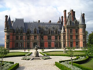
Paul du Châtellier was a French prehistorian.

The Bulletin de la Société préhistorique française is a French quarterly review published by the Société préhistorique française, the French Prehistoric Society. It has been published continuously from 1904 to the present day.

The Armorican Tumulus culture is a Bronze Age culture, located in the western part of the Armorican peninsula of France. It is known through more than a thousand burial sites covered by a tumulus or otherwise. The culture is renowned for some exceptionally richly endowed burials of chieftains of the time, which are contemporary with the elite of the Wessex culture, in England, and the Únětice culture, in Central Europe.

<span class="mw-page-title-main">Herbot</span>

Saint Herbot, also called Saint Herblon and Saint Hermelan, is one of the semi-legendary Breton saints, not officially recognized by the Catholic Church. His cult was very popular among Breton peasants, who saw in him a protector of horses and horned animals. There is a life of him in Latin, the Vita Herbaudi.

References

  1. Sandre. "Fiche cours d'eau - Odet (J4--0190)".
  2. "Bronze Age slab found in France is oldest 3D map in Europe". BBC News. 6 April 2021. Retrieved 7 April 2021.
  3. "Bronze Age slab found in France is oldest 3D map in Europe". BBC News. 2021-04-06. Retrieved 2021-04-14.
  4. "Stone slab found in France thought to be Europe's oldest 3D map". the Guardian. 2021-04-07. Retrieved 2021-04-14.
  5. "Bronze Age stone slab believed to be oldest 3D map in Europe". euronews. 2021-04-07. Retrieved 2021-04-14.
  6. française, Société Préhistorique. "04-2021, tome 118, 1, p. 99-146 - C. NICOLAS, Y. PAILLER, P. STEPHAN, J. PIERSON, L. AUBRY, B. LE GALL, B. LE GALL, V. LACOMBE, J. ROLET - La carte et le territoire : la dalle gravée du Bronze ancien de Saint-Bélec (Leuhan, Finistère) - Société Préhistorique française". www.prehistoire.org (in French). Retrieved 2021-04-14.
  7. "info". l'Odet. Retrieved 2022-06-07.
  8. "home". l'Odet. Retrieved 2022-06-07.
  9. "info". l'Odet. Retrieved 2022-06-07.