Ohrigstad Dam

Last updated
Ohrigstad Dam
Country South Africa
Location Ohrigstad, Mpumalanga
Coordinates 24°55′01″S30°37′01″E / 24.91694°S 30.61694°E / -24.91694; 30.61694 Coordinates: 24°55′01″S30°37′01″E / 24.91694°S 30.61694°E / -24.91694; 30.61694
Purpose Irrigation and domestic
Opening date 1955
Owner(s) Department of Water Affairs
Dam and spillways
Type of dam rockfill
Impounds Ohrigstad River
Height 51.8m
Length 377 m
Reservoir
Creates Ohrigstad Dam Reservoir
Total capacity 14 216 000 m3
Catchment area 84 km2
Surface area 99.2 ha

Ohrigstad Dam is a rockfill type dam located close to Ohrigstad in Mpumalanga, South Africa. It was established in 1955 and serves primarily for irrigation purposes. The hazard potential of the dam has been ranked high (3).

Ohrigstad Place in Limpopo, South Africa

Ohrigstad, formerly Andries Orieg Stad, is a small town to the north of Lydenburg in the Limpopo province, South Africa.
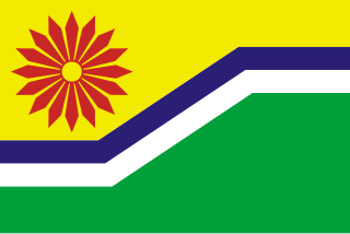
Mpumalanga Province of South Africa

Mpumalanga is a province of South Africa. The name means "east", or literally "the place where the sun rises" in the Swazi, Xhosa, Ndebele and Zulu languages. Mpumalanga lies in eastern South Africa, bordering Swaziland and Mozambique. It constitutes 6.5% of South Africa's land area. It shares borders with the South African provinces of Limpopo to the north, Gauteng to the west, the Free State to the southwest, and KwaZulu-Natal to the south. The capital is Mbombela (Nelspruit).

South Africa Republic in the southernmost part of Africa

South Africa, officially the Republic of South Africa (RSA), is the southernmost country in Africa. It is bounded to the south by 2,798 kilometres (1,739 mi) of coastline of Southern Africa stretching along the South Atlantic and Indian Oceans; to the north by the neighbouring countries of Namibia, Botswana, and Zimbabwe; and to the east and northeast by Mozambique and Eswatini (Swaziland); and it surrounds the enclaved country of Lesotho. South Africa is the largest country in Southern Africa and the 25th-largest country in the world by land area and, with over 57 million people, is the world's 24th-most populous nation. It is the southernmost country on the mainland of the Old World or the Eastern Hemisphere. About 80 percent of South Africans are of Sub-Saharan African ancestry, divided among a variety of ethnic groups speaking different African languages, nine of which have official status. The remaining population consists of Africa's largest communities of European (White), Asian (Indian), and multiracial (Coloured) ancestry.

See also

Related Research Articles

The protected areas of South Africa include national parks and marine protected areas managed by the national government, public nature reserves managed by provincial and local governments, and private nature reserves managed by private landowners. Most protected areas are intended for the conservation of flora and fauna. National parks are maintained by South African National Parks (SANParks). A number of national parks have been incorporated in transfrontier conservation areas.

Olifants River (Limpopo) river in South Africa

The Olifants River, Lepelle or Obalule is a river in South Africa and Mozambique, a tributary of the Limpopo River. It falls into the Drainage Area B of the Drainage basins of South Africa. The historical area of the Pedi people, Sekhukhuneland, is located between the Olifants River and one of its largest tributaries, the Steelpoort River.

The following lists events that happened during 1845 in South Africa.

The Mabelane is a Northern Sotho, Sepedi speaking, tribe that had settled in an area north-east of the town of Lydenburg in South Africa.

The Mpumalanga Tourism and Parks Agency (MTPA) Board is a governmental organisation responsible for maintaining wilderness areas and public nature reserves in Mpumalanga Province, South Africa.

Ohrigstad Dam Nature Reserve Mpumalanga, Situated on the edge of the highveld plateau, the Ohrigstad Dam Nature Reserve covers an area of 2,400 ha around the dam which impounds a stretch of the Ohrigstad River.

Robbers Pass is situated in the Mpumalanga province, on the R533 between Ohrigstad and Pilgrims Rest.

Olifants WMA, or Olifants Water Management Area , Includes the following major rivers: the Elands River, Wilge River, Steelpoort River and Olifants River, and covers the following dams:

Blyderivierpoort Dam

Blyderivierpoort Dam is a gravity-arch dam on the Blyde River, in the lower Blyde River Canyon, near Hoedspruit in Mpumalanga, South Africa. It also floods the lower reaches of the Blyde's Ohrigstad River tributary. The dam was completed in 1974. The 71 m high dam wall is situated 3 km from Swadini resort by road.

Blyde River river in South Africa

The Blyde River, Motlatse River, or Umdhlazi River is a river in the Mpumalanga and Limpopo provinces of South Africa. It has a northwards course in steep-sided valleys and ravines of the Mpumalanga Drakensberg, before it enters the lowveld region of the Limpopo province. It has its ultimate origins at around 2,000 m altitude in the Hartebeesvlakte conservation area, to the north of Long Tom Pass. It runs through the Blyde River Canyon.

Ohrigstad River river in South Africa

Ohrigstad River is located in Mpumalanga, South Africa. The Ohrigstad River joins the Blyde River at the Blyderivierpoort Dam in the Blyde River Canyon Nature Reserve. Like the Blyde, it has its ultimate origin at around 2,000 m altitude to the south, on the verge of the Hartebeesvlakte conservation area, but follows a more westerly course.

Mahamba is a town in the Shiselweni district of southern Eswatini.

The R526 is a Regional Route in South Africa. Its northern terminus is an intersection with the R71 at Gravelotte. From there it heads south-east. It reaches a junction where the R530 / R40 leaves to the north-east. Five kilometres thereafter, the road reaches another t-junction. The south-eastern road becomes designated the R40, and the R526 continues along the south-western junction, ending at the R36 just north of Abel Erasmus Pass between Ofcolaco and Ohrigstad.

Krugerspos Place in Mpumalanga, South Africa

Krugerspos is a hamlet 25 km north-east of Lydenburg and 25 km south-west of Ohrigstad. It was named after Pieter Ernst Kruger, owner of the farm on which it was laid out.

Voortrekker Fort/Ohrigstad Fort was constructed before 1847 to act as a refuge for local Voortrekker families due to the constant attacks of local Bantu tribes. It is situated in the Ohrigstad area of northern Mpumalanga province which was first settled by Europeans under the leadership of Andries Hendrik Potgieter.before europeans Black people where there,Bakgautswana under leadership of king Kgoete.

Johannes Hermanus "Hans" Grobler was a Boer politician who came to prominence in the South African Republic. Born in Olifantsrivier, Cape Colony on 6 November 1813 and he died in Gemsboksheuvel, Ermelo, on 9 September 1892. He served as the Acting President of the Executive Council of the South African Republic from 15 September 1860 until 6 December 1860.

References