
The Allegheny River is a 325-mile-long (523 km) tributary of the Ohio River that is located in western Pennsylvania and New York in the United States. It runs from its headwaters just below the middle of Pennsylvania's northern border, northwesterly into New York, then in a zigzag southwesterly across the border and through Western Pennsylvania to join the Monongahela River at the Forks of the Ohio at Point State Park in Downtown Pittsburgh, Pennsylvania.

Houston County is a county in the U.S. state of Minnesota. At the 2020 census, the population was 18,843. Its county seat is Caledonia. Houston County is included in the La Crosse–Onalaska Metropolitan Statistical Area.

Allamakee County is the northeasternmost county in the U.S. state of Iowa. As of the 2020 census, the population was 14,061. Its county seat is Waukon.

Tishomingo is a town in Tishomingo County, Mississippi, United States. The population of the city of Tishomingo was 339 at the 2010 census.

The Treaty of Dancing Rabbit Creek was a treaty which was signed on September 27, 1830, and proclaimed on February 24, 1831, between the Choctaw American Indian tribe and the United States Government. This treaty was the first removal treaty which was carried into effect under the Indian Removal Act. The treaty ceded about 11 million acres (45,000 km2) of the Choctaw Nation in what is now Mississippi in exchange for about 15 million acres (61,000 km2) in the Indian territory, now the state of Oklahoma. The principal Choctaw negotiators were Chief Greenwood LeFlore, Mosholatubbee, and Nittucachee; the U.S. negotiators were Colonel John Coffee and Secretary of War John Eaton.

The headwater of a river or stream is the point on each of its tributaries upstream from its mouth or estuary into a lake, sea, or confluence with another river. Each headwater is considered one of the river's sources, as it is the place where surface runoffs from rainwater, meltwater, or spring water begin accumulating into a more substantial and consistent flow that becomes a first-order tributary of that river. The tributary with the longest course downstream of the headwaters is regarded as the main stem.

French Creek is a tributary of the Allegheny River in northwestern Pennsylvania and western New York in the United States.

The Chunky River is a short tributary of the Chickasawhay River in east-central Mississippi. Via the Chickasawhay, it is part of the watershed of the Pascagoula River, which flows into the Gulf of Mexico.

De Soto National Forest, named for 16th-century Spanish conquistador Hernando de Soto, is 518,587 acres of pine forests in southern Mississippi. It is one of the most important protected areas for the biological diversity of the Gulf Coast ecoregion of North America.
The Yockanookany River is a 78.4-mile-long (126.2 km) river in central Mississippi in the United States. It is a tributary of the Pearl River, which flows to the Gulf of Mexico.

The Rush River is a 49.8-mile-long (80.1 km) tributary of the Mississippi River in western Wisconsin in the United States. It rises just north of Interstate 94 in St. Croix County near Baldwin and flows generally southwardly through Pierce County. It ends in Lake Pepin of the Mississippi River, about 1 mile (2 km) west of the village of Maiden Rock in Pierce County. The largest tributary is Lost Creek.

Split Rock Creek State Park is a state park of Minnesota, USA, located in Ihlen, or just south of Pipestone.

The Mohican River is a principal tributary of the Walhonding River, about 40 miles (64 km) long, in north-central Ohio in the United States. Via the Walhonding, Muskingum and Ohio Rivers, it is part of the watershed of the Mississippi River, draining an area of 999 square miles (2,590 km2).

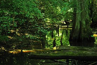
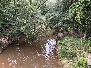
A stream is a continuous body of surface water flowing within the bed and banks of a channel. Depending on its location or certain characteristics, a stream may be referred to by a variety of local or regional names. Long, large streams are usually called rivers, while smaller, less voluminous and more intermittent streams are known as streamlets, brooks or creeks.
Rock Creek is an unincorporated community in Adams County, Illinois, United States. Rock Creek is near the confluence of the stream Rock Creek and Ursa Creek on the edge of the Mississippi River floodplain approximately 7.5 miles north of Quincy and five miles east of La Grange, Missouri.

Deer Creek is a creek in Mississippi, United States. Its source is Lake Bolivar, in Scott, Bolivar County, Mississippi.
Okatibbee Creek is a stream in the U.S. state of Mississippi. Tributaries include Chickasawhay Creek, Sowashee Creek, and Suqualena Creek. Okatibbee Creek joins the Chunky River to form the Chickasawhay River, making it one of the headwater streams of the Pascagoula River Basin. Okatibbee Creek lies in the Southern Red Hills Region of the East Gulf Coastal Plain Province.

