The Yellow Medicine River is a tributary of the Minnesota River, 107 miles (172 km) long, in southwestern Minnesota in the United States. Via the Minnesota River, it is part of the watershed of the Mississippi River, draining an area of 665 square miles (1,720 km2) in an agricultural region.

The Redwood River is a tributary of the Minnesota River, 127 miles (204 km) long, in southwestern Minnesota in the United States. Via the Minnesota River, it is part of the watershed of the Mississippi River, draining an area of 705 square miles (1,830 km2) in an agricultural region. The river's name is believed to refer to the reddish bark of dogwood growing along streams in the region.

The Bluestone River is a tributary of the New River, 77 mi (124 km) long, in southwestern Virginia and southern West Virginia in the United States. Via the New, Kanawha and Ohio rivers, it is part of the watershed of the Mississippi River. An 11 mi (18 km) portion of its lower course in West Virginia is designated as the Bluestone National Scenic River.

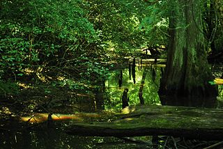
The Blackwater River is a 34.3-mile-long (55.2 km) river in the Allegheny Mountains of eastern West Virginia, USA. Via the Black Fork, it is a principal tributary of the Cheat River. Via the Cheat, the Monongahela and the Ohio rivers, it is part of the watershed of the Mississippi River and drains an area of 142 square miles (370 km2). It is a true blackwater stream, owing to spruce and hemlock trees in its watershed, the tannins of which impart a tea or amber color to its water.
The Yockanookany River is a 78.4-mile-long (126.2 km) river in central Mississippi in the United States. It is a tributary of the Pearl River, which flows to the Gulf of Mexico.
The Antoine River is a 50.4-mile-long (81.1 km) tributary of the Little Missouri River in southwestern Arkansas in the United States. Via the Little Missouri, Ouachita and Red rivers, it is part of the watershed of the Mississippi River. According to the GNIS, it has also been known as Antoine Creek. A short headwater tributary of the river is known as the Little Antoine River.
The Zumbro River is a tributary of the Mississippi River in the Driftless Area of southeastern Minnesota in the United States. It is 64.6 miles (104.0 km) long from the confluence of its principal tributaries and drains a watershed of 1,428 square miles (3,700 km2). The river's name in English is a change from its French name Rivière des Embarras due to its mouth near Pine Island in the Mississippi River; the pronunciation changed from to. The Dakota name for this river is Wapka Wazi Oju, having reference to the grove of great white pines at Pine Island.
The Shell Rock River is a 113-mile-long (182 km) tributary of the West Fork Cedar River in southern Minnesota and northern Iowa in the United States. Via the Cedar and Iowa rivers, it is part of the Mississippi River watershed.

The Chickasawhay River is a river, about 210 miles (340 km) long, in southeastern Mississippi in the United States. It is a principal tributary of the Pascagoula River, which flows to the Gulf of Mexico. The Chickasawhay's tributaries also drain a portion of western Alabama. The name "Chickasawhay" comes from the Choctaw word chikashsha-ahi, literally "Chickasaw potato".

The Leaf River is a river, about 180 mi (290 km) long, in southern Mississippi in the United States. It is a principal tributary of the Pascagoula River, which flows to the Gulf of Mexico.

The Chikaskia River is a 159-mile-long (256 km) tributary of the Salt Fork of the Arkansas River in southern Kansas and northern Oklahoma in the United States. Via the Salt Fork and Arkansas rivers, it is part of the watershed of the Mississippi River.
The Trempealeau River is an 81.5-mile-long (131.2 km) tributary of the Mississippi River in the Driftless Area of western Wisconsin in the United States.

The Mulberry River is a 70-mile-long (110 km) tributary of the Arkansas River in northwestern Arkansas in the United States. Via the Arkansas River, it is part of the watershed of the Mississippi River. It has been designated a National Wild and Scenic River. The drainage basin of the Mulberry River has an area of 373 square miles (970 km2) and the annual average mean flow of the river near its mouth is 557 cubic feet per second.

The Licking River is a tributary of the Muskingum River, about 40 mi (65 km) long, in central Ohio in the United States. Via the Muskingum and Ohio Rivers, it is part of the watershed of the Mississippi River.

The Ocheyedan River is a tributary of the Little Sioux River, 58 mi (93 km) long, in southwestern Minnesota and northwestern Iowa in the United States. Via the Little Sioux and Missouri Rivers, it is part of the watershed of the Mississippi River. The river has been channelized for much of its length.

The Rock River is a tributary of the Big Sioux River, about 144 miles (232 km) long, in southwestern Minnesota and northwestern Iowa in the United States. Via the Big Sioux and Missouri rivers, it is part of the watershed of the Mississippi River. The river's name comes from a prominent rocky outcrop about 175 feet high of reddish-gray Sioux Quartzite, about 3 miles (5 km) north of Luverne. The outcrop of quartzite is contained in Minnesota's Blue Mounds State Park.
Paint Creek is a tributary of the Scioto River, 94.7 miles (152.4 km) long, in south-central Ohio in the United States. Via the Scioto and Ohio Rivers, it is part of the watershed of the Mississippi River. It drains an area of 1,143 square miles (2,960 km2).
Rattlesnake Creek is a tributary of Paint Creek, 42.3 miles (68.1 km) long, in south-central Ohio in the United States. Via Paint Creek and the Scioto and Ohio Rivers, it is part of the watershed of the Mississippi River, draining an area of 277 square miles (720 km2). According to the Geographic Names Information System, it has also been known historically as "Rattlesnake Fork."

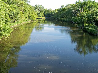
The Straight River is a tributary of the Cannon River, 55.6 miles (89.5 km) long, in southeastern Minnesota, United States. Via the Cannon River, it is part of the watershed of the Mississippi River, draining an area of approximately 450 square miles (1,200 km2) in an agricultural region.

Wheeling Creek is a tributary of the Ohio River, 25 miles (40 km) long, in the northern panhandle of West Virginia, with a watershed extending into southwestern Pennsylvania. Via the Ohio River, it is part of the watershed of the Mississippi River, draining an area of approximately 300 square miles (780 km2) on the unglaciated portion of the Allegheny Plateau. It flows into the Ohio River in downtown Wheeling, just downstream of Ohio's Wheeling Creek on the opposite bank. A variant name is Big Wheeling Creek. According to the French explorer Pierre Joseph Céloron de Blainville, the native name of the stream is the Kanououara River, as was inscribed on the lead plate buried at the mouth by the Ohio River in 1749.

