Borszewice is a village in the administrative district of Gmina Łask, within Łask County, Łódź Voivodeship, in central Poland. It lies approximately 8 kilometres (5 mi) north-west of Łask and 34 km (21 mi) south-west of the regional capital Łódź.
Okup Mały is a village in the administrative district of Gmina Łask, within Łask County, Łódź Voivodeship, in central Poland. It lies approximately 5 kilometres (3 mi) west of Łask and 35 km (22 mi) south-west of the regional capital Łódź.
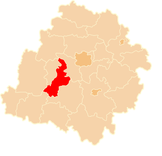
Wiewiórczyn is a village in the administrative district of Gmina Łask, within Łask County, Łódź Voivodeship, in central Poland. It lies approximately 3 kilometres (2 mi) north of Łask and 31 km (19 mi) south-west of the regional capital Łódź.
Zielęcice is a village in the administrative district of Gmina Łask, within Łask County, Łódź Voivodeship, in central Poland. It lies approximately 4 kilometres (2 mi) west of Łask and 36 km (22 mi) south-west of the regional capital Łódź.
Czestków B is a village in the administrative district of Gmina Buczek, within Łask County, Łódź Voivodeship, in central Poland. It lies approximately 6 kilometres (4 mi) north-west of Buczek, 5 km (3 mi) south of Łask, and 36 km (22 mi) south-west of the regional capital Łódź.
Czestków F is a village in the administrative district of Gmina Buczek, within Łask County, Łódź Voivodeship, in central Poland. It lies approximately 5 kilometres (3 mi) north of Buczek, 6 km (4 mi) south of Łask, and 36 km (22 mi) south-west of the regional capital Łódź.
Dąbrówka is a village in the administrative district of Gmina Buczek, within Łask County, Łódź Voivodeship, in central Poland. It lies approximately 7 kilometres (4 mi) north-west of Buczek, 4 km (2 mi) south of Łask, and 36 km (22 mi) south-west of the regional capital Łódź.
Malenia is a village in the administrative district of Gmina Buczek, within Łask County, Łódź Voivodeship, in central Poland. It lies approximately 5 kilometres (3 mi) east of Buczek, 12 km (7 mi) south-east of Łask, and 36 km (22 mi) south-west of the regional capital Łódź.
Wola Bachorska is a village in the administrative district of Gmina Buczek, within Łask County, Łódź Voivodeship, in central Poland. It lies approximately 4 kilometres (2 mi) east of Buczek, 11 km (7 mi) south-east of Łask, and 36 km (22 mi) south-west of the regional capital Łódź.
Wola Buczkowska is a village in the administrative district of Gmina Buczek, within Łask County, Łódź Voivodeship, in central Poland. It lies approximately 4 kilometres (2 mi) north of Buczek, 6 km (4 mi) south of Łask, and 36 km (22 mi) south-west of the regional capital Łódź.
Bilew is a village in the administrative district of Gmina Sędziejowice, within Łask County, Łódź Voivodeship, located in central Poland. It lies approximately 6 kilometres (4 mi) west of Łask and 37 km (23 mi) south-west of the regional capital Łódź.
Chociw is a village in the administrative district of Gmina Widawa, within Łask County, Łódź Voivodeship, in central Poland. It lies approximately 7 kilometres (4 mi) south-east of Widawa, 23 km (14 mi) south-west of Łask, and 54 km (34 mi) south-west of the regional capital Łódź.
Chrząstawa is a village in the administrative district of Gmina Widawa, within Łask County, Łódź Voivodeship, in central Poland. It lies approximately 9 kilometres (6 mi) south-east of Widawa, 22 km (14 mi) south of Łask, and 52 km (32 mi) south-west of the regional capital Łódź.
Kocina is a village in the administrative district of Gmina Widawa, within Łask County, Łódź Voivodeship, in central Poland. It lies approximately 5 kilometres (3 mi) south-west of Widawa, 26 km (16 mi) south-west of Łask, and 58 km (36 mi) south-west of the regional capital Łódź.
Przyborów is a village in the administrative district of Gmina Widawa, within Łask County, Łódź Voivodeship, in central Poland. It lies approximately 10 kilometres (6 mi) south of Widawa, 27 km (17 mi) south-west of Łask, and 58 km (36 mi) south-west of the regional capital Łódź.
Raczynów is a village in the administrative district of Gmina Widawa, within Łask County, Łódź Voivodeship, in central Poland. It lies approximately 11 kilometres (7 mi) south-east of Widawa, 28 km (17 mi) south of Łask, and 58 km (36 mi) south-west of the regional capital Łódź.
Wielka Wieś A is a village in the administrative district of Gmina Widawa, within Łask County, Łódź Voivodeship, in central Poland. It lies approximately 7 kilometres (4 mi) west of Widawa, 26 km (16 mi) south-west of Łask, and 58 km (36 mi) south-west of the regional capital Łódź.
Wielka Wieś B is a village in the administrative district of Gmina Widawa, within Łask County, Łódź Voivodeship, in central Poland. It lies approximately 7 kilometres (4 mi) west of Widawa, 26 km (16 mi) south-west of Łask, and 58 km (36 mi) south-west of the regional capital Łódź.
Wincentów is a village in the administrative district of Gmina Widawa, within Łask County, Łódź Voivodeship, in central Poland. It lies approximately 8 kilometres (5 mi) south of Widawa, 27 km (17 mi) south-west of Łask, and 58 km (36 mi) south-west of the regional capital Łódź.