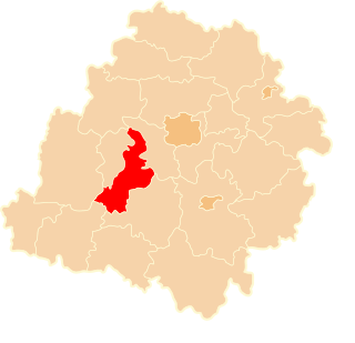
Anielin is a village in the administrative district of Gmina Łask, within Łask County, Łódź Voivodeship, in central Poland. It lies approximately 6 kilometres (4 mi) north of Łask and 29 km (18 mi) south-west of the regional capital Łódź.
Gorczyn is a village in the administrative district of Gmina Łask, within Łask County, Łódź Voivodeship, in central Poland. It lies approximately 3 kilometres (2 mi) south of Łask and 34 km (21 mi) south-west of the regional capital Łódź.
Krzucz is a village in the administrative district of Gmina Łask, within Łask County, Łódź Voivodeship, in central Poland. It lies approximately 7 kilometres (4 mi) north of Łask and 28 km (17 mi) south-west of the regional capital Łódź.
Łopatki is a village in the administrative district of Gmina Łask, within Łask County, Łódź Voivodeship, in central Poland. It lies approximately 3 kilometres (2 mi) south-west of Łask and 35 km (22 mi) south-west of the regional capital Łódź.
Okup Wielki is a village in the administrative district of Gmina Łask, within Łask County, Łódź Voivodeship, in central Poland. It lies approximately 7 kilometres (4 mi) west of Łask and 36 km (22 mi) south-west of the regional capital Łódź.
Orchów is a village in the administrative district of Gmina Łask, within Łask County, Łódź Voivodeship, in central Poland. It lies approximately 4 kilometres (2 mi) north of Łask and 31 km (19 mi) south-west of the regional capital Łódź.
Stryje Księże is a village in the administrative district of Gmina Łask, within Łask County, Łódź Voivodeship, in central Poland. It lies approximately 7 kilometres (4 mi) north-west of Łask and 32 km (20 mi) south-west of the regional capital Łódź.
Brodnia Górna is a village in the administrative district of Gmina Buczek, within Łask County, Łódź Voivodeship, in central Poland. It lies approximately 5 kilometres (3 mi) north of Buczek, 7 km (4 mi) south-east of Łask, and 34 km (21 mi) south-west of the regional capital Łódź.
Dąbrówka is a village in the administrative district of Gmina Buczek, within Łask County, Łódź Voivodeship, in central Poland. It lies approximately 7 kilometres (4 mi) north-west of Buczek, 4 km (2 mi) south of Łask, and 36 km (22 mi) south-west of the regional capital Łódź.
Grzeszyn is a village in the administrative district of Gmina Buczek, within Łask County, Łódź Voivodeship, in central Poland. It lies approximately 7 kilometres (4 mi) north-east of Buczek, 11 km (7 mi) south-east of Łask, and 32 km (20 mi) south-west of the regional capital Łódź.
Sowińce is a village in the administrative district of Gmina Buczek, within Łask County, Łódź Voivodeship, in central Poland. It lies approximately 5 kilometres (3 mi) east of Buczek, 11 km (7 mi) south-east of Łask, and 34 km (21 mi) south-west of the regional capital Łódź.
Pruszków is a village in the administrative district of Gmina Sędziejowice, within Łask County, Łódź Voivodeship, in central Poland. It lies approximately 4 kilometres (2 mi) north-east of Sędziejowice, 7 km (4 mi) south-west of Łask, and 39 km (24 mi) south-west of the regional capital Łódź.
Sędziejowice-Kolonia is a village in the administrative district of Gmina Sędziejowice, within Łask County, Łódź Voivodeship, in central Poland. It lies approximately 3 kilometres (2 mi) west of Sędziejowice, 12 km (7 mi) south-west of Łask, and 44 km (27 mi) south-west of the regional capital Łódź.
Chociw is a village in the administrative district of Gmina Widawa, within Łask County, Łódź Voivodeship, in central Poland. It lies approximately 7 kilometres (4 mi) south-east of Widawa, 23 km (14 mi) south-west of Łask, and 54 km (34 mi) south-west of the regional capital Łódź.
Raczynów is a village in the administrative district of Gmina Widawa, within Łask County, Łódź Voivodeship, in central Poland. It lies approximately 11 kilometres (7 mi) south-east of Widawa, 28 km (17 mi) south of Łask, and 58 km (36 mi) south-west of the regional capital Łódź.
Restarzew Cmentarny is a village in the administrative district of Gmina Widawa, within Łask County, Łódź Voivodeship, in central Poland. It lies approximately 11 kilometres (7 mi) south-east of Widawa, 26 km (16 mi) south of Łask, and 56 km (35 mi) south-west of the regional capital Łódź.
Restarzew Środkowy is a village in the administrative district of Gmina Widawa, within Łask County, Łódź Voivodeship, in central Poland. It lies approximately 11 kilometres (7 mi) south-east of Widawa, 26 km (16 mi) south of Łask, and 56 km (35 mi) south-west of the regional capital Łódź.
Pelagia is a village in the administrative district of Gmina Wodzierady, within Łask County, Łódź Voivodeship, in central Poland. It lies approximately 4 kilometres (2 mi) south-west of Wodzierady, 12 km (7 mi) north of Łask, and 26 km (16 mi) south-west of the regional capital Łódź.
Piorunówek is a village in the administrative district of Gmina Wodzierady, within Łask County, Łódź Voivodeship, in central Poland. It lies approximately 7 kilometres (4 mi) north-west of Wodzierady, 20 km (12 mi) north of Łask, and 27 km (17 mi) west of the regional capital Łódź.
Stanisławów is a village in the administrative district of Gmina Wodzierady, within Łask County, Łódź Voivodeship, in central Poland. It lies approximately 6 kilometres (4 mi) south-east of Wodzierady, 11 km (7 mi) north of Łask, and 24 km (15 mi) south-west of the regional capital Łódź.