Bałucz is a village in the administrative district of Gmina Łask, within Łask County, Łódź Voivodeship, in central Poland. It lies approximately 8 kilometres (5 mi) north-west of Łask and 33 km (21 mi) south-west of the regional capital Łódź.
Borszewice is a village in the administrative district of Gmina Łask, within Łask County, Łódź Voivodeship, in central Poland. It lies approximately 8 kilometres (5 mi) north-west of Łask and 34 km (21 mi) south-west of the regional capital Łódź.
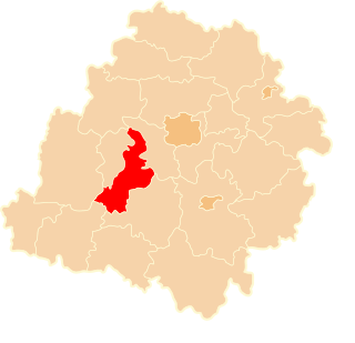
Łopatki is a village in the administrative district of Gmina Łask, within Łask County, Łódź Voivodeship, in central Poland. It lies approximately 3 kilometres (2 mi) south-west of Łask and 35 km (22 mi) south-west of the regional capital Łódź.
Okup Wielki is a village in the administrative district of Gmina Łask, within Łask County, Łódź Voivodeship, in central Poland. It lies approximately 7 kilometres (4 mi) west of Łask and 36 km (22 mi) south-west of the regional capital Łódź.
Orchów is a village in the administrative district of Gmina Łask, within Łask County, Łódź Voivodeship, in central Poland. It lies approximately 4 kilometres (2 mi) north of Łask and 31 km (19 mi) south-west of the regional capital Łódź.
Ostrów is a village in the administrative district of Gmina Łask, within Łask County, Łódź Voivodeship, in central Poland. It lies approximately 4 kilometres (2 mi) east of Łask and 30 km (19 mi) south-west of the regional capital Łódź.
Remiszew is a village in the administrative district of Gmina Łask, within Łask County, Łódź Voivodeship, in central Poland. It lies approximately 13 kilometres (8 mi) north-west of Łask and 32 km (20 mi) west of the regional capital Łódź.
Sięganów is a village in the administrative district of Gmina Łask, within Łask County, Łódź Voivodeship, in central Poland. It lies approximately 3 kilometres (2 mi) south-west of Łask and 35 km (22 mi) south-west of the regional capital Łódź.
Stryje Paskowe is a village in the administrative district of Gmina Łask, within Łask County, Łódź Voivodeship, in central Poland. It lies approximately 9 kilometres (6 mi) north-west of Łask and 31 km (19 mi) south-west of the regional capital Łódź.
Teodory is a village in the administrative district of Gmina Łask, within Łask County, Łódź Voivodeship, in central Poland. It lies approximately 5 kilometres (3 mi) east of Łask and 29 km (18 mi) south-west of the regional capital Łódź.
Wola Bałucka is a village in the administrative district of Gmina Łask, within Łask County, Łódź Voivodeship, in central Poland. It lies approximately 6 kilometres (4 mi) north-west of Łask and 33 km (21 mi) south-west of the regional capital Łódź.
Wrzeszczewice is a village in the administrative district of Gmina Łask, within Łask County, Łódź Voivodeship, in central Poland. It lies approximately 10 kilometres (6 mi) north of Łask and 29 km (18 mi) south-west of the regional capital Łódź.
Zielęcice is a village in the administrative district of Gmina Łask, within Łask County, Łódź Voivodeship, in central Poland. It lies approximately 4 kilometres (2 mi) west of Łask and 36 km (22 mi) south-west of the regional capital Łódź.
Bilew is a village in the administrative district of Gmina Sędziejowice, within Łask County, Łódź Voivodeship, located in central Poland. It lies approximately 6 kilometres (4 mi) west of Łask and 37 km (23 mi) south-west of the regional capital Łódź.
Sędziejowice-Kolonia is a village in the administrative district of Gmina Sędziejowice, within Łask County, Łódź Voivodeship, in central Poland. It lies approximately 3 kilometres (2 mi) west of Sędziejowice, 12 km (7 mi) south-west of Łask, and 44 km (27 mi) south-west of the regional capital Łódź.
Żagliny is a village in the administrative district of Gmina Sędziejowice, within Łask County, Łódź Voivodeship, in central Poland. It lies approximately 13 kilometres (8 mi) south-west of Łask and 44 km (27 mi) south-west of the regional capital Łódź.
Ruda is a village in the administrative district of Gmina Widawa, within Łask County, Łódź Voivodeship, in central Poland. It lies approximately 6 kilometres (4 mi) south-east of Widawa, 21 km (13 mi) south-west of Łask, and 52 km (32 mi) south-west of the regional capital Łódź.
Przyrownica is a village in the administrative district of Gmina Wodzierady, within Łask County, Łódź Voivodeship, in central Poland. It lies approximately 8 kilometres (5 mi) north-west of Wodzierady, 21 km (13 mi) north of Łask, and 28 km (17 mi) west of the regional capital Łódź.
Cieszątki is a village in the administrative district of Gmina Kobiele Wielkie, within Radomsko County, Łódź Voivodeship, in central Poland. It lies approximately 5 kilometres (3 mi) north-west of Kobiele Wielkie, 11 km (7 mi) east of Radomsko, and 81 km (50 mi) south of the regional capital Łódź.