
Old Goa or Velha Goa is a historical city in North Goa district in the Indian state of Goa. The city was constructed by the Bijapur Sultanate in the 15th century and served as capital of Portuguese India from the 16th century until its abandonment in the 18th century due to a plague. Under the Portuguese, it is said to have once been a city of nearly 200,000 wherefrom, before the plague, the Portuguese traded across continents. The remains of the city are a UNESCO World Heritage Site. Old Goa is approximately 10 kilometres east of the state capital Panaji.

Panaji, also known as Panjim, is the capital of the Indian state of Goa and the headquarters of North Goa district. It lies on the banks of the Mandovi River estuary in the Ilhas de Goa sub-district (taluka). With a population of 114,759 in the metropolitan area, Panjim is Goa's largest Urban agglomeration, ahead of Margão and Vasco da Gama.

The efficient running of the North-east Indian railways during World War II became critical to the success of the Allied war effort in the South-East Asian Theatre.

Margao or Madgao is the second largest city by population, and the commercial and cultural capital of the Indian state of Goa. It is the administrative headquarters of Salcete sub-district and South Goa district.

Bicholim, pronounced, also known as Divchal in Konkani and Dicholi in Marathi,is a city and a municipal council in North Goa district in the state of Goa, India.It is a town in the territory of Goa, and the headquarters of the concelho (district) of the same name; the Concelho of Bicholim, located in the north-east quarter is one of the seven that make up the Novas Conquistas or New Conquests, territories added to Goa comparatively latter than the first three of the Velhas Conquistas. The town is located about 30 kilometres from the capital Panjim. It is in the mining heartland of Goa.

During World War II, Operation Dracula was the name given to an airborne and amphibious attack on Rangoon by British, American and Indian forces, part of the Burma Campaign.
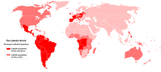
The Catholic Church in Myanmar is part of the worldwide Catholic Church, under the spiritual leadership of the Pope in Rome. There are around 750,000 Catholics in Burma - approximately 1% of the total population. The country is divided into sixteen dioceses including three archdioceses. Each of the archdioceses is also a metropolitan.
Loutolim or Loutulim is a large village of South Goa district in the state of Goa, India. It is an important settlement in the Salcete sub-district.
Curchorem (Kudchade) is a town and municipal council in the South Goa district of Goa, and is part of Quepem taluka. Curchorem and Sanvordem are twin towns on either side of the Zuari River. The town is self-sufficient and has a number of hospitals, schools, a police station, banks, ATMs, a railway station, good road links, a market, places of worship, restaurants, a play ground, an electricity station and a theatre.

Chandgad is a small city and tehsil headquarters in Gadhinglaj, which is a subdivision of Kolhapur district that is in the Indian state of Maharashtra. Jagrut Devastan Sri Ravalnath temple is located here.
The Western Coastal Plains is a strip of coastal plain 50 kilometres (31 mi) in width between the west coast of India and the Western Ghats hills, which starts near the south of the Tapi River. The plains are located between the Western Ghats and the Arabian Sea. The plains begin at Gujarat in the north and end at Kerala in the south. It includes the states of Maharashtra, Goa and Karnataka. The region consists of three sections: the Northern part of the coast is called the Konkan (Mumbai-Goa), the central stretch is called the Kanara, while the southern stretch is referred to as the Malabar Coast. On its northern side there are two gulfs: the Gulf of Khambat and the Gulf of Kutch. The rivers along the coast form estuaries and provide conditions ideal for pisciculture. because of the presence of less coastal land in this part, it will be affected more by the global warming.

Joida is a small town in the Uttara Kannada district in the Indian state of Karnataka. The town is the headquarters of the eponymous taluk. Located close to Ambikanagar, Joida is also called Supa by locals. KPCL maintains the Supa Dam, which straddles the Kali River nearby. The closest tourism destination to Joida is Dandeli. Other close by tourism destinations include Yellapur, Canacona and Castle Rock. Joida is 22 km from Dandeli. Although it is a taluk, it is still underdeveloped, with the forest surrounding most of the town. Joida comes under Ansi Tiger Reserve Area, this reserve area is one of the 30 Tiger reserve area in India, just 1 km from Patoli on Dandeli-Joida Road. Joida is covered in dense forest of about 87% and Joida taluk having lowest population in Karnataka State.

Bhagwan Mahaveer Sanctuary and Mollem National Park is a 240 square kilometres (93 sq mi) protected area located in the Western Ghats of South India, in Sanguem taluk, Goa along the eastern border with Karnataka. The area is situated near the town of Molem, 57 kilometres (35 mi) east of Panaji, the state capital of Goa. National Highway 4A divides it into two parts and the Mormugao - Londa railway line passes through the area. It is located between 15°15"30' to 15°29"30' N and 74°10"15' to 74°20"15' E. It contains several important temples dating to the Kadamba Dynasty, and Dudhsagar Falls. The parkland is also home to a community of nomadic buffalo herders known as the Dhangar.
Sattari is a sub-district of North Goa district in the state of Goa, India. The headquarters of Sattari taluka is Valpoi (वाळपई) municipal council. It lies in the north-eastern region of Goa where it is known for its greenery and dense forest. Part of the Western Ghats forms the eastern part of the Sattari taluka. The Mandovi River is considered to be the lifeline of Sattari. It has a geographical area of 490 km2; the Mhadei Wildlife Sanctuary covers 208 km2 of this area.
Chathamangalam is a village in Kozhikode district of Kerala state, India.
Chandor is a village in South Goa district, Salcete sub-district, in the Indian state of Goa. on the banks of the river Kushavati, 10 km east from Margao.

Colvá is a coastal village in Salcete, south Goa, on the west coast of India. Colva Beach stretches for around 2.4 kilometres (1.5 mi), part of a beach consisting of about 25 kilometres (16 mi) of powder white sand, lined along its shore by coconut palms and extending from Bogmalo in the north to Cabo de Rama in the south.

The Battle of Sittang Bridge was part of the Burma campaign during the Second World War. Fought between 19 February and 23 February 1942, the battle was a victory for the Empire of Japan, with many losses for the British Indian Army, which was forced to retreat in disarray. Brigadier Sir John George Smyth, V.C.—who commanded the British Indian Army at Sittang Bridge—called it "the Sittang disaster".

Honnihalli is a village in Belagavi district in the southern state of Karnataka, India.
Kanakumbi is a village in Belgaum district in Karnataka, India.. A beautiful village situated on boarder of satteri taluka Goa. Near cities are mapusa 65km. Punaji 71km. Belgaum city 45km. 101%konkani speaking people village. And people use village officially language is marathi. Karnataka and maharashtra boarder disputes on thise village but kanakumbi people not happy to accept or merge in maharashtra. But linguistic diversity kanakumbi village and their neibhar Villages injusticed by central govt. All people village belong hindu 96kuli Maratha community.village situated on MH Goa Ka boarder.


