Old Garston River

Last updated

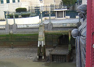
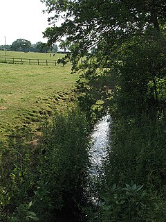
The Old Garston River or Garston River, sometimes referred to as the Garston Brook, is a tributary of the River Mersey in Garston, Merseyside, a district of Liverpool. Having been encroached upon by urban development, it is now a subterranean river, culverted for all of its length, although unlike many culverted urban rivers it has not been incorporated into the sewer system. [1]

River Mersey Major river emptying into Liverpool Bay

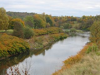
The River Mersey is a river in the North West of England. Its name is derived from the Anglo-Saxon language and translates as "boundary river". The river may have been the border between the ancient kingdoms of Mercia and Northumbria and for centuries it formed part of the boundary between the historic counties of Lancashire and Cheshire.

Liverpool City and Metropolitan borough in England

Liverpool is a city and metropolitan borough in North West England, with an estimated population of 491,500. Its metropolitan area is the fifth-largest in the UK, with a population of 2.24 million in 2011. The local authority is Liverpool City Council, the most populous local government district in the metropolitan county of Merseyside and the largest in the Liverpool City Region.

Subterranean river A river that runs wholly or partly beneath the ground surface

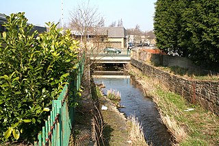
A subterranean river is a river that runs wholly or partly beneath the ground surface – one where the riverbed does not represent the surface of the Earth. It should also not be confused with an aquifer which may flow like a river but is contained within a permeable layer of rock or other unconsolidated materials.

The mouth of the Garston River was a haven for fishing boats, and probably contributed to the development of the settlement of Garston, around five miles upstream from central Liverpool. [2] The river was fed by two tributaries, a western and eastern. The shorter eastern tributary rose near Allerton. The western tributary rose about a quarter mile north west of the Calder Stones and followed the present line of Mather Avenue, but much of its drainage was intercepted by later drainage works and conveyed more directly to the Mersey. [3] There were once several mills along the river's course, along with two large pools, one of which – Garston Mill – was located on the opposite side of Church Road from St Michael's Parish Church. [4]

Allerton, Liverpool District of Liverpool

Allerton is a suburb of Liverpool, England. Historically in Lancashire, it is located 3 miles (4.8 km) southeast of Liverpool city centre, bordered by Mossley Hill, Woolton, Hunt's Cross and Garston.

Calderstones Park

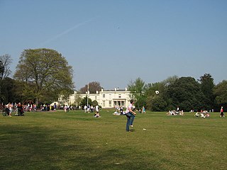
Calderstones Park is a public park in Liverpool, Merseyside, United Kingdom. The 126 acres (0.51 km2) park is mainly a family park. Within it there are a variety of different attractions including a playground, a botanical garden and places of historical interest. There is a lake in the park with geese and ducks, and the mansion house, which features a café and a children's play area.

Due to a low capacity of its culvert, the Old Garston River still presents an occasional flooding risk and is thought to be responsible for flooding at Woolton Golf Course and other nearby sites. [5]

See also

Related Research Articles

River Effra river in south London, England

The River Effra is a former stream or small river in south London, England, now culverted for most of its course. Once a tributary of the River Thames, flows from the Effra were incorporated in the Victorian era into a combined sewer draining much of the historic area of Peckham and Brixton.

River Cole, West Midlands river in West Midlands, England

The River Cole is a 25 miles (40 km) river in the English Midlands. It rises on the lower slopes of Forhill, one of the south-western ramparts of the Birmingham Plateau, at Hob Hill, near Wythall; and flows largely north-east across the plateau to enter the River Blythe below Coleshill, near Ladywalk, shortly before the Blythe meets the Tame. This then joins the Trent, whose waters reach the North Sea via the Humber Estuary. Its source is very near the main watershed of Midland England : tributaries are few and very short except in the lower reaches, so the Cole is only a small stream.

River Bollin river in the United Kingdom

The River Bollin is a major tributary of the River Mersey in the north-west of England.

River Croal river in the United Kingdom

The River Croal is a river located in Greater Manchester, England. It is a tributary of the River Irwell.

River Frome, Bristol river in South Gloucestershire and Bristol, England, United Kingdom

The River Frome, historically the River Froom, is a river in South Gloucestershire and Bristol, England. It is approximately 20 miles (32 km) long, rises in Dodington Park, South Gloucestershire, and flows in a south westerly direction through Bristol, joining the former course of the river Avon in Bristol's Floating Harbour. The mean flow at Frenchay is 60 cubic feet per second (1.7 m3/s) The name Frome is shared with several other rivers in South West England and means 'fair, fine, brisk’. The river is familiarly known in east Bristol as the Danny.

River Alt river in Liverpool, United Kingdom

The River Alt is an urban river that flows across Merseyside in England. The river has suffered from heavy pollution from industry and sewage upstream and run-off from farmland in its lower reaches. It empties into the River Mersey, near to where the Mersey itself, flows into the Irish Sea. the river has benefited from clean-up schemes and a de-culverting process to improve its water quality and provide a better environment for wildlife.

River Cole, Wiltshire river in Wiltshire, United Kingdom

The River Cole is a tributary of the River Thames in England which flows through Wiltshire and Oxfordshire, where it forms part of the border between the two counties.

Garston and Halewood (UK Parliament constituency) Parliamentary constituency in the United Kingdom

Garston and Halewood is a constituency created in 2010 represented in the House of Commons of the UK Parliament since 2010 by Maria Eagle of the Labour Party.

Blackburn Brook

The Blackburn Brook is a stream in Sheffield, South Yorkshire, England which flows through the Blackburn Valley along the M1 and Ecclesfield Road and joins the River Don near the Meadowhall shopping centre. Downstream from the A61 road at Chapeltown the Blackburn Brook is defined as a main river by the Environment Agency, which requires new building development to be at least 8m from the bank side as a flood defence measure and to allow access to the watercourse for maintenance.

River Croco river in Cheshire, United Kingdom

The River Croco is a small river in Cheshire in England. It starts as lowland field drainage west of Congleton, flows along the south edge of Holmes Chapel, and joins the River Dane at Middlewich. It is about 8 miles (13 km) long.

Gaywood River river in the United Kingdom

Gaywood River is a tributary of the River Great Ouse in the west of the county of Norfolk. Its source is 11 metres above sea level, northwest of the village of Gayton in Derby Fen, Map Reference TF 705 209. It runs for 6.7 miles (10.8 km) to its outflow into the River Great Ouse in the town of King's Lynn.

Naniken River river in Dublin, Ireland

The Naniken River is a minor river on the north side of Dublin city, Ireland, one of more than forty watercourses monitored by Dublin City Council. It is culverted for its upper course, visible in St Anne's Park for its entire lower course, and causes flooding somewhere along its line most years. The river flows entirely within the jurisdiction of Dublin City Council.

Wom Brook human settlement in United Kingdom

The Wom Brook is a stream in South Staffordshire, England. It flows through the large village of Wombourne, and has played an important part in its industrial history. It is an important tributary of the River Smestow and part of the Severn catchment.

Chino Creek river in the United States of America

Chino Creek is a major stream of the Pomona Valley, in the western Inland Empire region of Southern California. It is a tributary of the Santa Ana River.

Markeaton Brook river in the United Kingdom

The Markeaton Brook is an 11-mile-long (17 km) tributary of the River Derwent in Derbyshire, England. The brook rises from its source south of Hulland Ward, and flows for most of its length through the countryside north-west of Derby before entering a culvert to the north of the city centre; it reappears from this culvert and runs through a short section of open channel on the other side of the city before joining the Derwent.

The River Jordan, Little Jordan or Otterspool Brook is a tributary of the River Mersey. It has now been culverted for most of the lower part of its course, which runs through Otterspool Park in Aigburth, Liverpool.

Tue Brook

The Tue Brook or Tew Brook is a small river or stream in Liverpool. It flows through the suburb of West Derby and is the main tributary of the River Alt. The brook is now almost entirely culverted and runs underground, but is remembered in the name of Tuebrook ward.

Wildcat Creek is a tributary of the Lackawanna River in Lackawanna County, Pennsylvania, in the United States. It is approximately 3.8 miles (6.1 km) long and flows through Archbald and Blakely. The watershed of the creek has an area of 4.49 square miles (11.6 km2). It has one named tributary, which is known as West Branch Tinklepaugh Creek. The creek may lose flow to coal measures and may receive only intermittent flow even at its source. Only the upper reaches of the creek have a natural channel. It flows through an open box culvert in its lower reaches.

Walverden Water

Walverden Water is a minor river in Lancashire, England. It is approximately 2.6 miles (4.2 km) long and has a catchment area of 5.04 square miles (1,304.23 ha).

References

  1. Liverpool City Council, Strategic Flood Risk Assessment (Jan 2008), p.26
  2. Garston Industrial Development, Garston Historical Society
  3. Transactions of the Liverpool Engineering Society, Vol. 59-61, 1938, 223
  4. Ordnance Survey of Great Britain; First Edition
  5. LCC, SFRA Jan. 2008, p.34

Coordinates: 53°20′50″N2°54′21″W / 53.34735°N 2.90585°W / 53.34735; -2.90585

Geographic coordinate system Coordinate system

A geographic coordinate system is a coordinate system that enables every location on Earth to be specified by a set of numbers, letters or symbols. The coordinates are often chosen such that one of the numbers represents a vertical position and two or three of the numbers represent a horizontal position; alternatively, a geographic position may be expressed in a combined three-dimensional Cartesian vector. A common choice of coordinates is latitude, longitude and elevation. To specify a location on a plane requires a map projection.