
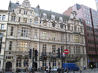
Whitechapel is a district in East London and the future administrative centre of the London Borough of Tower Hamlets. It is a part of the East End of London, 3.4 miles (5.5 km) east of Charing Cross. Part of the historic county of Middlesex, the area formed a civil and ecclesiastical parish after splitting from the ancient parish of Stepney in the 14th century. It became part of the County of London in 1889 and Greater London in 1965. The district is primarily built around Whitechapel High Street and Whitechapel Road, which extend from the City of London boundary to just east of Whitechapel station.

The Metropolitan Borough of Westminster was a metropolitan borough in the County of London, England, from 1900 to 1965.
The Metropolitan Borough of Holborn was a metropolitan borough in the County of London between 1900 and 1965, when it was amalgamated with the Metropolitan Borough of St Pancras and the Metropolitan Borough of Hampstead to form the London Borough of Camden.
The Metropolitan Borough of Finsbury was a metropolitan borough within the County of London from 1900 to 1965, when it was amalgamated with the Metropolitan Borough of Islington to form the London Borough of Islington.

The Metropolitan Borough of Stepney was a Metropolitan borough in the County of London created in 1900. In 1965 it became part of the London Borough of Tower Hamlets.

Minories is the name of a small former administrative unit, and also of a street in central London. Both the street and the former administrative area take their name from the Abbey of the Minoresses of St. Clare without Aldgate.

The City and Liberty of Westminster was a unit of local government in the county of Middlesex, England. It was located immediately to the west of the City of London. Originally under the control of Westminster Abbey, the local authority for the area was the Westminster Court of Burgesses from 1585 to 1900. The area now forms the southern part of the City of Westminster in Greater London.
The Precinct of the Savoy, also known as Savoy St John the Baptist, was a component of the Liberty of the Savoy in the county of Middlesex, England, located between the Strand and the River Thames. Formerly extra-parochial, it was a civil parish between 1866 and 1922. It now forms part of the City of Westminster in Greater London.
The Savoy was a manor and liberty located between the Liberty of Westminster, on two sides, the Inner and Middle Temple part of City of London and the River Thames. It was in the county of Middlesex. It was all held by the Duchy of Lancaster, and was also known as the Liberty of the Duchy of Lancaster. The duchy continues to have land holdings within the area. The manor, enjoying the status of a liberty, comprised the precinct of the Savoy, the southern half and detached south-west of the parish of St Clement Danes and about three quarters of St Mary le Strand as it only, in a tiny part, extended north of the Strand whereas those parishes straddled this ancient road.

Bills of mortality were the weekly mortality statistics in London, designed to monitor burials from 1592 to 1595 and then continuously from 1603. The responsibility to produce the statistics was chartered in 1611 to the Worshipful Company of Parish Clerks. The bills covered an area that started to expand as London grew from the City of London, before reaching its maximum extent in 1636. New parishes were then only added where ancient parishes within the area were divided. Factors such as the use of suburban cemeteries outside the area, the exemption of extra-parochial places within the area, the wider growth of the metropolis, and that they recorded burials rather than deaths, rendered their data incomplete. Production of the bills went into decline from 1819 as parishes ceased to provide returns, with the last surviving weekly bill dating from 1858. They were superseded by the weekly returns of the Registrar General from 1840, taking in further parishes until 1847. This area became the district of the Metropolitan Board of Works in 1855, the County of London in 1889 and Inner London in 1965.

The Liberties of the Tower, or the Tower Liberty is a small neighbourhood in the London Borough of Tower Hamlets, East London, which includes both Tower Hill and the Tower of London. The area was defined sometime after 1200 to provide an open area around the Tower to ensure its defensibility. The liberty was an independent administrative unit from then until it was formally abolished on 25 June 1894. The district maintains a ceremonial existence, with its custom of beating the bounds being a particularly well known example of the tradition.
Westminster St James was a civil parish in the metropolitan area of London, England. The creation of the parish followed the building of the Church of St James, Piccadilly, in 1684. After several failed attempts, the parish was formed in 1685 from part of the ancient parish of St Martin in the Fields in the Liberty of Westminster and county of Middlesex. It included part of the West End of London, taking in sections of Soho, Mayfair and St James's. Civil parish administration was in the hands of a select vestry until the parish adopted the Vestries Act 1831. The vestry was reformed again in 1855 by the Metropolis Management Act. In 1889 the parish became part of the County of London and the vestry was abolished in 1900, replaced by Westminster City Council. The parish continued to have nominal existence until 1922.
St Martin-in-the-Fields was a civil parish in the metropolitan area of London, England. It took its name from the church of St Martin-in-the-Fields and was within the Liberty of Westminster. It included within its boundaries the former extra-parochial areas of Buckingham Palace and St James's Palace.
The Close of the Collegiate Church of St Peter was an extra-parochial area, and later civil parish, in the metropolitan area of London, England. It corresponded to the area of Westminster Abbey and was an enclave between the parishes of St Margaret and St John, within the City and Liberty of Westminster. The Collegiate Church of St Peter is an alternative name for Westminster Abbey.

Mile End New Town is a former hamlet and then civil parish in the East End of London. Its former area is now part of the London Borough of Tower Hamlets.
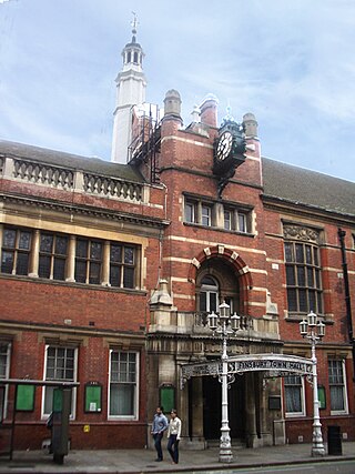
Whitechapel was a local government district within the metropolitan area of London, England from 1855 to 1900.

Norton Folgate was a liberty in Middlesex, England; adjacent to the City of London in what would become the East End of London.

The Liberty of Glasshouse Yard was an extra-parochial liberty adjacent to the City of London. The liberty took its name from a glass manufacturing works established there. The area now forms part of the London Borough of Islington.
The Royal Foundation of St Katherine is a religious charity based in the East End of London. The Foundation traces its origins back to the medieval church and monastic hospital St Katharine's by the Tower, established in 1147, next to the Tower of London.
