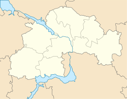
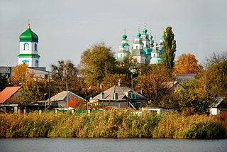
Olexandrivka is located on the left bank of the Samara River. Dnipropetrovsk State Fish Farm are adjacent to the rural upstream, and the city of Dnipro is 1km downstream. At village also located Tatarka River.
History
Village was founded in 1861 as the German colony of Billerfeld (German: Billerveld). In 1886, Billerfeld had 379 residents, 49 yards, a prayer house, a school, and a carpentry workshop. The colony was part of the Josefstal volost of the Novomoskovsk district. In 1925, there were 79 yards in which 616 men and women lived. In 1926, it was renamed to its current name. In 1959, the city of Igren (currently part of city Dnipro) was formed, which included the village of Olexandrivka.
On May 20, 1970, Olexandrivka was classified as a village, and at the same time, the Olexandrivska village council was formed. As of 1989, the population of Olexandrivka was approximately 2 400 people.
In 2020 Olexandrivska village council was subordinated to Slobozhanske settlement council,[1] after this village became part of the Slobozhanske settlement hromada.
Economics of village
Educational Department of the Dnipro State Agrarian and Economic University .
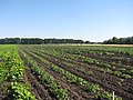
Dnipropetrovsk Research Station of the Institute of Vegetable and Melon Growing of the National Academy of Sciences.
Samara River, Samara Bay, Lake Velikiy (Big) Liman, Tatarka River, Pavlivskiy Forest, islands and bays. Closer to the northern outskirts of the village, between the horticultural society "Perlyna" and the summer cooperative "Samarskyi razlyv", which are territorially part of Olexandrivka, a beach has been arranged on Hnylokish Bay.
Dnipropetrovsk Oblast, also referred to as Dnipropetrovshchyna, is an oblast (province) in southeastern Ukraine, the most important industrial region of the country. It was created on February 27, 1932. Dnipropetrovsk Oblast has a population of about 3,096,485, approximately 80% of whom live centering on administrative centers: Dnipro, Kryvyi Rih, Kamianske, Nikopol and Pavlohrad. The Dnieper River runs through the oblast.
Dnipro, formerly Dnipropetrovsk (1926–2016), is Ukraine's fourth-largest city, with about one million inhabitants. It is located in the eastern part of Ukraine, 391 km (243 mi) southeast of the Ukrainian capital Kyiv on the Dnipro River, after which its name is derived. Dnipro is the administrative centre of Dnipropetrovsk Oblast. It hosts the administration of Dnipro urban hromada. Dnipro has a population of 968,502.
Novomoskovsk is a city and municipality in Dnipropetrovsk Oblast, Ukraine. It serves as the administrative center of Novomoskovsk Raion within the oblast. Novomoskovsk is located predominantly on the right bank of the Samara River, a left tributary of the Dnieper River. The city is located 27 kilometres (17 mi) from the administrative center of the oblast, Dnipro. As of January 2022, Novomoskovsk's population was approximately 69,855.
Dnipro Raion, formerly Dnipropetrovsk Raion until 2016, is a raion (district) of Dnipropetrovsk Oblast, southeastern Ukraine. Its administrative centre is the city of Dnipro. The population is 1,145,065.
Hvardiiske is a rural settlement in Dnipropetrovsk Oblast, Ukraine. It is part of Novomoskovsk Raion. Hvardiiske is located on the left bank of the Samara River, about 5.5 kilometres (3.4 mi) upstream from Cherkaske. It belongs to Cherkaske settlement hromada, one of the hromadas of Ukraine. Population: 6,024 According to the 2001 census, population was 5,199.
Samarskyi District is an urban district of the city of Dnipro, in southern Ukraine. It is located at the confluence of the Dnieper and Samara rivers in the eastern and southeastern parts of the city.
Aviatorśke is a rural settlement in Dnipro Raion within Dnipropetrovsk Oblast of eastern Ukraine. It belongs to Dnipro urban hromada, one of the hromadas of Ukraine. Population: 2,576
Mahdalynivka is a rural settlement in Novomoskovsk Raion, Dnipropetrovsk Oblast, Ukraine. It hosts the administration of Mahdalynivka settlement hromada, one of the hromadas of Ukraine. Population: 6,119.
Petropavlivka is a rural settlement in Synelnykove Raion, Dnipropetrovsk Oblast, Ukraine. It hosts the administration of Petropavlivka settlement hromada, one of the hromadas of Ukraine. Population: 6,651.
Sofiivka is a rural settlement in Kryvyi Rih Raion, central Ukraine. It hosts the administration of Sofiivka settlement hromada, one of the hromadas of Ukraine. Population: 6,329.
Solone is a rural settlement in Dnipro Raion, Dnipropetrovsk Oblast, Ukraine. It hosts the administration of Solone settlement hromada, one of the hromadas of Ukraine. Population: 7,380.
Vasylkivka is a rural settlement in Synelnykove Raion, Dnipropetrovsk Oblast, Ukraine. It hosts the administration of Vasylkivka settlement hromada, one of the hromadas of Ukraine. Population: 11,242.
Yurivka is a rural settlement in Pavlohrad Raion, Dnipropetrovsk Oblast, Ukraine. It hosts the administration of Yurivka settlement hromada, one of the hromadas of Ukraine. Population: 2,126.
Karnaukhivka is a rural settlement in Kamianske Raion, Dnipropetrovsk Oblast, Ukraine. It is located on the right bank of the Dnieper, about 5 kilometres (3.1 mi) southeast of Kamianske. Karnaukhivka belongs to Kamianske urban hromada, one of the hromadas of Ukraine. Population: 6,600.
Slobozhanske is a rural settlement in Dnipro Raion, Dnipropetrovsk Oblast, Ukraine. The populated place is part of the Dnipro urban sprawl being its immediate northern suburb. Slobozhanske hosts the administration of Slobozhanske settlement hromada, one of the hromadas of Ukraine. Population: 14,661.
Kurylivka is a rural settlement in Dnipro Raion, Dnipropetrovsk Oblast, Ukraine. It is located on the right bank of the Dnieper, downstream of the Kamianske Reservoir, across the river from the city of Kamianske. Kurylivka belongs to Petrykivka settlement hromada, one of the hromadas of Ukraine. Population: 2,432.
Novopokrovka is a rural settlement in Dnipro Raion, Dnipropetrovsk Oblast, Ukraine. It is located on the banks of the Komyshuvata Sura, a tributary of the Mokra Sura in the drainage basin of the Dnieper. Novopokrovka hosts the administration of Novopokrovka settlement hromada, one of the hromadas of Ukraine. Population: 1,725.
Slobozhanske settlement hromada is a territorial community in Ukraine, in Dnipro Raion of Dnipropetrovsk Oblast. The administrative center is the settlement of Slobozhanske. It was formed on August 14, 2015 by merging the Yuvileyne settlement council and the Stepove village council of Dnipropetrovsk Raion.
Balivka is a village in Ukraine, in Slobozhanske settlement hromada of the Dnipro district of the Dnipropetrovsk oblast. According to the 2021 census, the population is 2,297 people.
Dnipro urban territorial hromada is one of the hromadas of Ukraine, located in Dnipro Raion within Dnipropetrovsk Oblast. Its capital is the city of Dnipro.
This page is based on this Wikipedia article Text is available under the CC BY-SA 4.0 license; additional terms may apply. Images, videos and audio are available under their respective licenses.