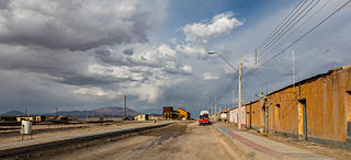
Panilonco Airport is an airport 11 kilometres (6.8 mi) north of Pichilemu, a Pacific coastal city in the O'Higgins Region of Chile.
Mocopulli Airport is an airport serving Dalcahue, a port city on Chiloé Island in the Los Lagos Region of Chile. The airport is 6 kilometres (3.7 mi) northwest of Dalcahue.
Alto Palena Airport is an airport serving Palena, a small town in the mountains of the Los Lagos Region of Chile. Palena is 5 kilometres (3.1 mi) from the Argentina border. The airport is just north of the town, and south of a bend in the Palena River.
Chaitén Airfield was an airport serving Chaitén, a town in the Los Lagos Region of Chile. The airport was damaged and closed after the 2008 eruption of Chaitén Volcano.
Chile Chico Airport Spanish: Aeródromo Chile Chico, is an airport serving Chile Chico, a lakeside town in the Aysén Region of Chile. Chile Chico is on the south shore of General Carrera Lake, 3 kilometres (1.9 mi) west of the Argentina border. The airport is 5 kilometres (3.1 mi) southeast of the town.
Teniente Vidal Airport Spanish: Aeródromo Teniente Vidal, is an airport serving Coyhaique, capital of the Aysén Region of Chile. The airport is 3 kilometres (1.9 mi) southwest of Coyhaique.
San Rafael Airport Spanish: Aeródromo de San Rafael de Los Andes, is an airport serving Los Andes, a city in the Valparaíso Region of Chile. The airport is 5 kilometres (3.1 mi) west-northwest of the city.
Agua Santa Airport, is an airport serving Palmilla, a town in the O'Higgins Region of Chile. The airport is 9 kilometres (5.6 mi) north of Santa Cruz.
María Dolores Airport is an airport serving Los Ángeles, capital of Bío Bío Province in the Bío Bío Region of Chile.
Santa Teresa del Almendral Airport, is an airport 12 kilometres (7.5 mi) north-northwest of Melipilla, a city in the Santiago Metropolitan Region of Chile. The airport is 1 kilometre (0.6 mi) west of the Puangue River.
Papageno Airport, was an airstrip 1 kilometre (0.6 mi) west of Calafquén Lake. Panguipulli, a city in the Los Lagos Region of Chile, is 11 kilometres (6.8 mi) to the south.
Panimávida Airport was an airstrip 1 kilometre (0.6 mi) east of Panimávida, a town in the Maule Region of Chile.
Piedra Negra Airport, is an airstrip just southwest of Curanipe, a Pacific coastal town 6 kilometres (4 mi) southwest of Pelluhue, in the Maule Region of Chile.
Pichidangui Airport, is an airport 3 kilometres (2 mi) east-southeast of Pichidangui, a Pacific coastal town in the Coquimbo Region of Chile.
Capitán Fuentes Martínez Airport, is an airport 5 kilometres (3.1 mi) northeast of Porvenir, a port city off the Strait of Magellan in the Magallanes Region of Chile.
Curimanque Airport, is an airport 7 kilometres (4.3 mi) southwest of Pucón, a lakeside city in the La Araucanía Region of Chile. The runway is 3 kilometres (1.9 mi) south of Villarrica Lake.
Panguilemo Airport is an airport 5 kilometres (3.1 mi) northeast of Talca, capital of the Maule Region of Chile.
Las Breas Airport is an airport 20 kilometres (12 mi) south-southeast of Taltal, a Pacific coastal town in the Antofagasta Region of Chile.
Lequecahue Airport is an airport 2 kilometres (1.2 mi) south of Tirúa, a Pacific coastal town in the Bío Bío Region of Chile.
Barriles Airport Spanish: Aeropuerto Barriles is an airport 15 kilometres (9.3 mi) east-southeast of Tocopilla, a Pacific coastal town in the Antofagasta Region of Chile.


