Bangata is an administrative ward in the Arusha Rural District of the Arusha Region of Tanzania. According to the 2012 census, the ward has a total population of 9,136.
Bwawani is an administrative ward in the Arusha Rural District of the Arusha Region of Tanzania. According to the 2012 census, the ward has a total population of 11,117.
Ilkiding'a is an administrative ward in the Arumeru district of the Arusha Region of Tanzania. Ikiding'a means a gathering place in Masai language. According to the 2012 census, the ward has a total population of 10,850.
Kimnyaki is an administrative ward in the Arusha Rural District of the Arusha Region of Tanzania. The name "Kimnyaki" means "we are lucky" in Maasai. According to the 2012 census, the ward has a total population of 3,487.
Kiranyi is an administrative ward in the Arusha Rural District of the Arusha Region of Tanzania. According to the 2012 census, the ward has a total population of 25,469.
Mateves is a Tanzanian administrative ward located in Arusha Rural District of the Arusha Region. It is one of 21 administrative wards in the district. Mateves means places where the fever tree grows in the Maasai language. Mateves ward is bordered by Musa ward to the northwest, Oltrumet ward to the far northeast, a tip of the Olorieni ward to the northeast as well. Olasiti ward borders Mateves to the north east and Terrat to the south east. To the south of Mateves is Oljoro ward and the southwest of Mateves is the Moita Ward and lastly, towards the west is Kisongo ward. The small town of Ngorbob is the seat of the ward. The ward is home to the Mungu Crater and Loljoro Hill at 1,585 meters. The ward covers an area of 104.4 km2 (40.3 sq mi), and has an elevation of 1,328 m (4,357 ft). According to the 2012 census, the ward had a total population of 15,632
Mlangarini is an administrative ward in the Arumeru district of the Arusha Region of Tanzania. According to the 2012 census, the ward has a total population of 12,983.
Nduruma, is a administrative ward in Arusha Rural District in the east Arusha Region of Tanzania. It is bordered to the north by Mlangarini, to the south by Bwawani, and to the east by Kikwe ward of the Meru District. The ward covers an area of 62.72 square kilometres (24.22 sq mi) with an average elevation of 1,041 metres (3,415 ft).
Oldonyosambu is an administrative ward in the Arumeru district of the Arusha Region of Tanzania. The name is derived from the Maasai word Oldonyosambok meaning 'thick mountain'. According to the 2012 census, the ward has a total population of 16,484.
Oljoro is an administrative ward in the Arusha Rural District of the Arusha Region of Tanzania. The ward is home to Mungu Crater which is 1,030 meters deep. According to the 2002 census, the ward has a total population of 7,896
Olkokola is an administrative ward in the Arusha Rural District of the Arusha Region of Tanzania. According to the 2012 census, the ward has a total population of 24,728.

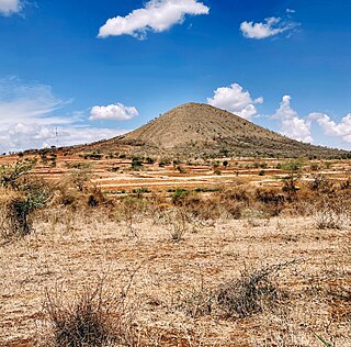
Oltroto or also spelt as Oltoroto is a Tanzanian administrative ward located in Arusha Rural District of the Arusha Region. Oltoroto means "a place to collect chalk" in Maasai language. The ward is bordered by Ilkiding'a to the north, Sokon II to the east, Moivo to the south and finally Olorieni and Kiranyi wards to the west. The ward is home to plateau mountain called Oldonyo Sapuk and on the east of the ward is Kivesi Hill at 1,897 meters tall. The ward covers an area of 11.85 km2 (4.58 sq mi), and has an average elevation of 1,699 m (5,574 ft). According to the 2012 census, the ward had a total population of 15,451
Oltrumet is an administrative ward in the Arusha District of the Arusha Region of Tanzania. The name of the ward is from a Maasai word meaning a place of grazing. According to the 2012 census, the ward has a total population of 10,226.
Engutoto is an administrative ward in the Arusha District of the Arusha Region of Tanzania. In 2016 the Tanzania National Bureau of Statistics report there were 8,287 people in the ward, from 6,970 in 2012.

Arusha District or Arusha District Council is one of the seven districts of the Arusha Region of Tanzania. The district is bordered to the north by Longido District, to the east by Meru District, to the south by Kilimanjaro Region, and to the west by Monduli District. the district surrounds Arusha City on all three sides. The district covers an area of 1,547.6 km2 (597.5 sq mi). The district is comparable in size to the land area of Guadeloupe. The district capital is located in Sokon II. According to the 2022 Tanzania National Census, the population of Arusha District was 449,518.
Olmotonyi is a village and an administrative ward in the Arusha District Council located in the Arusha Region of Tanzania. According to the 2012 census, the ward has a total population of 18,560.
Sambasha is a village and an administrative ward in the Arusha District Council located in the Arusha Region of Tanzania. According to the 2012 census, the ward has a total population of 9,484.

Sokon II is one of the 27 administrative wards of the Arusha District Council located in the Arusha Region of Tanzania. The name Sokon comes from the Swahili word for market, sokoni. The ward shares a similar name with another ward located in Arusha Urban District called Sokon I and the former is one of 27 rural administrative wards in the district as of 2012. Sokon II ward is bordered by Oltoroto and Moivo ward in the west, Ilkiding'a ward to the north, Bangata ward to the east. On the southern border Sokon II is bordered by Baraa, Kimandolu and Sekei wards. According to the 2012 census, the ward has a total population of 32,073. Thus, Sokon II is the most populous ward in Arusha District. Also the ward headquarters are Oldadai village. In addition, the Arusha District Administration building is located in Sokon II ward.
Olasiti is an administrative ward in the Arusha City Council located in the Arusha Region of Tanzania. According to the 2012 census, the ward has a total population of 36,361.
Mussa is an administrative ward in the Arusha Rural District of the Arusha Region of Tanzania. The ward covers an area of 71.60 km2 (27.64 sq mi), and has an average elevation of 1,571 m (5,154 ft). According to the 2012 census, the ward has a total population of 11,836.
