
Arusha City is a Tanzanian city, with a population of 617,631, and the regional capital of the Arusha Region, with a population of 2,356,255.

Moshi is a municipality and the capital of Kilimanjaro region in the north eastern Tanzania. As of 2017, the municipality has an estimated population of 201,150 and a population density of 3,409 persons per km2. In the last official census of 2022, the municipality had a population of 221,733. The municipality is situated on the lower slopes of Mount Kilimanjaro, a dormant volcano that is the highest mountain in Africa. The name Moshi has been reported to refer to the smoke that emanates from the nearby mountain. The municipality covers about 59 square kilometres (23 sq mi) and is the smallest municipality in Tanzania by area.
Arusha Region is one of Tanzania's 31 administrative regions and is located in the northeast of the country. The region's capital and largest city is the city of Arusha. The region is bordered by Kajiado County and Narok County in Kenya to the north, the Kilimanjaro Region to the east, the Manyara and Singida Regions to the south, and the Mara and Simiyu regions to the west. Arusha Region is home to Ngorongoro Conservation Area, a UNESCO World Heritage Site. The region is comparable in size to the combined land and water areas of the state of Maryland in the United States.

United World College East Africa (UWCEA) is an independent international school in Tanzania, and a member of the United World Colleges movement. Established in 1969 as International School Moshi, the school is based on two campuses on the slopes of Mount Kilimanjaro and Mount Meru near the city of Moshi, the capital of the Kilimanjaro region in north eastern Tanzania.

'Monduli District is one of seven districts of the Arusha Region of Tanzania. It is bordered to the north by Longido District, to the east by Arusha Rural District, to the south by the Manyara Region and to the west by Ngorongoro District and Karatu District. The District covers an area of 6,993 km2 (2,700 sq mi). The town of Monduli is the administrative seat of the district. According to the 2002 Tanzania National Census, the population of the Monduli District was 185,237. By 2012, the population of the district was 158,929. By 2022, the population had grown to 227,585.
Arusha City Council is one of seven administrative districts of Arusha Region in Tanzania. It is surrounded to the south, west and north by Arusha Rural District and to east by Meru District. The district covers an area of 267.0 km2 (103.1 sq mi). The district is comparable in size to the land area of Cayman Islands. The district capital is the city of Arusha. As of 1994, Arusha District was the wealthiest district in Tanzania. According to the 2022 Tanzania National Census, the population of Arusha Urban District was 617,631.

Usa River also known locally as Ussa is an administrative ward of the Meru District in the Arusha Region of Tanzania. It is the seat of Meru District. To the north and west, the ward is surrounded by the wards of Nkoaranga, Poli, and Seela Sing'isi. To the south and east, respectively, are the wards of Kikwe and Maroroni, and Maji ya Chai. As of 2012, Usa River ward had a population of 23,437.
Taveta is a town in the Taita-Taveta County, Kenya.

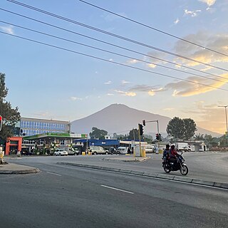
Meru District, officially the Meru District Council is one of seven districts of the Arusha Region of Tanzania.The District is bordered to the north by Longido District, to the east by Siha and Hai Districts of Kilimanjaro Region, to the south by Simanjiro District of Manyara Region, and to the west by Arusha Rural District and Arusha Urban District. It covers an area of 1,266 km2 (489 sq mi). The district is comparable in size to the land area of Faroe Islands. Meru District has an max elevation of 3,800 m (12,500 ft) at Rhino Point on Mount Meru. The administrative capital of the district is Usa River. According to the 2022 Tanzania National Census, the population of Meru District council was 331,603.
Braeburn High School is a private international school located on Gitanga Road in the Lavington suburb of Nairobi, Kenya.
Mateves is a Tanzanian administrative ward located in Arusha Rural District of the Arusha Region. It is one of 21 administrative wards in the district. Mateves means places where the fever tree grows in the Maasai language. Mateves ward is bordered by Musa ward to the northwest, Oltrumet ward to the far northeast, a tip of the Olorieni ward to the northeast as well. Olasiti ward borders Mateves to the north east and Terrat to the south east. To the south of Mateves is Oljoro ward and the southwest of Mateves is the Moita Ward and lastly, towards the west is Kisongo ward. The small town of Ngorbob is the seat of the ward. The ward is home to the Mungu Crater and Loljoro Hill at 1,585 meters. The ward covers an area of 104.4 km2 (40.3 sq mi), and has an elevation of 1,328 m (4,357 ft). According to the 2012 census, the ward had a total population of 15,632

Moshono is an administrative ward located in Arusha District, Arusha Region of Tanzania. It is one of 19 urban administrative wards in the municipality. Moshono ward is bordered by four wards to the north namely; Bangata, Baraa and Nkoanrua. Moshono is bordered to the west by Olorein, Themi and Engutoto wards. The ward of Mlangarini borders Moshono to the east. Moshono ward is the third largest ward in Arusha Urban District thus its mostly a rural ward with many farming communities and large schools. The ward covers an area of 24.59 km2 (9.49 sq mi), and has an elevation of 1,348 m (4,423 ft). According to the 2012 census, the ward had a total population of 20,698
Nduruma, is a administrative ward in Arusha Rural District in the east Arusha Region of Tanzania. It is bordered to the north by Mlangarini, to the south by Bwawani, and to the east by Kikwe ward of the Meru District. The ward covers an area of 62.72 square kilometres (24.22 sq mi) with an average elevation of 1,041 metres (3,415 ft).

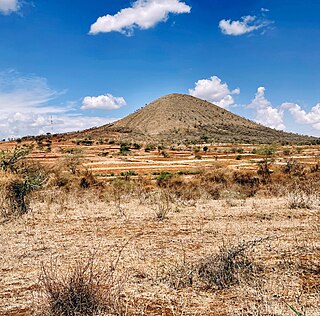
Oltroto or also spelt as Oltoroto is a Tanzanian administrative ward located in Arusha Rural District of the Arusha Region. Oltoroto means "a place to collect chalk" in Maasai language. The ward is bordered by Ilkiding'a to the north, Sokon II to the east, Moivo to the south and finally Olorieni and Kiranyi wards to the west. The ward is home to plateau mountain called Oldonyo Sapuk and on the east of the ward is Kivesi Hill at 1,897 meters tall. The ward covers an area of 11.85 km2 (4.58 sq mi), and has an average elevation of 1,699 m (5,574 ft). According to the 2012 census, the ward had a total population of 15,451

Monduli Mjini is an administrative ward and district capital located in the Monduli District of the Arusha Region of Tanzania.The ward is totally surrounded by the Engototo ward. In 2016 the Tanzania National Bureau of Statistics report there were 8,699 people in the ward, from 7,796 in 2012. The average elevation of Monduli Mjini is 1,553m.

Elerai is an administrative ward in Arusha District, Arusha Region of Tanzania. It is one of 19 urban administrative wards in the municipality. The ward is bordered by Olasiti ward to the west, Kiranyi ward to the north, Ngarenaro ward to the east, Sombetini to the south and, a tiny portion of Unga L.T.D ward to the southeast. The ward covers an area of 3.746 km2 and ranks number eleven in the area in Arusha city. The ward is home to the national National College of Tourism, the African Court and Tanzania National Parks Authority (TANAPA)'s national headquarters, also the Arusha Modern school. The school's famous alumna is Tanzanian recording artist, Vanessa Mdee, who received secondary education there. According to the 2012 census, the ward had a total population of 40,749.

Levolosi is an administrative ward in the Arusha District of the Arusha Region of Tanzania. Levolosi means "middle" in the Maasai language word olevolos. Levolosi is one of 19 urban administrative wards in the municipality. The ward is bordered by Ngarenaro ward to the west, Kaloleni ward to the northeast, Kati ward to the southeast and, Unga L.T.D ward to the south. The ward covers an area of 1.148 square kilometers. The ward is home to some one of the largest hospitals, markets and transportation hubs in the city. Levolosi is home to the Levolosi cemetery, one of the oldest in the city located next to Sheikh Amri Abeid Memorial Stadium. According to the 2012 census, the ward has a total population of 8,838.
Ngarenaro is an administrative ward located in the Arusha City Council of Arusha Region in Tanzania. The ward gets its name from the Ngarenaro River, which runs on the eastern border with Levolosi ward. the word Ngarenaro is a Swahilization of the Masai word Engarenarok, meaning "Black River".

Kenya–Tanzania relations are bilateral relations between Tanzania and Kenya. Tanzania is a partner of Kenya in many areas, particularly trade, security (military), education, agriculture and energy.

Arusha District or Arusha District Council is one of the seven districts of the Arusha Region of Tanzania. The district is bordered to the north by Longido District, to the east by Meru District, to the south by Kilimanjaro Region, and to the west by Monduli District. the district surrounds Arusha City on all three sides. The district covers an area of 1,547.6 km2 (597.5 sq mi). The district is comparable in size to the land area of Guadeloupe. The district capital is located in Sokon II. According to the 2022 Tanzania National Census, the population of Arusha District was 449,518.
