
Mwanga is one of the seven districts of the Kilimanjaro Region of Tanzania. The district covers an area of 1,831 km2 (707 sq mi), It is bordered to the northeast by Kenya, to the northwest by the Moshi Rural District, to the southwest by Simanjiro District of Manyara Region, and to the south by the Same District. Its administrative seat is the town of Mwanga. The tallest peak in the district is Kindoroko at 2,100m in the North Pare Mountains that are located entirly within the district. According to the 2012 Tanzania National Census, the population of Mwanga District was 131,442.
Bangata is an administrative ward in the Arusha Rural District of the Arusha Region of Tanzania. According to the 2012 census, the ward has a total population of 9,136.
Bwawani is an administrative ward in the Arusha Rural District of the Arusha Region of Tanzania. According to the 2012 census, the ward has a total population of 11,117.
Ilkiding'a is an administrative ward in the Arumeru district of the Arusha Region of Tanzania. Ikiding'a means a gathering place in Masai language. According to the 2012 census, the ward has a total population of 10,850.
Kimnyaki is an administrative ward in the Arusha Rural District of the Arusha Region of Tanzania. The name "Kimnyaki" means we are lucky in Maasai. According to the 2012 census, the ward has a total population of 3,487.
Kiranyi is an administrative ward in the Arusha Rural District of the Arusha Region of Tanzania. According to the 2012 census, the ward has a total population of 25,469.
Mlangarini is an administrative ward in the Arumeru district of the Arusha Region of Tanzania. According to the 2012 census, the ward has a total population of 12,983.
Nduruma is an administrative ward in the Arusha Rural District of the Arusha Region of Tanzania. According to the 2012 census, the ward has a total population of 12,042.
Oljoro is an administrative ward in the Arusha Rural District of the Arusha Region of Tanzania. The ward is home to Mungu Crater which is 1,030 meters deep. According to the 2002 census, the ward has a total population of 7,896
Olkokola is an administrative ward in the Arusha Rural District of the Arusha Region of Tanzania. According to the 2012 census, the ward has a total population of 24,728.
Oltrumet is an administrative ward in the Arusha District of the Arusha Region of Tanzania. The name of the ward is from a Maasai word meaning a place of grazing. According to the 2012 census, the ward has a total population of 10,226.
Gelai Meirugoi is an administrative ward in the Longido District district of the Arusha Region of Tanzania. According to the 2012 census, the ward has a total population of 9,173.
Matale is an administrative ward in the Longido District district of the Arusha Region of Tanzania. According to the 2012 census, the ward has a total population of 4,411.
Buger is an administrative ward in the Karatu district of the Arusha Region of Tanzania. According to the 2012 census, the ward has a total population of 9,919.
Daa is an administrative ward in the Karatu district of the Arusha Region of Tanzania. According to the 2012 census, the ward has a total population of 9,868.
Daraja Mbili is an administrative ward in the Arusha District of the Arusha Region of Tanzania. According to the 2012 census, the ward has a total population of 19,491.
Kaloleni is an administrative ward in the Arusha District of the Arusha Region of Tanzania. According to the 2012 census, the ward has a total population of 9,591.
Lemara is an administrative ward in the Arusha District of the Arusha Region of Tanzania. According to the 2012 census, the ward has a total population of 19,564.
Sokon I is an administrative ward in the Arusha District of the Arusha Region of Tanzania. According to the 2012 census, the ward has a total population of 73,331.
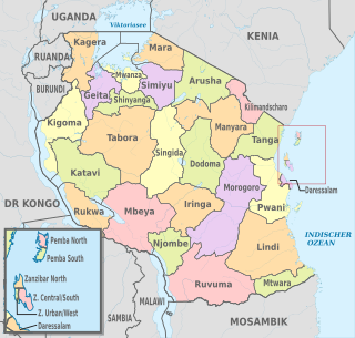
The administrative divisions of Tanzania are controlled by Part I, Article 2.2 of the Constitution of Tanzania. Tanzania is divided into thirty-one regions. Each region is subdivided into districts. The districts are sub-divided into divisions and further into local wards. Wards are further subdivided for management purposes: for urban wards into streets and for rural wards into villages. The villages may be further subdivided into hamlets.
