Olopa

Last updated

Olopa is a municipality in the Chiquimula department of Guatemala. The municipality comprises an area of 112 km2, distributed in 1 town (Olopa) and 29 villages, with a total population of 27,511. [1]

Contents

It is bordered on the north by the municipality of Jocotán, on the south and east by Esquipulas, and on the west by Quezaltepeque and San Juan Hermitage. It has a subtropical highland climate (Köppen: Cwb).

History

Olopa was originally inhabited by the Ch'orti' but was invaded by tribes of the Valley of Mexico. In April or May 1860, the Capuchin Fathers, who had evangelized in the eastern of the country, donated to the inhabitants of the valley of Olopa an "Image of the Divine Shepherd" and constructed a church, made of straw. In March 1870, according to the Corregidor de Chiquimula Don Juan Peralta Baptist, Olopa was an indigenous town, with a pajiza church, and a resident Catholic Priest. On 1870-11-25 Don Juan Peralta Baptist authorized the establishment of Olopa as a municipality.

Climate

Olapa is located between the 1,300 and 1,600 meters above sea level, with an average of 130 days of rain per year. Temperature varies between 18 and 25 degrees Celsius.

Related Research Articles

Esquipulas Municipality and town in Chiquimula Department, Guatemala

Esquipulas, officially Municipality of Esquipulas, whose original name was Yzquipulas, is a town, with a population of 18,667, and a municipality located in the department of Chiquimula, in eastern Guatemala. Esquipulas' main attraction is the beautiful Black Christ located in the Basilica of Esquipulas, making the town an important place of Catholic pilgrimage for Central America. It is also one of the most important towns of the country and one that has had the most economic and cultural growth.

Chiquimula Department Department of Guatemala

Chiquimula is one of the 22 departments of Guatemala, in Central America. The departmental capital is also called Chiquimula. The department was established by decree in 1871, and forms a part of the northeastern region of Guatemala. Physically, it is mountainous, with a climate that varies between tropical and temperate, depending on the location.

El Progreso Department Department of Guatemala

El Progreso is a department in Guatemala. The departmental capital is Guastatoya. The Spanish established themselves in the region by 1551, after the Spanish conquest of Guatemala. El Progreso was declared a department in 1908, but was dissolved in 1920 before being reestablished in 1934. Guastatoya was badly affected by the 1976 Guatemala earthquake.

Zacapa Department Department of Guatemala

Zacapa is one of the 22 departments of Guatemala. It lies in eastern Guatemala with its capital in the city of Zacapa, approximately 112 kilometers from Guatemala City.

Zacapa Municipality in Guatemala

Zacapa is the departmental capital municipality of Zacapa Department, one of the 22 Departments of Guatemala. It is located approximately 70 miles or 112 kilometers from Guatemala City.

Ocotepeque Municipality in Honduras

Ocotepeque is a town and municipality in the Honduran department of Ocotepeque.

Chalchuapa Place in Santa Ana Department, El Salvador

Chalchuapa is a town and a municipality located in the Santa Ana department of El Salvador. The city of Chalchuapa is in a wide valley at 650 meters above sea level, and watered by the Pampe River.

Concepción Las Minas is a municipality in southern Chiquimula department of Guatemala in Central America. It has a population of 11,693 (2018) and cover an area of 222 km2.

Ipala, Guatemala Municipality in Chiquimula, Guatemala

Ipala is a town and municipality in the Chiquimula department of Guatemala.

Jocotán Municipality and town in Guatemala, Guatemala

Jocotán is a town and municipality in the Chiquimula department of Guatemala.

Quezaltepeque is a municipality, with a population of 28,075 and an area of 239 km2, in the Chiquimula department of Guatemala. The local economy is based on agriculture. Agricultural products include coffee, maize and beans. As of 1993, there was a working telegraph terminal there in the post office.

San Jacinto is a municipality, in the Chiquimula department of Guatemala. It has a population of 12,619 and cover an area of 72 km2.

San José La Arada Municipality of Chiquimula Department, Guatemala

San José La Arada is a municipality in the Chiquimula department of Guatemala. It has a population of 8,756 and cover an area of 121 km2.

San Juan Ermita is a municipality in the Chiquimula department of Guatemala. It has a population of 16,418 and cover an area of 80.5 km2.

San Cristóbal Acasaguastlán Municipality in El Progreso, Guatemala

San Cristóbal Acasaguastlán is a town in the El Progreso department of Guatemala. San Cristóbal Acasaguastlán is located on the northern bank of the Motagua River at an altitude of 250 m. It had a population of 6,129 people at the 2002 census, and covers a territory of 124 square kilometres (48 sq mi). San Cristóbal Acasaguastlán borders on San Agustín Acasaguastlán to the northwest, Usumatlán to the east, and El Jicaro to the south. It is located on the inter-ocean highway (CA-9), 101 km from Guatemala City.

Almolonga, Quetzaltenango Municipality and town in Quetzaltenango, Guatemala

Almolonga is a town, with a population of 12,299, and a municipality in the Quetzaltenango Department of Guatemala, located on the road between Ciudad de Quetzaltenango and Zunil. Its population is primarily indigenous, speaking the K'iche' (Quiché) language

San Juan Ostuncalco Municipality and town in Quetzaltenango, Guatemala

Ostuncalco, full name San Juan Ostuncalco, is a town, with a population of 20,763, and a municipality in the Quetzaltenango department of Guatemala. Beside Spanish, local people speak the Mam language. La Victoria is a village in this municipality.

Patulul is a town, with a population of 11,343, and a municipality in the Suchitepéquez department of Guatemala.

Santa Catalina la Tinta Municipality in Corredor Seco, Guatemala

Santa Catalina la Tinta is a town and municipality in the Guatemalan department of Alta Verapaz. It is located in the hot Polochic River valley. It was originally part of the municipality of Panzós, but was given separate municipal status in 1999. La Tinta is the commercial center of the lower Polochic valley, and merchants and shoppers clog the town's streets especially on the official market days of Tuesdays and Thursdays. The town of Santa Catalina la Tinta is located at 110 km from Cobán and 278 km from Guatemala City and has a population of 20,552.

Lempa River river in Guatemala and El Salvador

The Lempa River is a 422-kilometre (262 mi) long river in Central America.

References

  1. Citypopulation.de Population of departments and municipalities in Guatemala

Coordinates: 
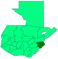
14°41′N89°21′W / 14.683°N 89.350°W / 14.683; -89.350