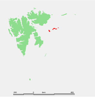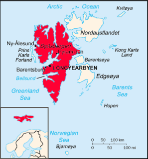
Kongsøya is an island in Svalbard, Norway. It is the largest of the islands in King Charles Land. Its area is 191 square kilometres (74 sq mi). The other main island in the chain is Svenskøya.

Prof Sven Ludvig Lovén, was a Swedish marine zoologist and malacologist. The Sven Loven Centre for Marine Sciences at both Kristineberg and Tjärnö are named in his honour.
Guissezholmen Bird Sanctuary is a bird reserve at Svalbard, Norway, established in 1973. It includes islets at Kapp Guissez in Haakon VII Land. The protected area covers a total area of around 400,000 square metres.
Olsholmen Bird Sanctuary is a bird reserve at Svalbard, Norway, established in 1973. It includes Olsholmen off Wedel Jarlsberg Land, Spitsbergen. The protected area covers a total area of around 461,000 square metres.
Nordfjorden is a northern branch of the fjord Isfjorden at Spitsbergen, Svalbard. It is located between Bohemanneset and Kapp Thordsen, and branches further into the fjords Ekmanfjorden and Dicksonfjorden. The 30 kilometer long glacier Sveabreen debouches into the fjord.
Kapp Klaveness is a headland at the west coast of Wedel Jarlsberg Land at Spitsbergen, Svalbard. It is named after ship owner Anton Klaveness.

Brennevinsfjorden is a fjord in Gustav V Land at Nordaustlandet, Svalbard. The fjord has a length of about eleven nautical miles, and runs in between Depotodden and Kapp Hansteen.
Platenhalvøya is a peninsula at Nordaustlandet, Svalbard, between Zorgdragerfjorden and Duvefjorden. The peninsula constitutes the northeastern part of Prins Oscars Land. The mountains Binneyfjellet and Goodenoughfjellet are among the highest peaks of Nordaustlandet.
Kapp Altmann is a headland at the southern side of Kongsøya in Kong Karls Land, Svalbard. It has a length of 1.9 kilometers and a width between 100 and 200 meters. Outside the spit are two small islands. The headland is named after Arctic explorer Johan Andreas Altmann. Kapp Altmann defines the western extension of the bay Breibukta.
Kapp Koburg is a headland at the western part of Kongsøya in Kong Karls Land, Svalbard. It is located at the western side of Hårfagrehaugen, and defines the southwestern extension of the bay Bünsowbukta.
Arnesenodden is a headland on Svenskøya in Kong Karls Land, Svalbard. It is the most northern point of Svenskøya, at the foot of the mountain Mohnhøgda. The headland is named after Arctic explorer Magnus Arnesen.

Mariaholmen is an islet in Nathorst Land at the mouth of Van Mijenfjorden at Spitsbergen, Svalbard. It is located south of Akseløya, between Akseløya and Måseneset. While Akselsundet north of Akseløya is regarded as the main entrance to Van Mijenfjorden, Mariasundet between Mariaholmen and Måseneset is also navigable.
Kapp Borthen is a headland in Wedel Jarlsberg Land at Spitsbergen, Svalbard. It is located at the western coast of Spitsbergen, at the front of the glacier Torellbreen. The headland is named after Norwegian ship-owner Harry Borthen.
Vaktarfjella is a mountain group in Andrée Land at Spitsbergen, Svalbard. It has an extension of about eleven kilometers, and is located north of the valley Woodfjorddalen. The highest summit in the group is Vaktaren, with a height of 1,227 m.a.s.l. The northwestern mountain in the group is Kapp Ringertz.
Femvatna is a group of five small lakes in Nordenskiöld Land at Spitsbergen, Svalbard. The lakes are located east of the headland of Kapp Bjørset, and northwest of the plain of Lågnesflya.
Dunérbukta is a bay at the western shore of Storfjorden in Sabine Land at Spitsbergen, Svalbard. It is named after Swedish astronomer Nils Christoffer Dunér. The glacier of Ulvebreen debouches into the bay. At the northern side of the bay is the mountain of Domen and the ridge Kapp Johannesen.
Kapp Bessels is a headland at Barentsøya, Svalbard. It is located at the northeastern coast of the island, and east of the glacier of Besselsbreen. The headland is named after German Arctic explorer Emil Bessels.
Frankenhalvøya is a peninsula at Barentsøya, Svalbard. It has a length of about nine kilometers, and a width of six kilometers. The peninsula is named after the German region of Franconia. The bay of Dorstbukta is situated between Frankenhalvøya and Besselsbreen. Northeast of the peninsula is the headland Kapp Voejkov.
Davisodden is a headland in Nathorst Land at Spitsbergen, Svalbard. It is named after American geomorphologist William Morris Davis. The headland is located at the northern side of Van Keulenfjorden, and is a river delta made by the river flowing through Davisdalen. Davisdalen extends from the mountain ridge of Mjellegga down to Davisodden. Its river is fed from several glaciers, including Martinbreen and Charpentierbreen.
Kapp Toscana is a headland at the southern side of Van Keulenfjorden in Wedel Jarlsberg Land at Spitsbergen, Svalbard. It is named after an Austrian family. West of the headland is the bay of Bourbonhamna, extending from Kapp Toscana to Kapp Madrid. East of the headland is the bay of Ingebrigtsenbukta, extending from Kapp Toscana to Ålesundneset.


