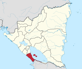
Ometepe Island is an important archaeological site, located in the Lake Nicaragua in the Republic of Nicaragua, administratively belongs to the Rivas Department. Its name derives from the Nahuatl words ome (two) and tepetl (mountain), meaning two mountains, given that it is formed and practically the whole island is formed by two volcanoes: Concepción and Maderas.
Ometepe has an area of 276km². It is the largest volcanic island located within a lake. The population is estimated at 42,000. The island has two larger cities, Moyogalpa and Altagracia that also are the main access ports to the island. There are an enormous amount of prehispanic statues, petroglyphs and pottery found on the island, and the area is believed to be an important ceremonial center for its ancient inhabitants, as well as dozens of petroglyphs carved into stones and the surrounding bedrock.[1]
History
There is evidence that the island was inhabited at least since 1500 BC. Apparently this population would be part of a migration movement originated in South America with final destination in Mexico. On the island found ceramic and large sculptures carved basalt rock have been found, that are exhibited today in the Park of Altagracia Church and the Managua National Museum. These sculptures are attributable to the same style as those found in the Zapatera Island by the Chorotega culture.
Ometepe petroglyphs found on the island.
Some petroglyphs were also found in the island made from 300 AD. Many of the petroglyphs include spirals. Others are used to depict the head of anthropomorphic figures, some of which resemble Mesoamerican depictions of Nagual, suggesting the shared practice of Tonal spirituality.[1]
The conquistadores found the country occupied by numerous towns populated by the Nicarao people, dedicated to the practice of the arts and peaceful industries. Dr. Berendt, great explorer and scholar of Aboriginal people of Central America, in the light of philological results obtained by himself and American diplomat Ephraim George Squier (1849), and traditions preserved mainly from Oviedo, Torquemada and Herrera, believed that the chorotegan, Cholutecas, Dirianes and Orotinas were descendants of people that migrated from Cholula, Mexico. These people occupied the greater part of the country from the Gulf of Fonseca to Nicoya, its territorial continuity was interrupted in the vicinity of current Leon by the Marabios and again by an Aztec colony that occupied the narrowest part of the strip of land between the Pacific and the Nicaragua Lake and the lake islands. The King and the capital of this nation was named Nicarao (Conference read before the American geographical society, July 10, 1876, by Dr. C. H. Berendt). The former inhabitants of this region left abundant relics of their civilization in mounds, cemeteries, etc. (Bransford, J.F. 1881. Introduction, p.4)
The first archaeological report on the Ometepe material came to light with the 1852 publication "Nicaragua, its people and landscapes" by American diplomat E. G. Squier, who explored the area in 1849.
In December, 1872, the Navy Department sent an expedition under the command of Commander E.P. Lull, USN, to Nicaragua, to complete the studies initiated in the spring of that year for an inter-oceanic canal. (For valuable information on the country, see the report published by the Navy Department, 1874 on studies for a canal through Nicaragua.) J.F Bransford, was a medical officer assigned to expeditions, with instructions to perform general scientific research on natural history, etc., of the country. He visited the Ometepe Island and while searching for antiquities, he managed by chance to see a ditch which had been recently excavated, in which were exposed funerary urns. This was an estate that belonged to don José Angel Luna, near Moyogalpa. (Bransford, J.F. 1881. Preliminary Note, p.1)
In 1876, he was sent to Nicaragua in particular service related to the study, and was instructed to perform archaeological research in the Ometepe Island. He was in the country from January to mid-May, more than half the time exploring and digging in the island, having carried out the main portion of the work at the Luna Hacienda, Los Angeles and San Francisco. He was again in the island from February, 1877 and remained until the first of July. As before, most of the time was spent on the island, focusing in Santa Helena and Chilaite, north from Moyogalpa. Then some investigations were made in firm land near San Jorge, followed by a trip south to Nicoya in Costa Rica. (Bransford, J.F. 1881. Preliminary Note, p.1)
For his part, Professor Carl Bovallius, arrived at Ometepe from Granada, on 1882–1883 New Year's Eve and stayed in the Moyogalpa village, on the northwest tip of the island. From there he took several trips in different directions, and although his zoological research occupied a lot of his time, he had numerous opportunities to perform archaeological excavations. (Carl Bovallius. 1886, p.9-10)
Related Research Articles
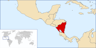
Nicaragua, officially the Republic of Nicaragua, is the largest country in Central America, bordered by Honduras to the north, the Caribbean to the east, Costa Rica to the south, and the Pacific Ocean to the west. Managua is the country's capital and largest city. As of 2015, it was estimated to be the third largest city in Central America. Nicaragua's multiethnic population of six million includes people of mestizo, Indigenous, European and African heritage. The main language is Spanish. Indigenous tribes on the Mosquito Coast speak their own languages and English.
A petroglyph is an image created by removing part of a rock surface by incising, picking, carving, or abrading, as a form of rock art. Outside North America, scholars often use terms such as "carving", "engraving", or other descriptions of the technique to refer to such images. Petroglyphs, estimated to be 20,000 years old are classified as protected monuments and have been added to the tentative list of UNESCO's World Heritage Sites. Petroglyphs are found worldwide, and are often associated with prehistoric peoples. The word comes from the Greek prefix petro-, from πέτρα petra meaning "stone", and γλύφω glýphō meaning "carve", and was originally coined in French as pétroglyphe.
The Nahua are an Indigenous group of Mesoamerican people inhabiting the western and central areas of present-day El Salvador. They speak the Nawat language, which belongs to the Nahuan language branch of the Uto-Aztecan language family. There are very few speakers of the language left, which is a reason for the current efforts being made to revitalize it.
Rivas is a department of the Republic of Nicaragua. It covers an area of 2,162 km2 and has a population of 183,611. The department's capital is the city of Rivas.
Ometepe is an island formed by two volcanoes rising out of Lake Nicaragua, located in the Rivas Department of the Republic of Nicaragua. Its name derives from the Nahuatl words ome (two) and tepetl (mountain), meaning "two mountains". It is the largest island in Lake Nicaragua.
Ephraim George Squier, usually cited as E. G. Squier, was an American archaeologist, history writer, painter and newspaper editor.
The following is an alphabetical list of topics related to Nicaragua.
The official language of Nicaragua is Spanish; however, Nicaraguans on the Caribbean coast speak indigenous languages and also English. The communities located on the Caribbean coast also have access to education in their native languages. Additionally, Nicaragua has four extinct indigenous languages.
Ruins of León Viejo is a World Heritage Site in Nicaragua. It was the original location of León. It is the present location of the town of Puerto Momotombo in the Municipality of La Paz Centro of the Department of León. It is administered by the Instituto Nicaragüense de Cultura.
The following outline is provided as an overview of and topical guide to Nicaragua:
Los Placeres is an archeological site located between the “Waspán” and “Tabacalera Nicaragüense” neighborhoods at kilometer 41⁄2 of the “Carretera Norte”, in Managua, en Nicaragua. The site extends to the coast of Lake Managua. A large part of the area that delimits the site is being impacted by a new urban settlement known as Barrio Hugo Chávez, which divides the site, where its new settlers have disturbed the ground for installation of pipes for drinking water, toilet and housing, this activity has caused a serious incidental findings and impacts to the prehispanic archaeological site.
Zapatera is an archaeological site located on Isla Zapatera, a volcanic island in Lake Nicaragua, Granada Department, Nicaragua. The large quantity of statues, petroglyphs and pottery found at the site, and on other islands in the Zapatera archipelago, suggests the area was an important ceremonial centre of pre-Columbian Chorotega people between 800 and 1350 CE.
El Ceibo is a museum in the Ometepe island in what once were the tobacco farm “Tel Aviv” kilns, known by its former name “El Refugio”, in the community of Sacramento, 10 kilometers from Moyogalpa in Lake Cocibolca or Lake Nicaragua administratively Ometepe Island belongs to the Rivas Department. The name of the island derives from the Nahuatl: ōme 'two' and tepētl 'mountain (s),' since it is almost entirely composed of two volcanic cones: Concepción (volcano) and Maderas volcano.
Coatetelco or Cuatetelco is a pre-Hispanic archaeological site located next to the Coatetelco Lagoon, two kilometers from Alpuyeca, in the Miacatlán municipality, Morelos, Mexico, near Xochicalco. It had its greatest development between 500 and 150 BCE.
Carl Erik Alexander Bovallius was a Swedish biologist and archaeologist.
Nicarao was said to be the name of an indigenous chieftain or cacique who presided over a territory in southwestern Nicaragua during the early 16th century. Based on research done by historians in 2002, it was discovered that his real name was Macuilmiquiztli.
El Ostional is a coastal town on the Pacific Ocean, in the municipality of San Juan del Sur and Rivas department in south-west Nicaragua. It is located 170 kilometers south of Managua and 10.5 kilometers from the border with Costa Rica. The region consists of the communities of Monte Cristo and San Antonio. El Ostional is becoming recognized as a quaint spot for voluntourism, sport fishing, birdwatching, turtle, dolphin, and whale watching, Cultural heritage events and is a vacation spot for Nicaraguan families and foreign tourists interested in immersing themselves in rural community life.
Regional communications in ancient Mesoamerica are believed to have been extensive. There were various trade routes attested since prehistoric times. In this article, especially the routes starting in the Mexico Central Plateau, and going down to the Pacific coast will be considered. These contacts then went on as far as Central America.
The Spanish conquest of Nicaragua was the campaign undertaken by the Spanish conquistadores against the natives of the territory now incorporated into the modern Central American republic of Nicaragua during the colonisation of the Americas. Before European contact in the early 16th century, Nicaragua was inhabited by a number of indigenous peoples. In the west, these included Mesoamerican groups such as the Chorotega, the Nicarao, and the Subtiaba. Other groups included the Matagalpa and the Tacacho.
The Kingdom of Nicoya, also called Cacicazgo or Lordship of Nicoya, was an indigenous nation that comprised much of the territory of the current Guanacaste Province, in the North Pacific of Costa Rica. Its political, economic and religious center was the city of Nicoya, located on the peninsula of the same name, which depends on several provinces located on both banks of the Gulf of Nicoya, as well as numerous tributary villages. In the 16th century, prior to the arrival of Europeans, Nicoya was the most important chiefdom of the North Pacific of present-day Costa Rica.
"Archaeological Research in Nicaragua" published in 1881 by Dr. J.F. Bransford, former U.S. Navy assistant surgeon and researcher of the Smithsonian Institution, Washington D.C.[1]
"Nicaraguan Antiquities" published in 1886 by Professor Carl Bovallius, Member of the Swedish Anthropology and Geography Society.[2]
↑ Bovallius, Carl. “Nicaraguan Antiquities”, Swedish Society of Anthropology and Geography, Stockholm 1886. Kongl. Boktryckeriet (Norstedt & Söner)
This page is based on this Wikipedia article Text is available under the CC BY-SA 4.0 license; additional terms may apply. Images, videos and audio are available under their respective licenses.