
Territorial authorities are the second tier of local government in New Zealand, below regional councils. There are 67 territorial authorities: 12 city councils, 53 district councils, Auckland Council and Chatham Islands Council. District councils serve a combination of rural and urban communities, while city councils administer the larger urban areas. Five territorial authorities also perform the functions of a regional council and thus are unitary authorities. The Chatham Islands Council is a sui generis territorial authority that is similar to a unitary authority.

Papakura District was a local council territory in New Zealand's Auckland Region that was governed by the Papakura District Council from 1989 until 2010. The area makes up the southernmost part of the Auckland metropolitan area.

Drury is a rural town near Auckland, in northern New Zealand. Located 36 kilometres to the south of Auckland CBD, under authority of the Auckland Council. Drury lies at the southern border of the Auckland metropolitan area, 12 kilometres to the northeast of Pukekohe, close to the Papakura Channel, an arm of the Manukau Harbour.

South Auckland is an imprecisely defined urban area of Auckland, New Zealand, with a young population, a relatively large Polynesian and Māori demographic, and lower incomes than other parts of Auckland. The name South Auckland, though not an official place name, has come into common use among New Zealanders. It also appears in the names of some organisations and companies.

Oranga is a small residential suburb in Auckland, New Zealand. It is located nine kilometres to the southeast of the city centre, between the commercial suburbs of Te Papapa and Penrose to the south and east, and the residential suburbs of One Tree Hill and Onehunga to the north and south.

Orakei is a suburb of Auckland city, in the North Island of New Zealand. It is located on a peninsula five kilometres to the east of the city centre, on the shore of the Waitemata Harbour, which lies to the north, and Hobson Bay and Orakei Basin, two arms of the Waitemata, which lie to the west and south. To the east is the suburb of Mission Bay. The mouth of the Waitemata is to the immediate north of Orakei, lying between Bastion Point, in Orakei, and North Head, in Devonport on the North Shore.
Alfriston is a small suburb of Auckland, New Zealand's largest city. Prior to November 2010 it was under the authority of the Papakura District Council and is now part of the enlarged Auckland city. The suburb is in the Franklin ward, one of the thirteen administrative divisions of Auckland Council.
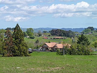
Conifer Grove is an upper-middle class suburb of Auckland, in northern New Zealand. Located on the eastern shores of the Pahurehure Inlet, on the Manukau Harbour, under authority of the Auckland Council. The suburb makes up the western side of the Takanini urban area and is in the Manurewa-Papakura ward of Auckland City. The suburb is known for its tree-lined streets, bay views, and until 2018 its border with the Manukau Golf Course.
Red Hill is a suburb of Auckland, in northern New Zealand. Located 34 kilometres to the southeast of Auckland CBD, under authority of the Auckland Council. The suburban area of Red Hill makes up the southernmost part of the Auckland metropolitan area, however the majority of the area is rural. The suburb lies on an ancient Pā Site known in Māori as Pukekiwiriki. The area is also situated on a no longer active volcano, and an old fault line in the region. Red Hill is located in the Manurewa-Papakura ward, one of the thirteen administrative divisions of Auckland city.
Pahurehure is a suburb of Auckland, in northern New Zealand. It is located on the south-eastern shores of the Manukau Harbour, under authority of the Papakura District Council. The suburb makes up the southernmost part of the Auckland metropolitan area.
Rosehill is a suburb of Auckland, in northern New Zealand. Located to the south of Pahurehure, under authority of the Auckland Council. The suburb makes up the southernmost part of the Auckland metropolitan area, and is located in the Manurewa-Papakura ward, one of the thirteen administrative divisions of Auckland city.
Papakura North is a suburb of Auckland, in northern New Zealand. Located on the eastern shores of the Pahurehure Inlet, approximately 30 kilometres south of Auckland CBD under authority of the Auckland Council. The suburb makes up the area between the Papakura Town Centre and Takanini, making up the southernmost part of the Auckland metropolitan area.
Papakura is a suburb of Auckland, in northern New Zealand. It is located on the shores of the Pahurehure Inlet, approximately 32 kilometres south of the Auckland CBD. It is under the authority of the Auckland Council.

Oratia is a suburb of west Auckland in New Zealand, located in the former territorial authority of Waitakere City.
Onepoto is a suburb of Porirua City in New Zealand. It is bounded to the north by Whitireia Park, a large park which is slowly being returned to native bush, and to the east by the Porirua Harbour.
Unsworth Heights is a suburb of North Shore in the Auckland metropolitan area in northern New Zealand. New Zealand State Highway 18 passes to the north of the suburb, and the Albany Highway to the south. The two routes intersect just to the west of Unsworth Heights. Unsworth Reserve is to the east.
Hingaia is a rural coastal suburb of Auckland, New Zealand. Located on the shores of the Pahurehure Inlet, to the southwest of the Papakura Town Centre, under local authority of the Papakura District Council. Hingaia is the smallest suburb and most eastern area in the Papakura District.
Rotokauri is a semi-rural suburb in western Hamilton in New Zealand. It is one of the future urban zones of Hamilton, along with Peacocke. The outskirts of Rotokauri have an impressive orchid farm, all under glass, exporting blooms across the world, and providing ample local employment.
Paparangi is one of the northern suburbs of Wellington, New Zealand. It lies approximately 10 km north of the city centre, north-east of Johnsonville, north-west of Newlands and south of Grenada and Woodridge. The population was 2,841 at the time of the 2013 census, an increase of 96 from the 2006 census population.
Hunua is a small settlement in the rural outskirts of south Auckland, New Zealand. The Hunua Statistical area, which covers a much larger area than the settlement, had a population of 4242 people in the 2013 Census, an increase of 144 people from the previous census in 2006.