| Opatovac | |
|---|---|
| Village | |
| Country | |
| County | Brod-Posavina County |
| Municipality | Cernik |
| Population (2011) [1] | |
| • Total | 332 |
| Time zone | CET (UTC+1) |
| • Summer (DST) | CEST (UTC+2) |
| Opatovac | |
|---|---|
| Village | |
| Country | |
| County | Brod-Posavina County |
| Municipality | Cernik |
| Population (2011) [1] | |
| • Total | 332 |
| Time zone | CET (UTC+1) |
| • Summer (DST) | CEST (UTC+2) |

Virovitica-Podravina County is a northern Slavonian county in Croatia. Its county seat is in Virovitica and it includes the area around the Drava river, hence the name Podravina. Other notable towns are Slatina and Orahovica.

Požega-Slavonia County is a Croatian county in western Slavonia. Its capital is Požega. Its population was 78,034 as of the 2011 census.

Stara Gradiška is a village and a municipality in Slavonia, in the Brod-Posavina County of Croatia. It is located on the left bank of the river Sava, across Gradiška in Bosnia and Herzegovina. The total population is 1,363, distributed in the following settlements:

Kaptol is a village in central Slavonia, Croatia. It is located on the slopes of Papuk mountain, east of Velika and northeast of Požega. The population of the municipality is 3,472, with 1,409 people in Kaptol itself, 97% are Croats.

Podsused – Vrapče is one of the districts of Zagreb, Croatia. It is located in the north-western part of the city. In 2011, the district had 45,759 inhabitants. Its area is 36.188 km2.
Gornje Psarjevo is a village in central Croatia, located south of Sveti Ivan Zelina. The population is 311.

Nova Bukovica is a village and municipality in Croatia in the Virovitica–Podravina County. It has a population of 1,771, 85% of which are Croats.

Dežanovac is a village and a municipality in Bjelovar-Bilogora County, Croatia. There are 2,715 inhabitants (2011). 58.9% of the population are Croats and 23.1% are Czechs.

Velika Pisanica is a village and municipality in Bjelovar-Bilogora County, Croatia. There are 1,781 inhabitants in the municipality, of whom 72% are Croats, and 13% are Serbs.

Gornji Bogićevci is a municipality in Brod-Posavina County, Croatia. There are 1,975 inhabitants of which 89% declare themselves Croats.

Nova Kapela is a municipality in Brod-Posavina County, Croatia. There are 4,227 inhabitants in the following settlements:

Vrbje is a village and a municipality in Brod-Posavina County, Croatia. There are 2,215 inhabitants, 99% of whom declare themselves Croats.

Sibinj is a village and municipality in Brod-Posavina County, Croatia part of Slavonski Brod built-up area. There are 6,895 inhabitants; a majority are Croats according to the 2011 census.

Kloštar Podravski is a settlement and a municipality in the Koprivnica-Križevci County in Croatia. According to the 2011 census, there are 3,306 inhabitants in the area.

Cernik is a village and a municipality in the Brod-Posavina County. According to the 2011 census, there are a total of 3,640 inhabitants in the area. It was ruled by the Ottoman Empire between 1536 and 1691 and was the ultimate centre of the Sanjak of Pakrac until the Austrian conquest.

Bačko Novo Selo is a village in Serbia. It is situated in the Bač municipality, South Bačka District, Vojvodina province. The village has a Serb ethnic majority and a Bosniak minority. Its population numbering 1,228 people.

Vuka is a municipality in Osijek-Baranja County, Croatia. In the 2011 Croatian census there were 1,200 inhabitants, 97.17% of which were Croats.

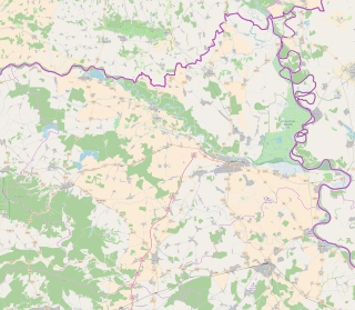
Opatovac is a village in Croatia. It is connected by the D2 highway.
Keleminovec is a settlement (naselje) in the Sveti Ivan Zelina administrative territory of Zagreb County, Croatia. As of 2011 it had a population of 116 people.
Majkovec is a settlement (naselje) in the Sveti Ivan Zelina administrative territory of Zagreb County, Croatia. As of 2011 it had a population of 194 people.
Coordinates: 45°19′46″N17°25′59″E / 45.3295286700°N 17.4331855500°E

A geographic coordinate system is a coordinate system that enables every location on Earth to be specified by a set of numbers, letters or symbols. The coordinates are often chosen such that one of the numbers represents a vertical position and two or three of the numbers represent a horizontal position; alternatively, a geographic position may be expressed in a combined three-dimensional Cartesian vector. A common choice of coordinates is latitude, longitude and elevation. To specify a location on a plane requires a map projection.
| This Brod-Posavina County geography article is a stub. You can help Wikipedia by expanding it. |