The Northwest Passage (NWP) is the sea lane between the Atlantic and Pacific oceans through the Arctic Ocean, near the northern coast of North America via waterways through the Arctic Archipelago of Canada. The eastern route along the Arctic coasts of Norway and Siberia is accordingly called the Northeast Passage (NEP). The various islands of the archipelago are separated from one another and from mainland Canada by a series of Arctic waterways collectively known as the Northwest Passages, Northwestern Passages or the Canadian Internal Waters.

The North Pole, also known as the Geographic North Pole or Terrestrial North Pole, is the point in the Northern Hemisphere where the Earth's axis of rotation meets its surface. It is called the True North Pole to distinguish from the Magnetic North Pole.

The Austro-Hungarian North Pole expedition was an Arctic expedition to find the North-East Passage that ran from 1872 to 1874 under the leadership of Julius Payer and Karl Weyprecht. The expedition discovered and partially explored Franz Josef Land.

George Washington De Long was a United States Navy officer and explorer who led the ill-fated Jeannette expedition of 1879–1881, in search of the Open Polar Sea.

Fram ("Forward") is a ship that was used in expeditions of the Arctic and Antarctic regions by the Norwegian explorers Fridtjof Nansen, Otto Sverdrup, Oscar Wisting, and Roald Amundsen between 1893 and 1912. It was designed and built by the Scottish-Norwegian shipwright Colin Archer for Fridtjof Nansen's 1893 Arctic expedition in which the plan was to freeze Fram into the Arctic ice sheet and float with it over the North Pole.

The Chukchi Sea, sometimes referred to as the Chuuk Sea, Chukotsk Sea or the Sea of Chukotsk, is a marginal sea of the Arctic Ocean. It is bounded on the west by the Long Strait, off Wrangel Island, and in the east by Point Barrow, Alaska, beyond which lies the Beaufort Sea. The Bering Strait forms its southernmost limit and connects it to the Bering Sea and the Pacific Ocean. The principal port on the Chukchi Sea is Uelen in Russia. The International Date Line crosses the Chukchi Sea from northwest to southeast. It is displaced eastwards to avoid Wrangel Island as well as the Chukotka Autonomous Okrug on the Russian mainland.

A polynya is an area of open water surrounded by sea ice. It is now used as a geographical term for an area of unfrozen seawater within otherwise contiguous pack ice or fast ice. It is a loanword from the Russian полынья, which refers to a natural ice hole and was adopted in the 19th century by polar explorers to describe navigable portions of the sea.

Elisha Kent Kane was a United States Navy medical officer and Arctic explorer. He served as assistant surgeon during Caleb Cushing's journey to China to negotiate the Treaty of Wangxia and in the Africa Squadron. He was assigned as a special envoy to the United States Army during the Mexican–American War and as a surveyor in the United States Coast Survey.

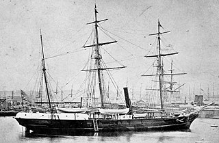
USSJeannette was a naval exploration vessel which, commanded by George W. De Long, undertook the Jeannette expedition of 1879–1881 to the Arctic. After being trapped in the ice and drifting for almost two years, the ship and her crew of 33 were released from the ice, then trapped again, crushed and sunk some 300 nautical miles north of the Siberian coast. The entire crew survived the sinking, but eight died while sailing towards land in a small cutter. The others reached Siberia, but 12 subsequently perished in the Lena Delta, including De Long.

Kane Basin is an Arctic waterway lying between Greenland and Ellesmere Island, Canada's northernmost. It links Smith Sound to Kennedy Channel and forms part of Nares Strait. It is approximately 180 km (110 mi) in length and 130 km (81 mi) at its widest.

A drifting ice station is a temporary or semi-permanent facility built on an ice floe. During the Cold War the Soviet Union and the United States maintained a number of stations in the Arctic Ocean on floes such as Fletcher's Ice Island for research and espionage, the latter of which were often little more than quickly constructed shacks. Extracting personnel from these stations proved difficult and in the case of the United States, employed early versions of the Fulton surface-to-air recovery system.

Arktika 2007 was a 2007 expedition in which Russia performed the first ever crewed descent to the ocean bottom at the North Pole, as part of research related to the 2001 Russian territorial claim, one of many territorial claims in the Arctic, made possible, in part, because of Arctic shrinkage. As well as dropping a titanium tube containing the Russian flag, the submersibles collected specimens of Arctic flora and fauna and apparently recorded video of the dives. The "North Pole-35" manned drifting ice station was established.

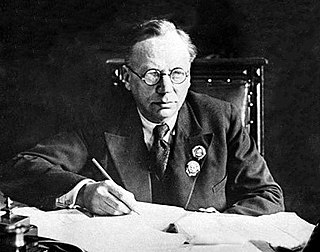
Vladimir Yulyevich Wiese was a Russian scientist of German descent who devoted his life to the study of the Arctic ice pack. His name is associated with the Scientific Prediction of Ice Conditions theory. Wiese was a member of the Soviet Arctic Institute and an authority on polar oceanography. He was also the founder of the Geographico-hydrological School of Oceanography.

The climate of the Arctic is characterized by long, cold winters and short, cool summers. There is a large amount of variability in climate across the Arctic, but all regions experience extremes of solar radiation in both summer and winter. Some parts of the Arctic are covered by ice year-round, and nearly all parts of the Arctic experience long periods with some form of ice on the surface.

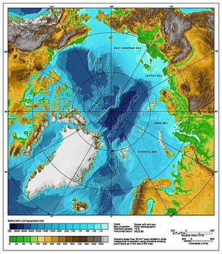
The Arctic Ocean is the smallest and shallowest of the world's five oceanic divisions. It spans an area of approximately 14,060,000 km2 (5,430,000 sq mi) and is the coldest of the world's oceans. The International Hydrographic Organization (IHO) recognizes it as an ocean, although some oceanographers call it the Arctic Mediterranean Sea. It has also been described as an estuary of the Atlantic Ocean. It is also seen as the northernmost part of the all-encompassing world ocean.

Nansen's Fram expedition of 1893–1896 was an attempt by the Norwegian explorer Fridtjof Nansen to reach the geographical North Pole by harnessing the natural east–west current of the Arctic Ocean. In the face of much discouragement from other polar explorers, Nansen took his ship Fram to the New Siberian Islands in the eastern Arctic Ocean, froze her into the pack ice, and waited for the drift to carry her towards the pole. Impatient with the slow speed and erratic character of the drift, after 18 months Nansen and a chosen companion, Hjalmar Johansen, left the ship with a team of Samoyed dogs and sledges and made for the pole. They did not reach it, but they achieved a record Farthest North latitude of 86°13.6′N before a long retreat over ice and water to reach safety in Franz Josef Land. Meanwhile, Fram continued to drift westward, finally emerging in the North Atlantic Ocean.

Arctic exploration is the physical exploration of the Arctic region of the Earth. It refers to the historical period during which mankind has explored the region north of the Arctic Circle. Historical records suggest that humankind have explored the northern extremes since 325 BC, when the ancient Greek sailor Pytheas reached a frozen sea while attempting to find a source of the metal tin. Dangerous oceans and poor weather conditions often fetter explorers attempting to reach polar regions, and journeying through these perils by sight, boat, and foot has proven difficult.

In The Kingdom of Ice: The Grand and Terrible Polar Voyage of the USS Jeannette (Doubleday), 2014, is a nonfiction book written by the author and historian Hampton Sides. The book tells the true story of the 1879–1881 arctic voyage of the USS Jeannette and the crew's struggle to survive after having to abandon their ship in the polar ice.

The Jeannetteexpedition of 1879–1881, officially called the U.S. Arctic Expedition, was an attempt led by George W. De Long to reach the North Pole by pioneering a route from the Pacific Ocean through the Bering Strait. The premise was that a temperate current, the Kuro Siwo, flowed northwards into the strait, providing a gateway to the hypothesized Open Polar Sea and thus to the pole.


