
St. John Cantius School is a high school in Poznań, Poland named after the scholar and theologian St. John Cantius.
Kołat-Rybniki is a village in the administrative district of Gmina Kikół, within Lipno County, Kuyavian-Pomeranian Voivodeship, in north-central Poland.

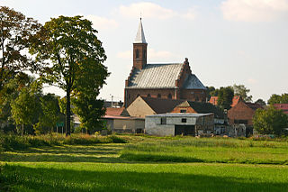
Wygoda is a village in the administrative district of Gmina Czernikowo, within Toruń County, Kuyavian-Pomeranian Voivodeship, in north-central Poland. It lies approximately 2 kilometres (1 mi) south of Czernikowo and 25 km (16 mi) south-east of Toruń.
Pojelce is a village in the administrative district of Gmina Biała Podlaska, within Biała Podlaska County, Lublin Voivodeship, in eastern Poland.

Kuybışev is a village in the Aghjabadi Rayon of Azerbaijan. Kuybışev is named in honor of Valerian Kuybyshev, a Soviet politician.
Konarzewo-Reczki is a village in the administrative district of Gmina Gołymin-Ośrodek, within Ciechanów County, Masovian Voivodeship, in east-central Poland. It lies approximately 21 kilometres (13 mi) east of Ciechanów and 67 km (42 mi) north of Warsaw.
Nowe Grobice is a village in the administrative district of Gmina Chynów, within Grójec County, Masovian Voivodeship, in east-central Poland.

Pieczyska is a village in the administrative district of Gmina Chynów, within Grójec County, Masovian Voivodeship, in east-central Poland. It lies approximately 5 kilometres (3 mi) west of Chynów, 13 km (8 mi) north-east of Grójec, and 33 km (21 mi) south of Warsaw.
Zadębie is a village in the administrative district of Gmina Prażmów, within Piaseczno County, Masovian Voivodeship, in east-central Poland.
Nowy Kiączyn is a village in the administrative district of Gmina Stawiszyn, within Kalisz County, Greater Poland Voivodeship, in west-central Poland.
Kopanica is a village in the administrative district of Gmina Siedlec, within Wolsztyn County, Greater Poland Voivodeship, in west-central Poland.
Wróblin, German Fröbel is a village in the administrative district of Gmina Głogówek (Oberglogau), within Prudnik County, Opole Voivodeship, in south-western Poland, close to the Czech border. It lies approximately 6 kilometres (4 mi) south-east of Głogówek (Oberglogau), 26 km (16 mi) east of Prudnik, and 40 km (25 mi) south of the regional capital Opole.
Załęże is a village in the administrative district of Gmina Koczała, within Człuchów County, Pomeranian Voivodeship, in northern Poland. It lies approximately 6 kilometres (4 mi) north-east of Koczała, 34 km (21 mi) north-west of Człuchów, and 109 km (68 mi) south-west of the regional capital Gdańsk.
Ostrowo is a village in the administrative district of Gmina Stężyca, within Kartuzy County, Pomeranian Voivodeship, in northern Poland. It lies approximately 9 kilometres (6 mi) north of Stężyca, 19 km (12 mi) west of Kartuzy, and 48 km (30 mi) west of the regional capital Gdańsk.
Górki is a village in the administrative district of Gmina Karsin, within Kościerzyna County, Pomeranian Voivodeship, in northern Poland. It lies approximately 4 kilometres (2 mi) north of Karsin, 21 km (13 mi) south of Kościerzyna, and 68 km (42 mi) south-west of the regional capital Gdańsk.
Kalinówek is a settlement in the administrative district of Gmina Braniewo, within Braniewo County, Warmian-Masurian Voivodeship, in northern Poland, close to the border with the Kaliningrad Oblast of Russia. It lies approximately 8 kilometres (5 mi) north-east of Braniewo and 80 km (50 mi) north-west of the regional capital Olsztyn.
Dworek is a village in the administrative district of Gmina Będzino, within Koszalin County, West Pomeranian Voivodeship, in north-western Poland. It lies approximately 4 kilometres (2 mi) west of Będzino, 17 km (11 mi) west of Koszalin, and 126 km (78 mi) north-east of the regional capital Szczecin.
Utonie is a settlement in the administrative district of Gmina Myślibórz, within Myślibórz County, West Pomeranian Voivodeship, in north-western Poland.
Hosszúvölgy is a village in Zala County, Hungary.

Slavkov is a village in the Moravian-Silesian Region of the Czech Republic. As of January 1, 2014, the population was 1,932.


