
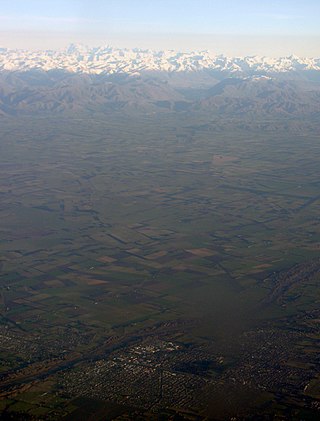
The Mackenzie Basin, popularly and traditionally known as the Mackenzie Country, is an elliptical intermontane basin located in the Mackenzie and Waitaki Districts, near the centre of the South Island of New Zealand. It is the largest such basin in New Zealand. Historically famous mainly for sheep farming, the sparsely populated area is now also a popular tourism destination.

The Waimakariri River is one of the largest rivers in Canterbury, on the eastern coast of New Zealand's South Island. It flows for 151 kilometres (94 mi) in a generally southeastward direction from the Southern Alps across the Canterbury Plains to the Pacific Ocean.
The Aparima River, earlier known as Jacob's River, is one of the southward-flowing braided rivers of Southland, New Zealand.
The Dennistoun Glacier is a glacier, 50 nautical miles long, draining the northern slopes of Mount Black Prince, Mount Royalist and Mount Adam in the Admiralty Mountains of Victoria Land, Antarctica. It flows northwest between the Lyttelton Range and Dunedin Range, turning east on rounding the latter range to enter the sea south of Cape Scott.

The Kaikōura Ranges are two parallel ranges of mountains located in the northeast of the South Island of New Zealand. The two ranges are visible from a great distance, including from the southern coast of the North Island.

The Rakaia River is in the Canterbury Plains in New Zealand's South Island. The Rakaia River is one of the largest braided rivers in New Zealand. The Rakaia River has a mean flow of 203 cubic metres per second (7,200 cu ft/s) and a mean annual seven-day low flow of 87 m3/s (3,100 cu ft/s). In the 1850s, European settlers named it the Cholmondeley River, but this name lapsed into disuse. The name Rakaia comes from Māori "Ō Rakaia", meaning the place where people were arranged by ranks.
The Opuha Dam is located on the Opuha River, a tributary of the Ōpihi River in South Canterbury, New Zealand. The dam is used for water storage for farming irrigation and provides 7.7 MW of electricity to New Zealand's national grid. The site has been identified as an Important Bird Area by BirdLife International because it supports breeding colonies of the endangered black-billed gull.

The Ōpihi River flows through south Canterbury, in New Zealand's South Island. It has been identified as an Important Bird Area by BirdLife International because it supports breeding colonies of the endangered black-billed gull.

South Canterbury is the area of the Canterbury Region of the South Island of New Zealand bounded by the Rangitata River in the north and the Waitaki River to the south. The Pacific Ocean and ridge of the Southern Alps form natural boundaries to the east and west respectively. Though the exact boundaries of the region have never been formalised, the term is used for a variety of government agencies and other entities. It is one of four traditional sub-regions of Canterbury, along with Mid Canterbury, North Canterbury, and Christchurch city.
Mid Canterbury is a traditional, semi-official subregion of New Zealand's Canterbury Region extending inland from the Pacific coast to the Southern Alps. It is one of four traditional sub-regions of Canterbury, along with South Canterbury, North Canterbury, and Christchurch City.

Porters, is a commercial ski resort just over an hour's drive (98 km) west from Christchurch, in the South Island of New Zealand. Originally functioning as a club skifield, it has one beginner magic carpet, one platter tow, one chairlift and three t-bars. The difficulty of the slopes is distributed as 15% beginner, 35% intermediate and 50% advanced. Modern grooming equipment is used, and snowmaking facilities operate along the main pistes along the chairlift.
The Eastern Hohonu River is a river of New Zealand. It rises in the Hohonu Range, an outlying range of the Southern Alps 28 kilometres southeast of Greymouth, flowing north then east before reaching its outflow into Lake Brunner. It is named the Eastern Hohonu River to differentiate it from the nearby Big Hohonu River, which is also called the Greenstone River.
The Hewson River is a river of New Zealand's South Island. It flows east and then south from the Ben McLeod Range of inland Canterbury before flowing into the upper reaches of the Orari River 5 kilometres (3 mi) west of Mount Peel.
The Kakahu River is a river of south Canterbury, New Zealand. It flows east and then southeast from its source 15 kilometres (9 mi) east of Fairlie, joining with the Hae Hae Te Moana River before flowing into the Waihi River close to the town of Temuka.

The Mathias River is a river of the Canterbury region of New Zealand's South Island. It flows from its origins in three rivers in the Southern Alps. Of these, the North Mathias River is the longest, flowing predominantly southwards from its source northeast of Mount Williams. After 18 kilometres (11 mi) its waters combine with those of the West Mathias River, which flows predominantly southwest for 13 kilometres (8 mi) from its sources 10 kilometres (6 mi) west of Mount Williams. The South Mathias River, a tributary of the West Mathias River, is a 6-kilometre (4 mi) long easterly-flowing river which meets the West Mathias 5 kilometres (3 mi) from its confluence with the North Mathias.
The Phantom River is a river of the Canterbury region of New Zealand's South Island. It flows predominantly east from the ben McLeod Range north of Fairlie to reach the Orari River 20 kilometres (12 mi) northwest of Peel Forest.
The Porter River is a river of the Canterbury Region of New Zealand's South Island. It rises close to the southern end of the Craigieburn Range east of Lake Coleridge, flowing generally northeast to reach the Broken River close to Castle Hill. The Porters Ski Area is above the river valley's western flank, and State Highway 73 follows the river's course for some distance to the west of Porters Pass.
The Smith Peninsula is an ice-covered, "dog-legged" peninsula 25 nautical miles long and 10 nautical miles wide, extending in an easterly direction between Keller Inlet and Nantucket Inlet from the east coast of Palmer Land, Antarctica.

The Ashburton River / Hakatere is a river in the Canterbury region of New Zealand, flowing across Mid Canterbury from the Southern Alps to the Pacific Ocean. The official name of the river was amended to become a dual name by the Ngāi Tahu Claims Settlement Act 1998. It has been identified as an Important Bird Area by BirdLife International because it supports breeding colonies of the endangered black-billed gull.

Korowai / Torlesse Tussocklands Park is a protected area in Canterbury, New Zealand. Covering around 21,000 hectares, it is located on both sides of State Highway 73, from east of Porters Pass to south of Castle Hill Village.
