
Coromandel, also called Coromandel Town to distinguish it from the wider district, is a town on the Coromandel Harbour, on the western side of the Coromandel Peninsula, which is in the North Island of New Zealand. It is 75 kilometres east of the city of Auckland, although the road between them, which winds around the Firth of Thames and Hauraki Gulf coasts, is 190 km long. The population was 1,890 as of June 2021.

Drury is a rural town near Auckland, in northern New Zealand. Located 36 kilometres to the south of Auckland CBD, under authority of the Auckland Council. Drury lies at the southern border of the Auckland metropolitan area, 12 kilometres to the northeast of Pukekohe, close to the Papakura Channel, an arm of the Manukau Harbour.
Clevedon, previously known as Wairoa South, is a rural town in Auckland, New Zealand, located in the Franklin ward, one of the thirteen administrative divisions of Auckland city. The town is governed by the Auckland Council. The town is the centre of an administrative ward of Franklin which takes in much of the largely rural area to the east of the urban heart of the city.

Kumeū is an affluent rural community situated 25 km north-west of the Auckland City centre in New Zealand. State Highway 16 and the North Auckland Line pass through the town. Huapai lies to the west, Riverhead to the north, Whenuapai to the east, and Taupaki to the south.

Ōkato is a small town in rural Taranaki, New Zealand. It is situated about 25 minutes drive around the coast from New Plymouth on State Highway 45. Oakura is 12 km to the north-east, and Warea is 9 km to the south-west. The place offers popular rocky surfing spots around coastal beaches. The town was established as a military settlement in the 1860s.

Ostend is a settlement on Waiheke Island, in New Zealand's Hauraki Gulf within the Auckland Region. Ostend is located in the west of the island, on and around a small peninsula which juts into Putiki Bay, one of two large indentations in the island's southwest coast. The southwest of the island contains much of the island's population, with Ostend being located immediately to the east of the settlement of Surfdale, and to the southwest of Onetangi.

Manaia is a rural town in South Taranaki District, New Zealand. Ōpunake is 29 km to the northwest, and Hāwera is 13 km to the southeast. Kaponga is 15 km north. State Highway 45 passes through the town. Manaia is named after the former Māori chief of the district, Hukunui Manaia.

Ardmore is a large rural locality of Auckland, New Zealand, located to the south-east of Auckland CBD, just 27 km away. The suburb is in the Franklin Ward, one of the thirteen administrative divisions of Auckland, and is under local governance of Auckland Council.

Maraetai is a town in the former Manukau City and the easternmost suburb of greater Auckland in New Zealand.

Normanby is a small village in South Taranaki, New Zealand. It is approximately 6 km inland from Hawera along State Highway 3. Eltham is 13 km further north.
Urenui is a settlement in northern Taranaki, in the North Island of New Zealand. It is located on State Highway 3 close to the shore of the North Taranaki Bight, 13 kilometres east of Waitara and 6 km south-west of Mimi. The Urenui River flows past the settlement into the North Taranaki Bight.

Onaero is a settlement in northern Taranaki, in the North Island of New Zealand. It is located on State Highway 3 close to the shore of the North Taranaki Bight, 15 kilometres (9.3 mi) east of Waitara. Onaero was the site of the No. 2 Company Redoubt, a British military installation created during the Second Taranaki War by soldiers from the Tikorangi Redoubt in 1865, however it was abandoned several months later.
Pohangina is a small rural community in the Manawatū-Whanganui region of New Zealand, just north of Ashhurst.
Egmont Village is a settlement in Taranaki, New Zealand. State Highway 3 runs through it. New Plymouth is 12 km to the north-west, and Inglewood is 6 km to the south-east. Waiwhakaiho River and Mangaoraka Stream flow past to the west and east, respectively.

Cust is a rural village in the South Island of New Zealand. It is located in North Canterbury and comes under seat of the Waimakariri District Council. It is located approximately 16 km east of Oxford and 17 km west of Rangiora. The town is named after Sir Edward Cust, who was a member of the Canterbury Association which organised European settlement of the area around 1850. Earlier names for the town were Moeraki Downs and Middleton-on-the-Cust.
Torbay Heights is an Auckland suburb, which is under local governance of Auckland Council.

Manakau is a settlement in the Horowhenua District, at the boundary of the Manawatū-Whanganui and Wellington regions of New Zealand's North Island. It lies 8 km north of Otaki and 12 km south of Levin, and is connected to both via State Highway 1, which skirts Manakau's western edge. The township 5 km inland from the coast of the Tasman Sea.
Hunua is a small settlement in the rural outskirts of south Auckland, New Zealand.
Oteha is an Auckland suburb, which is under local governance of Auckland Council. The area is defined by Oteha Valley Road on the north, East Coast Road on the east, Spencer Road on the south, and the Auckland Northern Motorway on the west. Until the end of the 20th century, the area was rural.
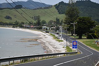
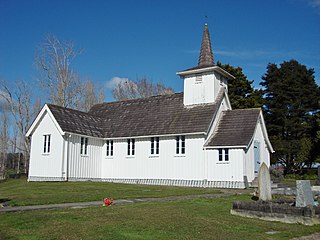
Kawakawa Bay is an east coast bay and settlement in the Franklin area of New Zealand's Auckland Region.


