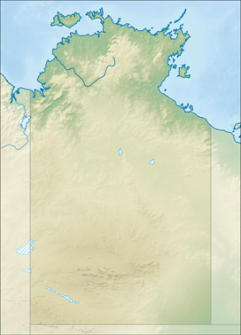
The protected areas of the Northern Territory consists of protected areas managed by the governments of the Northern Territory and Australia and private organisations with a reported total area of 335,527 square kilometres (129,548 sq mi) being 24.8% of the total area of the Northern Territory of Australia.

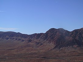
Tjoritja /West MacDonnell is a national park in the Northern Territory (Australia) due west of Alice Springs and 1234 km south of Darwin. It extends along the MacDonnell Ranges west of Alice Springs.
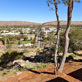
Alice Springs, is the third-largest town in the Northern Territory, Australia. The name Alice Springs was given by surveyor William Whitfield Mills after Alice, Lady Todd, wife of the telegraph pioneer Sir Charles Todd. Known colloquially as 'The Alice' or simply 'Alice', the town is situated roughly in Australia's geographic centre. It is nearly equidistant from Adelaide and Darwin.
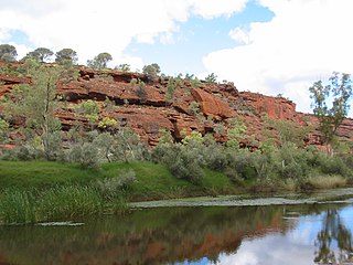
The Finke River, or Larapinta in the Indigenous Arrernte language, is a river in central Australia, whose bed courses through the Northern Territory and the state of South Australia. It is one of four main rivers of the Lake Eyre Basin and thought to be the oldest riverbed in the world. It flows for only a few days a year. When this happens, its water usually disappears into the sands of the Simpson Desert, rarely if ever reaching Lake Eyre.
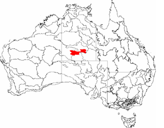
The MacDonnell Ranges, or Tjoritja in Arrernte, is a mountain range located in southern Northern Territory. MacDonnell Ranges is also the name given to an interim Australian bioregion broadly encompassing the mountain range, with an area of 3,929,444 hectares. The range is a 644 km (400 mi) long series of mountains in central Australia, consisting of parallel ridges running to the east and west of Alice Springs. The mountain range contains many spectacular gaps and gorges as well as areas of Aboriginal significance.
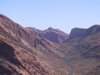
The Larapinta Trail is an extended walking track in the Northern Territory of Australia. Its total length covers 223 kilometres (139 mi) from east to west, with the eastern end at Alice Springs and the western end at Mount Sonder, one of the territory's highest mountains. It follows the West MacDonnell Ranges, sometimes along the ridge line, other times on the plain below, in the West MacDonnell National Park.

Mount Sonder, or Rwetyepme, its Aboriginal name, is the fourth highest mountain in the Northern Territory, Australia at 1,380 metres (4,530 ft) AHD . Mount Zeil is the highest at 1,531 metres (5,023 ft), 27 kilometres (17 mi) to the west.

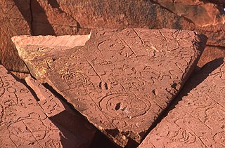
The Ochre Pits are a popular tourist destination in Australia's Northern Territory, approximately 100 kilometres west of Alice Springs along the Larapinta Trail.

Mount Giles is one of the highest mountains in the Northern Territory, Australia, at 1,389 metres (4,557 ft) AHD . It lies along the MacDonnell Ranges, dominating Ormiston Pound, in the West MacDonnell National Park, approximately 80 kilometres (50 mi) west of Alice Springs. It can be visited via the celebrated Larapinta Trail and has views of Mount Sonder, Ormiston Gorge and Pound, and the surrounding range.

Serpentine Gorge is one of the gorges in the West MacDonnell Ranges in Australia's Northern Territory. It is located approximately 100 kilometres west of Alice Springs along the Larapinta Trail.
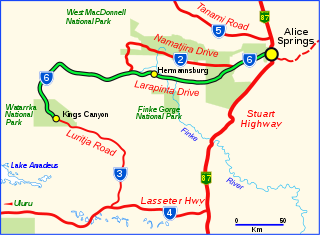
Larapinta Drive is a designated state route in the Northern Territory of Australia.
Narwietooma Station, most commonly known as Narwietooma, is a pastoral lease that operates as a cattle station in the Northern Territory of Australia.

Simpsons Gap is one of the gaps in the West MacDonnell Ranges in Australia's Northern Territory. It is located 18 kilometres west from Alice Springs, on the Larapinta Trail.
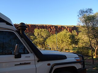
Redbank Gorge, is a gorge located in the Northern Territory of Australia, 156 km west of Alice Springs. It is situated at the bottom of Mount Sonder. The gorge is part of the West MacDonnell National Park, which has an area of approximately 2,568 square kilometres (992 sq mi).

Trephina Gorge is a gorge in the Northern Territory of Australia located in the locality of Hart in the East MacDonnell Ranges about 85 kilometres (53 mi) east of Alice Springs.

John Flynn's Grave Historical Reserve, more commonly referred to as Flynn's Grave is the grave site of John Flynn who was an Australian Presbyterian minister who founded the Australian Inland Mission (AIM) and founding the Royal Flying Doctor Service. The grave, which is now a historical reserve, is located at the base of Mount Gillen on Larapinta Drive in the Alice Springs suburb of Flynn.
Ross Highway is a road in the Northern Territory of Australia located to the south of Alice Springs.
Mount Zeil is a locality in the Northern Territory of Australia located about 1,248 kilometres (775 mi) south of the territory capital of Darwin.
Mount Liebig is an Aboriginal community in the Northern Territory of Australia located about 325 kilometres (202 mi) west of Alice Springs.

The Red Centre Way is a scenic route with a total length of 835 km, consisting of roads named Namatjira Drive, Luritja Road, Larapinta Drive and parts of the Lasseter Highway. Beginning in the city of Alice Springs, it connects the villages of Hermannsburg and Yulara, the Watarrka, West MacDonnell, Fink Gorge and Uluṟu-Kata Tjuṯa National Park, nature reserves such as Tnorala and Alice Springs Desert Park, and deserts, mountain ranges and many other unique tourist attractions.
