A geographic coordinate system is a coordinate system that enables every location on Earth to be specified by a set of numbers, letters or symbols. The coordinates are often chosen such that one of the numbers represents a vertical position and two or three of the numbers represent a horizontal position; alternatively, a geographic position may be expressed in a combined three-dimensional Cartesian vector. A common choice of coordinates is latitude, longitude and elevation. To specify a location on a plane requires a map projection.
In England and Wales, Northern Ireland, and the Republic of Ireland, an urban district was a type of local government district that covered an urbanised area. Urban districts had an elected urban district council (UDC), which shared local government responsibilities with a county council.
Lancashire is a ceremonial county in North West England. The administrative centre is Preston. The county has a population of 1,449,300 and an area of 1,189 square miles (3,080 km2). People from Lancashire are known as Lancastrians.
Lathom and Burscough was an urban district in the county of Lancashire from 1894 to 1931. It constituted the civil parishes of Burscough and Lathom, and apart from these two villages also included Newburgh.
Burscough is a small town and civil parish within West Lancashire in North West England, to the north of Ormskirk and Skelmersdale.The parish also includes the hamlet of Tarlscough and the Martin Mere Wetland Centre. The population taken at the 2011 Census was 9,182.
Newburgh is a rural village and civil parish in Lancashire, England, 3 miles (5 km) from Skelmersdale and 5 miles (8 km) from Ormskirk. Its population in 2011 was 1,056.
The Local Government Act 1972 is an Act of the Parliament of the United Kingdom that reformed local government in England and Wales on 1 April 1974.
Skelmersdale and Holland was an urban district in Lancashire, England from 1968 to 1974. It was created by the merger of Skelmersdale and Upholland urban districts. In 1974 it was itself merged into the new non-metropolitan district of West Lancashire, under the Local Government Act 1972.
West Lancashire was a rural district from 1894 to 1974 in Lancashire, England. It was created with other rural districts in 1894, based on the Ormskirk rural sanitary district. It was expanded in 1932 by the abolition of the Sefton Rural District.
This page is based on this Wikipedia article Text is available under the CC BY-SA 4.0 license; additional terms may apply. Images, videos and audio are available under their respective licenses.
Related Research Articles
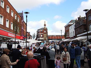
Ormskirk is a market town in West Lancashire, England, 13 miles (21 km) north of Liverpool, 11 miles (18 km) northwest of St Helens, 9 miles (14 km) southeast of Southport and 18 miles (29 km) southwest of Preston. Ormskirk is known for its gingerbread.
West Lancashire is a constituency represented in the House of Commons of the UK Parliament since 2005 by Rosie Cooper, a member of the Labour Party.
The River Tawd flows through Skelmersdale and Lathom in West Lancashire.
Burscough Priory, at Burscough, Lancashire, England, was an Augustinian foundation, established in around 1190 and dissolved in around 1536. Some remains of the church survive.
Burscough Junction pronounced is one of two railway stations serving the small West Lancashire town of Burscough in the north-west of England. It is sited on the Ormskirk Branch Line, 21⁄2 miles (4.0 km) north of Ormskirk and is served by Northern. The station was the scene of the Burscough Junction Station Crash in 1880.
Burscough Bridge railway station serves the town of Burscough in Lancashire, England. It is a main stop on the Manchester-Southport Line. It is run by Northern. A bus interchange has recently been constructed next to the station, including a shop and cafe. The station has been identified by Merseytravel as a possible interchange between the Liverpool to Ormskirk line and the Southport to Wigan line in its Liverpool City Region Long Term Rail Strategy.
Ormskirk was a county constituency represented in the House of Commons of the Parliament of the United Kingdom. It elected one Member of Parliament (MP) by the first past the post system of election. It was created by the Redistribution of Seats Act 1885 as a division of the parliamentary county of Lancashire. The constituency boundaries were changed in 1918, 1950, 1955 and 1974.
Lathom House was a large country house in the parish of Lathom in Lancashire, England. Built between 1725 and 1740, the main block was demolished in 1925.
The 2008 West Lancashire District Council election took place on 1 May 2008 to elect members of West Lancashire District Council in Lancashire, England. One third of the council was up for election and the Conservative party stayed in overall control of the council.
The Burscough Junction Station Crash occurred on 15 January 1880 at the Burscough Junction railway station on the Liverpool to Preston railway line in England. The line was operated by the Lancashire and Yorkshire Railway company at the time. There were nine people killed in the accident and more than fifty people were injured.
Burscough is a civil parish in the West Lancashire district of Lancashire, England. It contains 38 buildings that are recorded in the National Heritage List for England as designated listed buildings. Of these, two are at Grade II*, the middle grade, and the others are at Grade II, the lowest grade. The parish contains the large village of Burscough, the rural hamlet of Tarlscough, and the surrounding countryside. Passing through the parish is the Leeds and Liverpool Canal, and the junction between the canal and its Rufford Branch is in the parish. Also passing through the parish are the railways of the Ormskirk - Preston and the Manchester-Southport Lines, which cross in the parish. The oldest listed buildings are farmhouses and farm buildings, and houses and cottages. Associated with the canal are the structures at the junction, bridges and a lock. Associated with the railways are station buildings and a bridge. The other listed buildings include churches, a war memorial, and a former mill and its offices.
Lathom South is a civil parish in the West Lancashire district of Lancashire, England, situated near the towns of Ormskirk and Skelmersdale. The parish council was established in 2007, and the area, which includes the hamlets of Blaguegate and Scarth Hill, has historical ties to the neighbouring parish of Lathom. As of 2011, Lathom South has a population of 657.
Westhead is a village in the West Lancashire district of Lancashire, England. As of 2014, the estimated population was 886.
Burscough Methodist Church, formally Wesleyan Chapel at Burscough Bridge, is situated in Burscough and is part of the Lancashire West Methodist Circuit. It was built in between 1868 and 1869 of a brick construction in a cruciform layout. The church was opened on 26 March 1869, with construction coming in under budget. The contractor, foreman and architect all donated gifts to the church for its opening, as did the Mayor of Southport. A large portion of the church was used by the Methodist's Sunday school.