
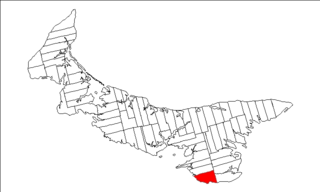
Kings County is located in eastern Prince Edward Island, Canada.

Confederation Centre of the Arts is a cultural centre dedicated to the visual and performing arts located in the city of Charlottetown, Prince Edward Island, Canada.
Lot 62 is a township in Queens County, Prince Edward Island, part of St. John's Parish. Lot 62 was awarded to Richard Spry, Esquire in the 1767 Land Lottery, and came to be settled through the efforts of Thomas Douglas, The 5th Earl of Selkirk in 1803. Richard Spry, Esquire, was then Commodore, Commander-in-Chief, Mediterranean Fleet at Gibraltar 1766–1769. Becoming the proprietor, he would be familiar with then the Island of St. John, having first come out to North America in 1754, with the English naval blockade of Ile Royal and the Fortress of Louisbourg in 1756, and then serving off Quebec and in the St. Lawrence into 1759. In 1762, he returned as Commander-in-Chief, North America, quartered in Halifax.

The Boreal Shield Ecozone, as defined by the Commission for Environmental Cooperation (CEC), is the largest ecozone in Canada. Covering 1.8 million square kilometres it covers almost 20% of Canada's landmass, stretching from northern Saskatchewan to Newfoundland.
Sir John Andrew Macphail, was a Canadian physician, author, professor of medicine, and soldier. Macphail was a prolific writer, and an influential intellectual during the early twentieth century.

Barnsley Town Hall is the seat of local government in the Metropolitan Borough of Barnsley, South Yorkshire, England. It is a Grade II listed building.

Belfast is a municipality that holds community status in Prince Edward Island, Canada. It is located in southeastern Queens County in the townships of Lot 57 and Lot 58.
New Glasgow is an unincorporated area located in Queens County in the central portion of Prince Edward Island, south-west of North Rustico. It is situated amongst beautiful rolling hills on the Hunter River. New Glasgow is home many popular tourist destinations, including the famous New Glasgow Lobster Suppers, the renowned Glasgow Hills Golf course, the Prince Edward Island Preserve Company, The Mill Restaurant and the FarmHouse Inn

Route 2, also known as Veterans Memorial Highway and the All Weather Highway, is a 216-kilometre (134 mi) two-lane uncontrolled access highway traversing Prince Edward Island, Canada from Tignish to Souris. Route 2 was recognized as the first numbered highway in the province in 1890, when it opened between Charlottetown and Summerside.

Sankaty was a propeller-driven steamer that served as a ferry to Martha's Vineyard and Nantucket in Massachusetts; in Rockland, Maine; Stamford, Connecticut and Oyster Bay, Long Island in the United States from 1911 to 1940. During World War II, the ship was requisitioned by the Royal Canadian Navy for service as a minelayer and maintenance vessel along the Canadian Atlantic coast. Following the war the ship returned to a ferry, working the Wood Islands, Prince Edward Island and Caribou, Nova Scotia route in Canada from 1947 until 1964. While being towed to the breaker's yard, the ship sank off the coast of Nova Scotia on October 27, 1964.
Joseph Alan McIsaac is a Canadian politician, who represented the electoral district of Vernon River-Stratford in the Legislative Assembly of Prince Edward Island as a member of the Liberal Party from 2007 to 2019.

The Boreal Plains Ecozone, as defined by the Commission for Environmental Cooperation (CEC), is a terrestrial ecozone in the western Canadian provinces of Manitoba, Saskatchewan and Alberta. It also has minor extensions into northeastern British Columbia and south-central Northwest Territories. The region extends over 779,471 km2, of which 58,981 km2 is conserved.

West Dean House is a large flint-faced manor house situated in West Dean, West Sussex, near the historic City of Chichester. This country estate has approximately 6,350 acres (25.7 km2) of land and dates back to 1086, with various royal connections throughout the years. In 1971 the Estate became the home of West Dean College, a centre of study of conservation, arts, crafts, writing, gardening, and music.
James Alexander "Sandy" Macphail was a Canadian engineer, educator and political figure on Prince Edward Island. He represented 4th Queens in the Legislative Assembly of Prince Edward Island from 1911 to 1915 as a Conservative.
Kinross is a settlement in Prince Edward Island. It is named after Kinross in Scotland. It is within the census subdivision of Lot 57, Prince Edward Island. Kinross borders three other communities: Uigg, Orwell, and Lyndale.

River Syfynwy is a river entirely within Pembrokeshire, Wales, rising in the Preseli Hills, feeding the Rosebush and Llys y Fran reservoirs and joining the Eastern Cleddau to the south. It is a river considered to be important as an ecological indicator and part is in a site of special scientific interest.
Boughton Island is a deserted island, located off Cardigan in Georgetown Harbour in central north-eastern Prince Edward Island. It is the province's third-largest island, with six kilometres of shoreline and an area of 240 hectares. It is a popular destination for locals and tourists to visit for picnicking and hiking.
SS Ossifrage was a Canadian barge that hit a shoal in the Northumberland Strait in 1919, while she was being towed from Wallace, Nova Scotia, Canada to Souris, Prince Edward Island, Canada.

The New Brunswick and Prince Edward Island Railway, was a company incorporated in 1874 to build a line from the Prince Edward Island ferry terminal at Cape Tormentine, New Brunswick to Sackville where it would connect to the Intercolonial Railway.
Prince Edward Island Route 142, known locally as O'Leary Road, is a 2-lane highway in Prince County, Prince Edward Island, Canada. The highway bisects the island approximately halfway between Summerside and Tignish, and passes through the town of O'Leary.
