The Rah Ahan Stadium is a multi-purpose stadium in Tehran, Iran. It is currently used mostly for football matches and is the home stadium of Rah Ahan F.C., who currently play in Iran's Premier Football League. The stadium was owned by Persepolis F.C. prior to 1975. The stadium holds 12,000 people.

WEOA 1400 is an AM station licensed to and serving the Evansville, Indiana market. The transmitter is located near the interchange of I-164 and Weinbach Avenue in Evansville.
Modrzewie is a village in the administrative district of Gmina Wleń, within Lwówek Śląski County, Lower Silesian Voivodeship, in south-western Poland. Prior to 1945 it was in Germany.
Korytów is a village in the administrative district of Gmina Gaworzyce, within Polkowice County, Lower Silesian Voivodeship, in south-western Poland. Prior to 1945 it was in Germany.

St. Mary's Malankara Syrian Catholic Cathedral, Pattom, Trivandrum is the central place of worship of the Syro-Malankara Catholic Church. It is the See of the Major Archbishop-Catholicos of Trivandrum. The tombs of the Servant of God Archbishop Geevarghese Mar Ivanios, Archbishop Benedict Mar Gregorios and of Major Archbishop Cyril Baselios Catholicos are there.
Odnoga-Kuźmy is a village in the administrative district of Gmina Michałowo, within Białystok County, Podlaskie Voivodeship, in north-eastern Poland, close to the border with Belarus.

Milejów is a village in the administrative district of Gmina Rozprza, within Piotrków County, Łódź Voivodeship, in central Poland. It lies approximately 8 kilometres (5 mi) north-east of Rozprza, 7 km (4 mi) south of Piotrków Trybunalski, and 52 km (32 mi) south of the regional capital Łódź.

Zagórzyce is a village in the administrative district of Gmina Poddębice, within Poddębice County, Łódź Voivodeship, in central Poland. It lies approximately 5 kilometres (3 mi) south-west of Poddębice and 38 km (24 mi) west of the regional capital Łódź.

Grzybów is a village in the administrative district of Gmina Szadek, within Zduńska Wola County, Łódź Voivodeship, in central Poland. It lies approximately 5 kilometres (3 mi) west of Szadek, 13 km (8 mi) north of Zduńska Wola, and 40 km (25 mi) west of the regional capital Łódź.

Dębniak is a village in the administrative district of Gmina Zgierz, within Zgierz County, Łódź Voivodeship, in central Poland. It lies approximately 11 kilometres (7 mi) north of Zgierz and 19 km (12 mi) north of the regional capital Łódź.

Przełaj is a village in the administrative district of Gmina Sędziszów, within Jędrzejów County, Świętokrzyskie Voivodeship, in south-central Poland. It lies approximately 12 kilometres (7 mi) south-west of Sędziszów, 29 km (18 mi) south-west of Jędrzejów, and 63 km (39 mi) south-west of the regional capital Kielce.
Oblin-Grądki is a village in the administrative district of Gmina Maciejowice, within Garwolin County, Masovian Voivodeship, in east-central Poland.

Model is a village in the administrative district of Gmina Pacyna, within Gostynin County, Masovian Voivodeship, in east-central Poland. It lies approximately 1 kilometre (1 mi) south of Pacyna, 22 km (14 mi) south-east of Gostynin, and 89 km (55 mi) west of Warsaw.
Adamowo is a village in the administrative district of Gmina Nowe Miasto, within Płońsk County, Masovian Voivodeship, in east-central Poland.
Odrodzenie is a village in the administrative district of Gmina Krotoszyn, within Krotoszyn County, Greater Poland Voivodeship, in west-central Poland.
Kowalewo Opactwo-Parcele is a village in the administrative district of Gmina Słupca, within Słupca County, Greater Poland Voivodeship, in west-central Poland.

Łuby is a village in the administrative district of Gmina Osiek, within Starogard County, Pomeranian Voivodeship, in northern Poland. It lies approximately 8 kilometres (5 mi) west of Osiek, 31 km (19 mi) south of Starogard Gdański, and 75 km (47 mi) south of the regional capital Gdańsk.
Janiki Wielkie is a village in the administrative district of Gmina Zalewo, within Iława County, Warmian-Masurian Voivodeship, in northern Poland.
Leibniz Institute of Agricultural Development in Transition Economies is a research institute located in Halle (Saale), Germany. IAMO pursues basic and applied research in the field of agricultural economics. It analyses economic, social and political processes of change in the agricultural and food sector, and in rural areas. The geographic focus covers the enlarging EU, transition regions of Central, Eastern and South Eastern Europe, as well as Central and Eastern Asia.

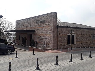
Erimtan Museum is an archaeology museum in Ankara, Turkey.


