Ospino, Portuguesa | |
|---|---|
 Flag  Seal | |
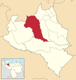 Ospino Municipality in Portuguesa State | |
 Ospino, Portuguesa | |
| Coordinates: 09°18′N69°27′W / 9.300°N 69.450°W | |
| Country | Venezuela |
| State | Portuguesa |
| Municipality | Ospino |
| Founded | 1713 |
| Government | |
| • Mayor | Yongeybi Yépez Alvarado (PSUV) |
| Area | |
• Total | 1,675 km2 (647 sq mi) |
| Population (2001) | |
• Total | 39,215 |
| • Demonym | Ospinense |
| Time zone | UTC-4:30 (VST) |
| • Summer (DST) | UTC-4:30 (not observed) |
| Area code | 0256 |
| Climate | Aw |
| Website | ospino-portuguesa.gob.ve |
| The area and population figures are for the municipality | |
Ospino is a town in the Venezuelan state of Portuguesa. This town is the shire town of the Ospino Municipality and, according to the 2001 Venezuelan census, the municipality has a population of 39,215. [1]