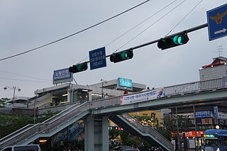
Noryangjin Station (노량진역) is a metro station in central Seoul, South Korea. The station is located in the Noryangjin-dong (neighborhood) of Dongjak-gu (ward) and is also a stop on Seoul Subway Line 1 and Seoul Subway Line 9. This stop is a popular destination for those seeking to eat raw fish, and other assorted seafood, as a large, covered sea food market is located next to the station, accessible by foot bridge. The Line 1 station is also notable in that Exit 1 and 2 have the same number as Exit 1 and 2 of Line 9's station.
Lisiny is a village in the administrative district of Gmina Rogowo, within Rypin County, Kuyavian-Pomeranian Voivodeship, in north-central Poland.
Markiewiczów is a village in the administrative district of Gmina Żółkiewka, within Krasnystaw County, Lublin Voivodeship, in eastern Poland.

Jaziewo is a village in the administrative district of Gmina Sztabin, within Augustów County, Podlaskie Voivodeship, in north-eastern Poland. It lies approximately 12 kilometres (7 mi) west of Sztabin, 22 km (14 mi) south of Augustów, and 63 km (39 mi) north of the regional capital Białystok.
Massacre Bay is an inlet on the southeast coast of the island of Attu in the Aleutian Islands in Alaska.
Sadłowice is a village in the administrative district of Gmina Puławy, within Puławy County, Lublin Voivodeship, in eastern Poland.
Czyżów Plebański is a village in the administrative district of Gmina Zawichost, within Sandomierz County, Świętokrzyskie Voivodeship, in south-central Poland. It lies approximately 5 kilometres (3 mi) north-west of Zawichost, 17 km (11 mi) north of Sandomierz, and 84 km (52 mi) east of the regional capital Kielce.
Ostromęczyn-Kolonia is a village in the administrative district of Gmina Platerów, within Łosice County, Masovian Voivodeship, in east-central Poland.
Żochy is a village in the administrative district of Gmina Czerwin, within Ostrołęka County, Masovian Voivodeship, in east-central Poland. It lies approximately 6 kilometres (4 mi) north-east of Czerwin, 21 km (13 mi) south-east of Ostrołęka, and 101 km (63 mi) north-east of Warsaw.
Kosów is a village in the administrative district of Gmina Lesznowola, within Piaseczno County, Masovian Voivodeship, in east-central Poland.
Helenów is a village in the administrative district of Gmina Krasne, within Przasnysz County, Masovian Voivodeship, in east-central Poland. It lies approximately 13 kilometres (8 mi) south of Przasnysz and 78 km (48 mi) north of Warsaw.
Szlasy-Leszcze is a village in the administrative district of Gmina Krasne, within Przasnysz County, Masovian Voivodeship, in east-central Poland. It lies approximately 9 kilometres (6 mi) south of Przasnysz and 82 km (51 mi) north of Warsaw.
Lęgniszewo is a village in the administrative district of Gmina Gołańcz, within Wągrowiec County, Greater Poland Voivodeship, in west-central Poland.
Tatarki is a village in the administrative district of Gmina Kolsko, within Nowa Sól County, Lubusz Voivodeship, in western Poland.
Karolewo is a village in the administrative district of Gmina Gardeja, within Kwidzyn County, Pomeranian Voivodeship, in northern Poland. It lies approximately 4 kilometres (2 mi) north of Gardeja, 12 km (7 mi) south of Kwidzyn, and 84 km (52 mi) south of the regional capital Gdańsk.
Veliš is a municipality and village in Benešov District in the Central Bohemian Region of the Czech Republic.
Amiret El Fhoul is a village and commune located in the Monastir Governorate, Tunisia, located 205 kilometres from Tunis. Population 4525 (2004).
Saksa is a village in Kehtna Parish, Rapla County in northern-central Estonia.
Sulu is a village in Märjamaa Parish, Rapla County in western Estonia.
Mariópolis is a region of Rio de Janeiro, but not officially recognized as a neighborhood.


