
The European route E 22 is one of the longest European routes. It has a length of about 5,320 km (3,310 mi). Many of the E-roads have been extended into Asia since the year 2000; the E 22 was extended on 24 June 2002.
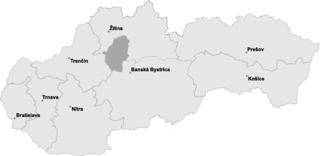
Turiec is a region in central Slovakia. Turiec is an informal designation of the territory, but it is also the name of one of the 21 official tourism regions of Slovakia. The region is not an administrative division in its own right, but between the late 11th century and 1920 it was an administrative county of the Kingdom of Hungary,.

Advanced Landing Grounds (ALGs) were temporary advance airfields constructed by the Allies during World War II during the liberation of Europe. They were built in the UK prior to the invasion and thereafter in northwest Europe from 6 June 1944 to V-E Day, 7 May 1945.

TOBB University of Economics and Technology is a private non-profit foundation university in Ankara, Turkey.

The Gunpowder Cellar is a historic building in Tartu, Estonia which now functions as a beer restaurant.
Kruszewo-Wypychy is a village in the administrative district of Gmina Sokoły, within Wysokie Mazowieckie County, Podlaskie Voivodeship, in north-eastern Poland.

Gardun, Croatia
Zamość Stary is a village in the administrative district of Gmina Przyłęk, within Zwoleń County, Masovian Voivodeship, in east-central Poland.
Algodão de Jandaíra is a municipality in the state of Paraíba in the Northeast Region of Brazil.
The National Coracle Centre is a museum in Cenarth, Carmarthenshire dedicated to coracles. It is owned by Martin Fowler and entry is via the wall of his boutique. It has on display coracles from around the world including Tibetan and Iraqi examples as well as British.
Curvelândia is a municipality in the state of Mato Grosso in the Central-West Region of Brazil.

The Albert River is a perennial river of the West Gippsland catchment, located in the South Gippsland region of the Australian state of Victoria.

Oakamoor Tunnel is a disused 497-yard (454 m) long tunnel located north of Oakamoor railway station on the former Uttoxeter to North Rode section of the North Staffordshire Railway.
Chromerida is a phylum of alveolates, which includes photosynthetic species Chromera velia and Vitrella brassicaformis. General features of the phylum include spherical cells each with a thick cell wall, chloroplast present with chlorophyll a only, and an internal developing flagellum at some lifestages.
The Mama is a river in Irkutsk Oblast, Russia. It is a left tributary of the Vitim River. Its tributaries are the Left Mama and the Right Mama. The total length including the Left Mama is 406 kilometres (252 mi).
Chuck Lenzie Generating Station is a 1,102-megawatt (1,478,000 hp) gas-fired power station located 30 miles north of Las Vegas, Nevada near the junction of Interstate 15 and the Great Basin Highway. Power is generated by two D-11 steam turbines powered by four 7FA combustion turbines. The plant is the first owned since a plant built in 1955.
Shahrbon is a village in Sajjadrud Rural District, Bandpey-ye Sharqi District, Babol County, Mazandaran Province, Iran. At the 2006 census, its population was 128, in 39 families.

Lenin Gardens was one of the first urban public parks in Ufa, Russia. The park stretches along all the length of the north Republic House.

The remains of the Orphir Round Church, dedicated to Saint Nicholas, are located in Orphir Parish on the Mainland of Orkney, Scotland. It is thought to have been built by jarl (earl) Haakon Paulsson as penance for murdering his cousin and co-ruler Magnus Erlendsson in the late 11th or early 12th century. According to the Orkneyinga saga, earl Haakon took sole power in 1117 after the killing of Magnus, and the round kirk was later rededicated to St Magnus. The saga refers to a "large drinking-hall" with a "magnificent church" nearby. The remains of the drinking hall, known as the Earl's Bu, can still be seen, as well as a later Norse horizontal watermill.
Liberty Township is a township in Stoddard County, in the U.S. state of Missouri.


