Łoskoń Stary, known also as Stary Łoskoń, is a village in the administrative district of Gmina Murowana Goślina, within Poznań County, Greater Poland Voivodeship, in west-central Poland. It lies approximately 11 kilometres (7 mi) north of Murowana Goślina and 31 km (19 mi) north of the regional capital Poznań. It is close to a small lake and expanses of forest.
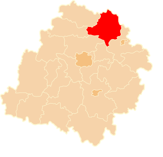
Niemojewo is a village in the administrative district of Gmina Świedziebnia, within Brodnica County, Kuyavian-Pomeranian Voivodeship, in north-central Poland.

Nowy Działyń is a village in the administrative district of Gmina Zbójno, within Golub-Dobrzyń County, Kuyavian-Pomeranian Voivodeship, in north-central Poland. It lies 7 kilometres (4 mi) west of Zbójno, 10 km (6 mi) south of Golub-Dobrzyń, and 30 km (19 mi) east of Toruń.
Nowe Boksze, is a village in the administrative district of Gmina Krasnopol, within Sejny County, Podlaskie Voivodeship, in north-eastern Poland.
Chlewisk Dolny is a village in the administrative district of Gmina Suchowola, within Sokółka County, Podlaskie Voivodeship, in north-eastern Poland. It lies approximately 4 kilometres (2 mi) east of Suchowola, 30 km (19 mi) north-west of Sokółka, and 51 km (32 mi) north of the regional capital Białystok.
Parma is a village in the administrative district of Gmina Łowicz, within Łowicz County, Łódź Voivodeship, in central Poland. It lies approximately 7 kilometres (4 mi) south-east of Łowicz and 48 km (30 mi) north-east of the regional capital Łódź.
Piaski is a village in the administrative district of Gmina Nieborów, within Łowicz County, Łódź Voivodeship, in central Poland. It lies approximately 13 kilometres (8 mi) south-east of Łowicz and 54 km (34 mi) north-east of the regional capital Łódź.
Jawor is a village in the administrative district of Gmina Mniszków, within Opoczno County, Łódź Voivodeship, in central Poland.
Biała Góra is a village in the administrative district of Gmina Wartkowice, within Poddębice County, Łódź Voivodeship, in central Poland. It lies approximately 3 kilometres (2 mi) east of Wartkowice, 11 km (7 mi) north-east of Poddębice, and 36 km (22 mi) north-west of the regional capital Łódź.
Ratoszyn Pierwszy is a village in the administrative district of Gmina Chodel, within Opole Lubelskie County, Lublin Voivodeship, in eastern Poland. It lies approximately 16 kilometres (10 mi) south-east of Opole Lubelskie and 35 km (22 mi) south-west of the regional capital Lublin.
Świerczek is a village in the administrative district of Gmina Skarżysko Kościelne, within Skarżysko County, Świętokrzyskie Voivodeship, in south-central Poland. It lies approximately 3 kilometres (2 mi) north of Skarżysko Kościelne, 5 km (3 mi) north of Skarżysko-Kamienna, and 38 km (24 mi) north-east of the regional capital Kielce.

Mirzec is a village in Starachowice County, Świętokrzyskie Voivodeship, in south-central Poland. It is the seat of the gmina called Gmina Mirzec. It lies approximately 10 kilometres (6 mi) north of Starachowice and 42 km (26 mi) north-east of the regional capital Kielce.
Czostków is a village in the administrative district of Gmina Krasocin, within Włoszczowa County, Świętokrzyskie Voivodeship, in south-central Poland. It lies approximately 5 kilometres (3 mi) south-east of Krasocin, 14 km (9 mi) east of Włoszczowa, and 33 km (21 mi) west of the regional capital Kielce.
Budziszyn is a village in the administrative district of Gmina Chynów, within Grójec County, Masovian Voivodeship, in east-central Poland. It lies approximately 4 kilometres (2 mi) south-west of Chynów, 14 km (9 mi) east of Grójec, and 38 km (24 mi) south of Warsaw.
Jabłonowo is a village in the administrative district of Gmina Lesznowola, within Piaseczno County, Masovian Voivodeship, in east-central Poland. It lies approximately 7 kilometres (4 mi) south-west of Lesznowola, 11 km (7 mi) west of Piaseczno, and 21 km (13 mi) south-west of Warsaw.

Racot is a village in the administrative district of Gmina Kościan, within Kościan County, Greater Poland Voivodeship, in west-central Poland. It lies approximately 6 kilometres (4 mi) south-east of Kościan and 41 km (25 mi) south of the regional capital Poznań.
Białkówek is a village in the administrative district of Gmina Cybinka, within Słubice County, Lubusz Voivodeship, in western Poland, close to the German border.
Bałdowo is a village in the administrative district of Gmina Tczew, within Tczew County, Pomeranian Voivodeship, in northern Poland. It lies approximately 7 kilometres (4 mi) south-east of Tczew and 36 km (22 mi) south of the regional capital Gdańsk.
Bojary is a village in the administrative district of Gmina Tczew, within Tczew County, Pomeranian Voivodeship, in northern Poland. It lies approximately 12 kilometres (7 mi) south-west of Tczew and 35 km (22 mi) south of the regional capital Gdańsk.
Brzeźnica is a village in the administrative district of Gmina Kętrzyn, within Kętrzyn County, Warmian-Masurian Voivodeship, in northern Poland. It lies approximately 4 kilometres (2 mi) south of Kętrzyn and 65 km (40 mi) north-east of the regional capital Olsztyn.