Shropshire (; alternatively Salop; abbreviated, in print only, Shrops; demonym Salopiansə-LOH-pee-ən, is a county in England, bordering Wales to the west, Cheshire to the north, Staffordshire to the east, and Worcestershire and Herefordshire to the south. Shropshire Council was created in 2009, a unitary authority taking over from the previous county council and five district councils. The borough of Telford and Wrekin has been a separate unitary authority since 1998 but continues to be included in the ceremonial county.

Oswestry is a market town, civil parish and historic railway town in Shropshire, England, close to the Welsh border. It is at the junction of the A5, A483 and A495 roads.

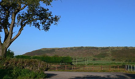
The Shropshire Hills area, in the English county of Shropshire, is designated as an Area of Outstanding Natural Beauty (AONB). It is located in the south of the county, extending to its border with Wales. Designated in 1958, the area encompasses 802 square kilometres (310 sq mi) of land primarily in south-west Shropshire, taking its name from the upland region of the Shropshire Hills. The A49 road and Welsh Marches Railway Line bisect the area north-south, passing through or near Shrewsbury, Church Stretton, Craven Arms and Ludlow.
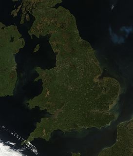
England comprises most of the central and southern two-thirds of the island of Great Britain, in addition to a number of small islands of which the largest is the Isle of Wight. England is bordered to the north by Scotland and to the west by Wales. It is closer to continental Europe than any other part of mainland Britain, divided from France only by a 33 km (21 mi) sea gap, the English Channel. The 50 km (31 mi) Channel Tunnel, near Folkestone, directly links England to mainland Europe. The English/French border is halfway along the tunnel.

The Shropshire Hills is an upland area and one of the natural regions of England. They lie wholly within the county of Shropshire and encompass several distinctive and well-known landmarks, such as the Long Mynd, Wenlock Edge, The Wrekin and the Clees.

The Dorset Heaths form an important area of heathland within the Poole Basin in southern England. Much of the area is protected.
The Natural Areas of England are regions, officially designated by Natural England, each with a characteristic association of wildlife and natural features. More formally, they are defined as "biogeographic zones which reflect the geological foundation, the natural systems and processes and the wildlife in different parts of England...".
A National Character Area (NCA) is a natural subdivision of England based on a combination of landscape, biodiversity, geodiversity and economic activity. There are 159 National Character Areas and they follow natural, rather than administrative, boundaries. They are defined by Natural England, the UK government's advisors on the natural environment.
The South Coast Plain is a natural region in England running along the central south coast in the counties of East and West Sussex and Hampshire.

The Marshwood and Powerstock Vales form a natural region in southwest England reaching to the Dorset coastline.

The Blackmoor Vale and Vale of Wardour area is a natural region in the counties of Dorset, Somerset and Wiltshire in southern England.

The Yeovil Scarplands are a natural region in southern England in the counties of Somerset and Dorset.

The Mid Somerset Hills are a major natural region in the county of Somerset in southwest west England, forming a series of low hills and ridges that divide up the Somerset Levels.

The North Northumberland Coastal Plain is a major natural region that lies on England's northeasternmost stretch of coastline on the North Sea. To the west lie the Cheviot Fringe, the Northumberland Sandstone Hills and Mid Northumberland; to the south it is continued by the South East Northumberland Coastal Plain.

The Northumberland Sandstone Hills are a major natural region that lies entirely within the English county of Northumberland. Their sandstone hills form distinctive skylines with generally level tops, northwest facing scarps and craggy outcrops offering exceptional views to the Cheviots further west.

The Mid Severn Sandstone Plateau is a rural landscape and one of the natural regions of central England, straddling the border between the counties of Shropshire and Staffordshire. It stretches from the western fringes of the Birmingham conurbation to Telford in the north and Kidderminster in the south. The major feature of the plateau is the valley of the River Severn, which cuts through it from north to south. It consists of Permian and Triassic-age New Red Sandstone getting older as one goes west until one reaches Silurian and Carboniferous-age siltstones and coals west of the river.

Creech Barrow Hill is a steep, conical hill, 193 metres (633 ft) high, near the coast of Dorset, England, and the highest point of the Dorset Heaths. It has been described as "one of Dorset's most distinctive landmarks." Geologically, it is also the highest Cenozoic hill in England.

Hensbarrow is a natural region in the county of Cornwall, England, UK, that has been recognized as National Character Area 154 by Natural England.

The Devon Redlands is a natural region in southwest Britain that has been designated as National Character Area (NCA) 148 by Natural England.

The Vale of Taunton and Quantock Fringes form a natural region in the southwest of England in the county of Somerset. Natural England have designated the Vale of Taunton and Quantock Fringes as National Character Area 146.