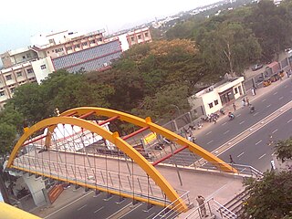
Chengalpattu, previously known as Chinglepet, is a city and the headquarters of Chengalpattu district of the state Tamil Nadu, India. The town is located near to the industrial and IT hub. It is the headquarters of the district and is 56 kilometres (35 mi) away from the state capital, Chennai on the National Highway 45.
Perundurai is a Special Grade Town Panchayat in Erode district in the Indian state of Tamil Nadu. Perundurai is the only special grade town panchayat among 42 in the district. Perundurai has developed as the industrial center with SIPCOT Industrial Estate and SEZ Complex. It is the Asia's Second largest SIPCOT.
Mangadu is a western neighborhood of Chennai, India. Literally meaning a mango forest, Mangadu Municipality is about 18 km from Chennai Central railway station, 14 km from Chennai International Airport and 13 km from CMBT.

Oddanchatram is a town in Dindigul district in the Indian state of Tamil Nadu. Oddanchatram is a region in the southwest of Tamil Nadu. The Town was carved out of Madurai District in 1985. Oddanchatram is also famous for vegetable and cattle market. As of 2011, the town had a population of 30,064. It is known as vegetable city of Tamil Nadu. Oddanchatram vegetable market is the largest supplying of vegetables in Tamilnadu and Kerala. Agriculture is the major economic support for the town.
Karumathampatti is a Municipality in the Coimbatore district in the state of Tamil Nadu, India. It is one of the most developing suburb in Coimbatore about 25 km away from the city centre. It is situated in between NH544 which connects the city of Coimbatore with Salem – Erode – Tirupur and also in between the State Highway 165 connects Annur – Kamanaikenpalayam. Nearby places are Somanur-3 km, Avinashi-10 km, Tirupur-20 km, Sulur-15 km, Annur-16 km. Coimbatore -27,Mettupalayam-38,Palladam-19. Karumathampatti lies near the junction of two major roads, NH544(Coimbatore – Salem) and Karumathampatti – Annur road.
Kaveripakkam is a town panchayat in Ranipet district in the Indian state of Tamil Nadu.
Kinathukadavu, meaning Pass of the Well, is a town panchayat suburb of Coimbatore city and taluk in Coimbatore district in the Indian state of Tamil Nadu. It is along the National Highway 209 and is 23 kilometres (14 mi) from Gandhipuram heart of Coimbatore city and 20.5 kilometres (13 mi) from Pollachi town. Neighboring places are Othakalmandapam, Malumichampatti, Eachanari to name a few.

Mallasamudram is a small town in Thiruchengode taluk, Namakkal district in the Indian state of Tamil Nadu. It is the headquarter of the Mallasamudram block. Mallasamudram is also known as "Mallai village", "Mallai".
Periya Negamam is a panchayat town in Coimbatore district in the southern Indian State of Tamil Nadu. It comes under Pollachi Taluk and pollachi Assembly constituency. Negamam used to be a popular small town serving the commercial and transport needs of many small villages around it until 1980s. With the arrival of frequent city buses to Pollachi and Udumalpet as transportation mode, growth of Negamam remained stunted. Weekly market on Tuesday used to be a big crowd puller.

Udumalai, also known as Udumalaipettai and Udumalpet, is a town in Tiruppur district in the Indian state of Tamil Nadu. Udumalaipettai is located 535 km south west from the state capital, Chennai and 72 km away from Coimbatore, the second largest city in the state.

Peelamedu is a major commercial centre and residential locality in the Eastern part of the city of Coimbatore in Tamil Nadu, India. It is governed by Coimbatore City Municipal Corporation since 1981. The growth of Peelamedu during the last decade can be cited due to the growth of the IT sector in Coimbatore. The rapid growth of Peelamedu as a commercial and residential hub could be attributed to its geographical advantage in terms of the connectivity to other parts of the city. It acts as an important hub connecting the rapidly growing business class Information Technology corridor. The Peelamedu area stretches from Nava India to the Coimbatore International Airport near SITRA, encompassing major educational institutions, hospitals, and Industries.
Tirupathur taluk is a taluk in Tirupathur district of the Indian state of Tamil Nadu. The headquarters of the taluk is the town of Tirupathur. It is known as the "Sandalwood Town" due to the abundant availability of sandalwood trees in the surrounding hills. On August 15, 2019, honourable Chief Minister of Tamil Nadu, Edapaadi K. Palanisami announced Tirupathur district, as a new district of Tamil Nadu.
Kurumbapalayam SSKulam is a part of Coimbatore city in the state of Tamil Nadu, India. It is located on NH 209 between Saravanampatti and Annur.

Gettupatti is a village in Dharmapuri District of Tamil Nadu State, India.
It comes under Dokkubothanahalli Panchayath and its south regions is covered by thoppur forest.
It is located 20 km towards South from Dharmapuri and 308 km from State capital Chennai.


