Canton is an unincorporated community in Jackson and Jones counties, Iowa, United States. There is a restaurant there, and no other businesses or services.
Bladensburg is a small unincorporated community in Wapello County, Iowa, United States. It lies midway between Agency and Batavia at a distance of five miles (8 km) from each, and the largest nearby city is Ottumwa, seven miles (11 km) to the west-southwest.
Augusta is an unincorporated community situated on the Skunk River in Des Moines County, Iowa, United States. It is located 10 miles southwest of Burlington and nine miles north of Fort Madison, off U.S. Route 61 and Iowa Highway 16. The community is part of the Burlington, IA–IL Micropolitan Statistical Area.
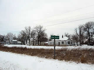
New Boston is an unincorporated community in central Lee County, Iowa, United States. It lies in the southeast corner of Iowa, along U.S. Highway 218 and southwest of the city of Fort Madison, the county seat of Lee County. New Boston is located nearby to the unincorporated communities of Argyle, Iowa and Charleston, Iowa. The community is part of the Fort Madison–Keokuk, IA-MO Micropolitan Statistical Area. There are no commercial establishments in New Boston, although this is the home of Liberty Baptist Church.
Bryantsburg is an unincorporated community in Buchanan County, Iowa, United States. It is located on Highway 150 north of Independence and south of Hazleton, at 42.579132N, -91.905063W.
Mederville is an unincorporated community in Clayton County, Iowa, United States.
Miller is an unincorporated community and census-designated place in Hancock County, Iowa, United States. As of the 2010 census, the population was 60.
Stilson is an unincorporated community in Hancock County, Iowa, United States.
Hutchins is an unincorporated community and census-designated place in Hancock County, Iowa, United States. As of the 2010 census the population was 28.
Waukon Junction is an unincorporated community in Allamakee County, Iowa, United States.
Olaf is an unincorporated community in Wright County, Iowa, United States.
Watson is an unincorporated community in Clayton County, Iowa, United States. The county seat of Elkader lies approximately 15 miles to the southwest.
Turkey River is an unincorporated community in Clayton County, Iowa, United States. The community of Turkey River borders the Mississippi River, and the Turkey River. Turkey River also is situated on Iowa's border with Wisconsin.
Depew is an unincorporated community in Independence Township, Palo Alto County, Iowa, United States. Depew is located along county highways B20 and N60, 8.7 miles (14.0 km) northeast of Emmetsburg.

Plainview is an unincorporated community in Cleona and Hickory Grove Townships, Scott County, Iowa, United States. Plainview is located along Iowa Highway 130 5.7 miles (9.2 km) north of Walcott.
Oneida is an unincorporated community in Oneida Township, Delaware County, Iowa, United States. The community is on county highway D13, 3 miles (4.8 km) south of Greeley.
Brainard is an unincorporated community in Fayette County, Iowa, United States. It is located at the junction of Echo Valley Road and F Avenue, four miles southwest of Elgin.
Lima is an unincorporated community in Fayette County, Iowa, United States. It is located at the junction of Ivy Road and Heron Road, four miles northeast of Fayette. and within a mile of the abandoned settlement of Albany.
Douglas is an unincorporated community in Fayette County, Iowa, United States. It is located near the junction of County Road B44 and Maple Road, three miles southwest of Eldorado.
Alice is an unincorporated community in Linn County, in the U.S. state of Iowa.


