Longdendale is a valley in the Peak District of England, north of Glossop and southwest of Holmfirth. The name means "long wooded valley" and the valley is mostly in the counties of Derbyshire and Greater Manchester.

The Metropolitan Borough of Tameside is a metropolitan borough of Greater Manchester in North West England. It is named after the River Tame, which flows through the borough and spans the towns of Ashton-under-Lyne, Audenshaw, Denton, Droylsden, Dukinfield, Hyde, Mossley and Stalybridge plus Longdendale. Its western border is approximately 4 miles (6.4 km) east of Manchester city centre. It borders High Peak in Derbyshire to the east, the Metropolitan Borough of Oldham to the north, the Metropolitan Borough of Stockport to the south, and the City of Manchester to the west. As of 2011 the overall population was 219,324.

Ashton-under-Lyne is a market town in Tameside, Greater Manchester, England. The population was 45,198 at the 2011 census. Historically in Lancashire, it is on the north bank of the River Tame, in the foothills of the Pennines, 6.2 miles (10.0 km) east of Manchester.

The River Bollin is a major tributary of the River Mersey in the north-west of England.
The history of Cheshire can be traced back to the Hoxnian Interglacial, between 400,000 and 380,000 years BP. Primitive tools that date to that period have been found. Stone Age remains have been found showing more permanent habitation during the Neolithic period, and by the Iron Age the area is known to have been occupied by the Celtic Cornovii tribe and possibly the Deceangli.

Warburton is a village and civil parish within the Metropolitan Borough of Trafford in Greater Manchester, England. Historically in Cheshire, Warburton lies on the south bank of the River Mersey between the borough of Warrington and Greater Manchester. In the 21st century, the village remains predominantly rural. Altrincham is the nearest town. According to the 2001 census, the parish had a population of 286.
Hale Barns is a village near Altrincham in the borough of Trafford, Cheshire, England. Hale Barns lies about 12 miles (19 km) south of Manchester city centre, 2 miles west of Manchester Airport and close to the River Bollin. At the 2011 census, the village had a population of 9,736.
Helsby is a village, civil parish and electoral ward in Cheshire, England, which in 2011 had a population of 4,972.
Prestbury is a village and civil parish in Cheshire, England. About 1.5 miles (3 km) north of Macclesfield, at the 2001 census, it had a population of 3,324, increasing slightly to 3,471 at the 2011 Census. Alongside fellow "Cheshire Golden Triangle" villages Wilmslow and Alderley Edge, it is one of the most sought after and expensive places to live outside London. The ecclesiastical parish is almost the same as the former Prestbury local government ward which consisted of the civil parishes of Prestbury, Adlington and Mottram St Andrew.

Partington is a town and civil parish in the Metropolitan Borough of Trafford, Greater Manchester, England, ten miles (16 km) south-west of Manchester city centre. Historically part of Cheshire, it lies on the southern bank of the Manchester Ship Canal, opposite Cadishead on the northern bank. It has a population of 7,327.

Flixton is a village and electoral ward in the Metropolitan Borough of Trafford, Greater Manchester, England. The population of the ward at the 2011 census was 10,786. It lies about six miles (9.7 km) to the southwest of Manchester city centre, within the historic county boundaries of Lancashire. Flixton and neighbouring Davyhulme are considered areas within Urmston. Neolithic and Bronze Age artefacts have been found locally and the area may have been inhabited in those periods. Medieval Flixton was a parish within the Hundred of Salford and encompassed the manor of Flixton, along with its church, first mentioned in the 12th century. The parish comprised isolated farmsteads and a manor house. Toward the end of the 17th century its population began to rise, continuing through the 19th century, although at a much slower pace than its neighbours. Flixton was a remote rural area with few transport links and did not witness the level of industrialisation other parts of Manchester saw, but its connection to the railway network in 1873 helped transform the area into a middle-class suburb.
Buckton Castle was a medieval enclosure castle near Carrbrook in Stalybridge, Greater Manchester, England. It was surrounded by a 2.8-metre-wide (9 ft) stone curtain wall and a ditch 10 metres (33 ft) wide by 6 metres (20 ft) deep. Buckton is one of the earliest stone castles in North West England and only survives as buried remains overgrown with heather and peat. It was most likely built and demolished in the 12th century. The earliest surviving record of the site dates from 1360, by which time it was lying derelict. The few finds retrieved during archaeological investigations indicate that Buckton Castle may not have been completed.

The Bridestones is a chambered cairn, near Congleton, Cheshire, England, that was constructed in the Neolithic period about 3500–2400 BC. It was described in 1764 as being 120 yards (110 m) long and 12 yards (11 m) wide, containing three separate compartments, of which only one remains today. The remaining compartment is 6 metres (20 ft) long by 2.7 metres (8.9 ft) wide, and consists of vertical stone slabs, divided by a now-broken cross slab. The cairn originally had a stone circle surrounding it, with four portal stones; two of these portal stones still remain. The site is protected as a scheduled ancient monument.

There are 37 scheduled monuments in Greater Manchester, a metropolitan county in North West England. In the United Kingdom, a scheduled monument is a "nationally important" archaeological site or historic building that has been given protection against unauthorised change by being placed on a list by the Secretary of State for Culture, Media and Sport; English Heritage takes the leading role in identifying such sites. Scheduled monuments are defined in the Ancient Monuments and Archaeological Areas Act 1979 and the National Heritage Act 1983. They are also referred to as scheduled ancient monuments. There are about 18,300 scheduled monument entries on the list, which is maintained by English Heritage; more than one site can be included in a single entry. While a scheduled monument can also be recognised as a listed building, English Heritage considers listed building status as a better way of protecting buildings than scheduled monument status. If a monument is considered by English Heritage to "no longer merit scheduling" it can be descheduled.
Stockport Castle was a promontory castle in Stockport, Cheshire. The castle was in the medieval town, overlooking a ford over the River Mersey. It was first documented in 1173, but the next mention of it is in 1535 when it was in ruins. What remained of the castle was demolished in 1775.
Mellor hill fort is a prehistoric site in North West England, that dates from the British Iron Age—about 800 BC to 100 AD. Situated on a hill in Mellor, Greater Manchester, on the western edge of the Peak District, the hill fort overlooks the Cheshire Plain. Although the settlement was founded during the Iron Age, evidence exists of activity on the site as far back as 8,000 BC; during the Bronze Age the hill may have been an area where funerary practices were performed. Artefacts such as a Bronze Age amber necklace indicate the site was high status and that its residents took part in long-distance trade. The settlement was occupied into the Roman period. After the site was abandoned, probably in the 4th century, it was forgotten until its rediscovery in the 1990s.
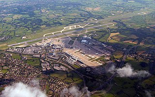
Construction started on Ringway on 28 November 1935 and it opened partly in June 1937 and completely on 25 June 1938, in Ringway parish north of Wilmslow, from which it derived its name Manchester (Ringway) Airport. Its north border was Yewtree Lane. Its southeast border was a little northwest of Altrincham Road (Styal).