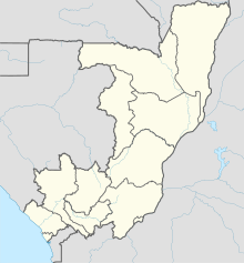
Mbandaka Airport is an airport serving the Congo River port of Mbandaka, capital city of the Équateur District in the Democratic Republic of the Congo. The runway is on the southeast side of the city.
Matari Airport is an airport serving Isiro, a city in Haut-Uélé Province, Democratic Republic of the Congo. The airport is 6 kilometres (3.7 mi) northwest of the city.
Muanda Airport or Moanda Airport is an airport serving Muanda, an Atlantic coastal city in the Democratic Republic of the Congo.
N'Dolo Airport, also known as Ndolo Airport, is a secondary airport in the city of Kinshasa, Democratic Republic of the Congo, located in the commune of Barumbu near the city center.
Lusambo Airport is an airport serving Lusambo, a town and territory in the Sankuru district of the Kasai-Oriental Province, Democratic Republic of the Congo. The runway is 6 kilometres (3.7 mi) west of Lusambo and parallels the Sankuru River.
Bétou Airport is an airport within the town of Bétou in the Likouala Department, Republic of the Congo. The runway also serves as part of the road leading westward out of town.
Gamboma Airport is an airport serving the city of Gamboma in the Plateaux Department of Republic of the Congo. The runway is 5 kilometres (3.1 mi) north of town.
Kellé Airport is an airstrip serving the village of Kellé in the Cuvette-Ouest Department, Republic of the Congo. The runway is 1.6 kilometres (0.99 mi) southeast of the village.
Makoua Airport is an airport serving the town of Makoua in the Cuvette Department, Republic of the Congo. The runway is 4 kilometres (2.5 mi) west of the town.
Mossendjo Airport is an airport serving the town of Mossendjo in the Niari Department, Republic of the Congo. The runway is on the west end of the town.
Yokangassi Airport is an airport serving the town of Nkayi in Bouenza Department, Republic of the Congo. The runway is 3.4 kilometres (2.1 mi) south of the town.
Sibiti Airport is an airport serving the city of Sibiti, Republic of the Congo. The airport is just east of the city. It replaces the former airstrip 10 kilometres (6.2 mi) southeast of town.
Souanké Airport is an airport serving the town of Souanké, Republic of the Congo. The runway is 8 kilometres (5.0 mi) southeast of the town.
Zanaga Airport is an airport serving Zanaga, a town in the Lékoumou Department of the Republic of the Congo. The runway is adjacent to the north side of the town.
Okoyo Airport is an airstrip serving the town of Okoyo in the Cuvette Department of the Republic of the Congo. The runway is 1.5 kilometres (1 mi) north of the town.
Aketi Airport is an airstrip serving the town of Aketi in Bas-Uele Province, Democratic Republic of the Congo. The runway is southeast of the town, across the Itimbiri River, and is accessed by ferry.
Kabalo Airport is an airport serving the town of Kabalo, in the Tanganyika Province of Democratic Republic of the Congo.
Rutshuru Airport is an airport serving the town of Rutshuru in Democratic Republic of the Congo. The runway is 3 kilometres (2 mi) northwest of Rutshuru in the town of Kiwanja.
Matadi Tshimpi Airport is an airport serving the city of Matadi in Kongo Central Province, Democratic Republic of the Congo. The runway is north of Matadi, across the Congo River.
Luishi Airport is an airport serving the village of Luishi in Katanga Province, Democratic Republic of the Congo. The runway is 4 kilometres (2.5 mi) southeast of the village.