The topic of this article may not meet Wikipedia's notability guideline for geographic features .(June 2024) |
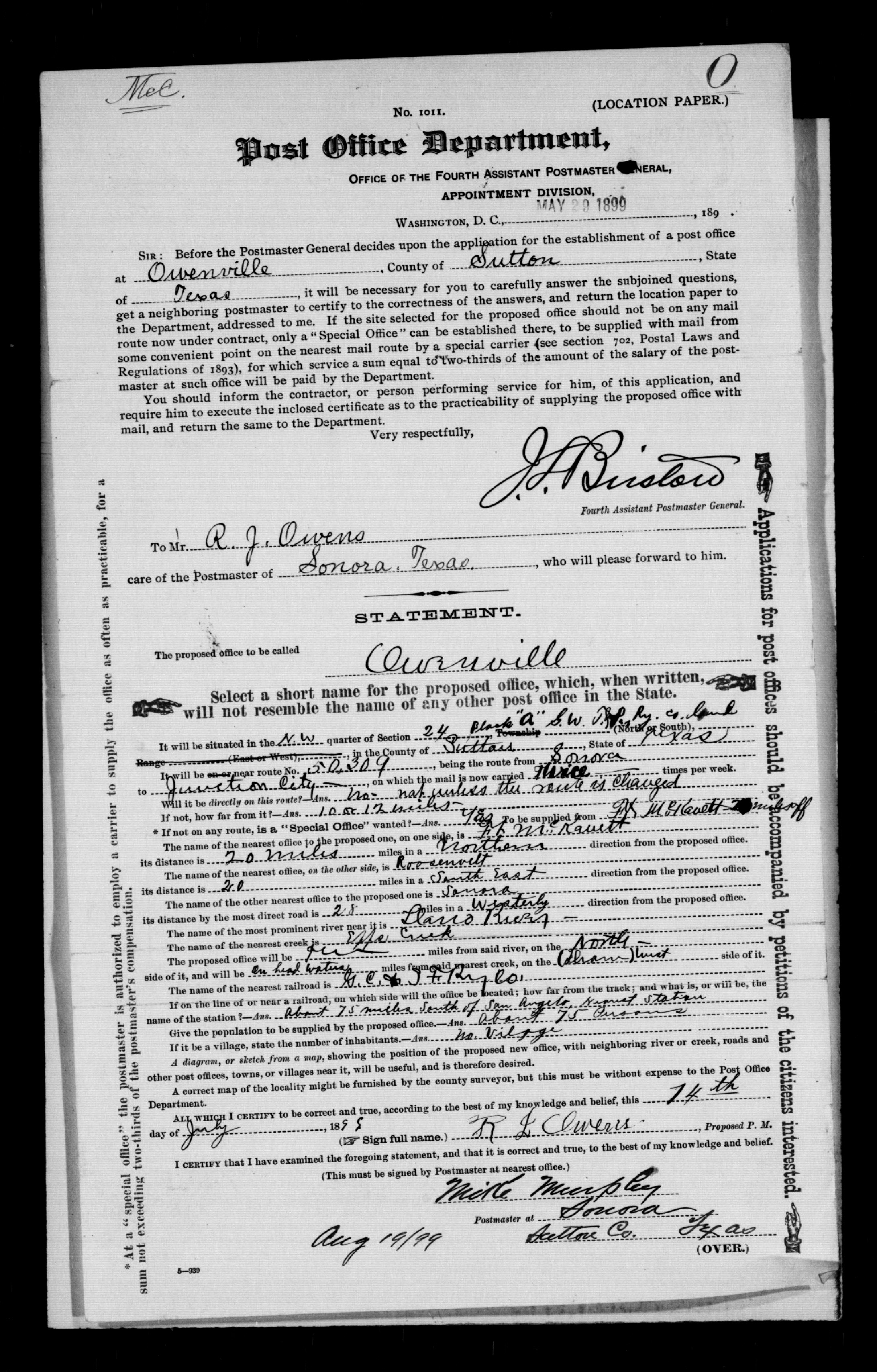
Owenville is a ghost town in Sutton County, Texas, United States. It was located on the headwaters of Epps Creek in May, 1899. [1]
The topic of this article may not meet Wikipedia's notability guideline for geographic features .(June 2024) |
Owenville is a ghost town in Sutton County, Texas, United States. It was located on the headwaters of Epps Creek in May, 1899. [1]
Municipalities and communities of Sutton County, Texas, United States | ||
|---|---|---|
| City |  | |
| Ghost towns | ||
30°37′44″N100°13′22″W / 30.6289°N 100.2227°W
| | This article about a location in Sutton County, Texas is a stub. You can help Wikipedia by expanding it. |
| | This United States ghost town-related article is a stub. You can help Wikipedia by expanding it. |