Oxnard Field

Last updated
Oxnard Field
Summary
Location Albuquerque, New Mexico
Opened1928
Closed1948

Oxnard Field (also known at various times as Albuquerque Airport and Albuquerque Army Air Field) was the first airport in Albuquerque, New Mexico. It served as the home of commercial aviation in Albuquerque from 1928 to 1929 and remained in use for other purposes until 1948. The field was located on Albuquerque's East Mesa, east of the present site of Albuquerque International Sunport.

Airport location where aircraft take off and land

An airport is an aerodrome with extended facilities, mostly for commercial air transport. Airports often have facilities to store and maintain aircraft, and a control tower. An airport consists of a landing area, which comprises an aerially accessible open space including at least one operationally active surface such as a runway for a plane to take off or a helipad, and often includes adjacent utility buildings such as control towers, hangars and terminals. Larger airports may have airport aprons, taxiway bridges, air traffic control centres, passenger facilities such as restaurants and lounges, and emergency services. In some countries, the US in particular, they also typically have one or more fixed-base operators, serving general aviation.

New Mexico U.S. state in the United States

New Mexico is a state in the Southwestern region of the United States of America; its capital and cultural center is Santa Fe, which was founded in 1610 as capital of Nuevo México, while its largest city is Albuquerque with its accompanying metropolitan area. It is one of the Mountain States and shares the Four Corners region with Utah, Colorado, and Arizona; its other neighboring states are Oklahoma to the northeast, Texas to the east-southeast, and the Mexican states of Chihuahua to the south and Sonora to the southwest. With a population around two million, New Mexico is the 36th state by population. With a total area of 121,592 sq mi (314,920 km2), it is the fifth-largest and sixth-least densely populated of the 50 states. Due to their geographic locations, northern and eastern New Mexico exhibit a colder, alpine climate, while western and southern New Mexico exhibit a warmer, arid climate.

Albuquerque International Sunport airport in Albuquerque, New Mexico, United States

Albuquerque International Sunport is a Class C public international airport 3 miles (5 km) southeast of downtown Albuquerque, in Bernalillo County, New Mexico. It is the largest civil airport in New Mexico, handling 5,467,693 passengers in 2018.

Contents

History

The field was originally constructed in 1928 by Santa Fe Railroad workers Frank G. Speakman and William Langford Franklin, using grading equipment loaned by the city after hours. Working with the town of Albuquerque, they graded two runways on the East Mesa—one approximately 5,300 feet (1,600 m) long and the other just under 4,000 feet (1,200 m). The venture became Albuquerque Airport. Other individuals and promoters soon became interested in Albuquerque as a crossroads location for southwestern air traffic.

Atchison, Topeka and Santa Fe Railway Large railroad company in the United States.

The Atchison, Topeka and Santa Fe Railway, often referred to as the Santa Fe or AT&SF, was one of the larger railroads in the United States. Chartered in February 1859, the railroad reached the Kansas-Colorado border in 1873 and Pueblo, Colorado, in 1876. To create a demand for its services, the railroad set up real estate offices and sold farm land from the land grants that it was awarded by Congress. Despite the name, its main line never served Santa Fe, New Mexico, as the terrain was too difficult; the town ultimately was reached by a branch line from Lamy.

James G. Oxnard, a New York entrepreneur, bought out Franklin's share in the airport soon after it was completed and renamed it Oxnard Field. [1] Oxnard expanded the facility to 480 acres (1.9 km2), adding an administration building and other facilities.

New York City Largest city in the United States

The City of New York, usually called either New York City (NYC) or simply New York (NY), is the most populous city in the United States. With an estimated 2018 population of 8,398,748 distributed over a land area of about 302.6 square miles (784 km2), New York is also the most densely populated major city in the United States. Located at the southern tip of the state of New York, the city is the center of the New York metropolitan area, the largest metropolitan area in the world by urban landmass and one of the world's most populous megacities, with an estimated 19,979,477 people in its 2018 Metropolitan Statistical Area and 22,679,948 residents in its Combined Statistical Area. A global power city, New York City has been described as the cultural, financial, and media capital of the world, and exerts a significant impact upon commerce, entertainment, research, technology, education, politics, tourism, art, fashion, and sports. The city's fast pace has inspired the term New York minute. Home to the headquarters of the United Nations, New York is an important center for international diplomacy.

In its brief stint as the city's main airport, Oxnard Field was served by two competing airlines, Western Air Express (WAE) and Transcontinental Air Transport (TAT). However, the proximity of the field to the Sandia Mountains made pilots uneasy, and Western Air Express built a new facility, West Mesa Airport, in 1929. Following the merger of TAT and WAE to form Transcontinental and Western Air (TWA), all commercial air service shifted to West Mesa. This airport became known as Albuquerque Airport—while the former Albuquerque Airport on the East Mesa took on the name Oxnard Field, continuing as a private venture.

Transcontinental Air Transport 1928-1930 American airline, predecessor of TWA

Transcontinental Air Transport (T-A-T) was an airline founded in 1928 by Clement Melville Keys that merged in 1930 with Western Air Express to form what became TWA. Keys enlisted the help of Charles Lindbergh to design a transcontinental network to get government airmail contracts. Lindbergh established numerous airports across the country in this effort.

Sandia Mountains mountain range located to the east of the city of Albuquerque in New Mexico in the southwestern United States

The Sandia Mountains, are a mountain range located in Bernalillo and Sandoval counties, immediately to the east of the city of Albuquerque in New Mexico in the southwestern United States. The range is largely within the Cibola National Forest, and part of the range is protected as the Sandia Mountain Wilderness. Its highest point is Sandia Crest, 10,678 feet (3,255 m).

West Mesa Airport airport in New Mexico, United States of America

West Mesa Airport, also known as Western Air Express Airport, TWA Airport, or Cutter-Carr Airport, was an airport on the West Side of Albuquerque, New Mexico, which was the city's main commercial aviation facility during the 1930s. It was built in 1929 by Western Air Express as a stop on the airline's Los Angeles–Kansas City route, with a hangar and passenger terminal added in 1930. It was the city's second airfield after the original Albuquerque Airport, which was used by a rival airline, Transcontinental Air Transport (TAT). The two airlines merged in 1930 to form TWA, moving all of their operations to the West Mesa field. The merger gave TWA control of the nation's first coast-to-coast passenger airline route and allowed it to secure a lucrative federal airmail contract.

The onset of World War II brought new activity to Oxnard Field. By 1939, Army and Navy pilots had begun using Oxnard Field for refuelling and maintenance. The Army eventually bought the Oxnard Field property and its subsequent transfer to the federal government on April 3, 1942 restricted the runways to military use only. The Army established a training depot for aircraft mechanics near Oxnard Field. An Army Air Forces Air Depot Training Station was established in June, and shortly thereafter the airport was designated Albuquerque Army Air Field. Two new runways and a variety of other facilities were built during this period.

By 1943, however, the mechanics' training program had ended and the depot was used as a convalescent center for wounded air crewmen and then as a storage and dismantling facility for war-weary and surplus aircraft as the war ended. Over 2,000 such planes were stripped and melted down, reclaiming some 10 million pounds of aluminum. [2]

The field was used for the last time between 1945 and 1948, when it served as the final destination for hundreds of surplus warplanes which were assembled there for scrapping. Following the end of this operation, the airport was closed permanently.

Facilities

The airport initially had two dirt runways, east-west (4300 ft) and northeast-southwest (2500 ft). The only facilities consisted of gravity-fed fuel tanks. Oxnard added the administration building, a hangar, and a 52-foot (16 m) beacon. The Airport Inn was a popular dining establishment. The airport reached its final configuration during the war, when the north-south and northwest-southeast runways were added.

Oxnard Field today

The former airport is now part of Kirtland Air Force Base, and new development has covered most of it. However, part of the northeast-southwest runway remains visible and the former administration building and hangar are still standing. Another legacy of Oxnard Field is the major streets Wyoming Boulevard and Ridgecrest Drive, both of which were originally developed as airport access roads.

Related Research Articles

Sandia National Laboratories United States research lab

The Sandia National Laboratories (SNL), managed and operated by the National Technology and Engineering Solutions of Sandia, is one of three National Nuclear Security Administration research and development laboratories. In December 2016, it was announced that National Technology and Engineering Solutions of Sandia, under the direction of Honeywell International, will take over the management of Sandia National Laboratories starting on May 1, 2017.

Floyd Bennett Field Historic former airport in Brooklyn, New York City

Floyd Bennett Field is an airfield in the Marine Park neighborhood of southeast Brooklyn in New York City, along the shore of Jamaica Bay. The airport originally hosted commercial and general aviation traffic before being used as a naval air station. Bennett Field is currently part of the Gateway National Recreation Area's Jamaica Bay Unit, and is managed by the National Park Service (NPS). While no longer used as an operational commercial, military, or general aviation airfield, a section is still used as a helicopter base by the New York City Police Department (NYPD).

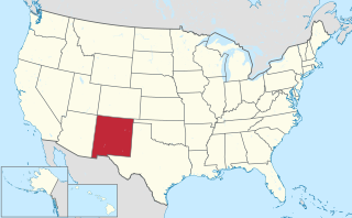
Sandia Base was the principal nuclear weapons installation of the United States Department of Defense from 1946 to 1971. It was located on the southeastern edge of Albuquerque, New Mexico. For 25 years, the top-secret Sandia Base and its subsidiary installation, Manzano Base, carried on the atomic weapons research, development, design, testing, and training commenced by the Manhattan Project during World War II. Fabrication, assembly, and storage of nuclear weapons was also done at Sandia Base. The base played a key role in the United States nuclear deterrence capability during the Cold War. In 1971 it was merged into Kirtland Air Force Base.

Kirtland Air Force Base United States Air Force base at Albuquerque International Sunport, New Mexico, USA

Kirtland Air Force Base is a United States Air Force base located in the southeast quadrant of the Albuquerque, New Mexico urban area, adjacent to the Albuquerque International Sunport. The base was named for the early Army aviator Col. Roy C. Kirtland. The military and the international airport share the same runways, making ABQ a joint civil-military airport.

Naval Air Station Alameda 1927-1997 military airbase in Alameda, California, USA

Naval Air Station Alameda was a United States Navy Naval Air Station in Alameda, California, on San Francisco Bay.

Charleston Air Force Base United States military facility located in the City of North Charleston, South Carolina

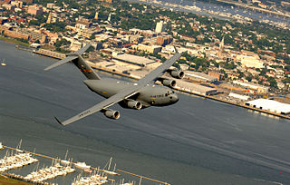
Charleston Air Force Base is a United States military facility located in the City of North Charleston, South Carolina. The facility is under the jurisdiction of the United States Air Force's 628th Air Base Wing, a subordinate element of the Air Mobility Command (AMC). It is part of Joint Base Charleston, which combined Charleston Air Force Base with Naval Support Activity Charleston.

Clovis Municipal Airport airport in New Mexico, United States of America

Clovis Municipal Airport is a city-owned, public-use airport located six nautical miles east of the central business district of Clovis, a city in Curry County, New Mexico, United States. It is mostly used for general aviation, but is also served by one commercial airline. Current scheduled passenger service is subsidized by the Essential Air Service program.

Stockton Metropolitan Airport Joint civil-military airport near Stockton, CA

Stockton Metropolitan Airport is a joint civil-military airport three miles southeast of downtown Stockton, a city in San Joaquin County, California. It is owned by the County of San Joaquin.

Santa Ana Army Air Base

Santa Ana Army Air Base (SAAAB) was an air base built during World War II that was decommissioned in 1946. The air base was used for basic training, but did not have planes, hangars or runways. The base was 1,336 acres (5.41 km2) and located in Costa Mesa between Baker Street on the north, Harbor Blvd. on the west, Wilson Street on the south, Newport Blvd. on the east.

Daniel Field airport in Georgia, United States of America

Daniel Field is a public use airport located one nautical mile (2 km) west of the central business district of Augusta, a city in Richmond County, Georgia, United States. It is owned by the City of Augusta and operated by the General Aviation Commission. This airport is included in the National Plan of Integrated Airport Systems for 2011–2015, which categorized it as a general aviation facility.

Oxnard Air Force Base

Oxnard Air Force Base is a former United States Air Force base, located in the city of Camarillo, California.

Imeson Field airport in Jacksonville, United States of America

Imeson Field, also known as Jacksonville Imeson Airport, was the airport serving Jacksonville, Florida, from 1927 until its closing in 1968. It was known as Jacksonville Municipal Airport prior to World War II, Jacksonville Army Airfield when the United States Army Air Forces controlled the facility during World War II, and at its closing the airport was Jacksonville – Thomas Cole Imeson Municipal Airport.

Beauregard Regional Airport airport in Louisiana, United States of America

Beauregard Regional Airport is a public use airport in Beauregard Parish, Louisiana, United States. It is owned by Beauregard Parish and is located three nautical miles (6 km) southwest of the central business district of De Ridder, Louisiana. The airport serves the general aviation community, with no scheduled commercial airline service.

Baltimore Municipal Airport airport in Maryland, United States of America

Baltimore Municipal Airport is a former airport and United States Air Force airfield about 6 miles southeast of Baltimore, Maryland on an artificial peninsula. Construction began in 1929 with a seaplane base and was completed in 1941. It closed on 30 December 1960. The western half of the airport was within the city of Baltimore, whereas the eastern half was in Dundalk, in Baltimore County.

Fort Sumner Municipal Airport airport in New Mexico, United States of America

Fort Sumner Municipal Airport is a village owned, public use airport located two nautical miles (4 km) northeast of the central business district of Fort Sumner, a village in De Baca County, New Mexico, United States. It is included in the National Plan of Integrated Airport Systems for 2011–2015, which categorized it as a general aviation airport.

Bruce Field airport in Texas

Bruce Field is a city-owned public-use general aviation airport located five nautical miles southwest of the central business district of Ballinger, a city in Runnels County, Texas, United States.

West Mesa Air Force Station

West Mesa Air Force Station is a closed United States Air Force General Surveillance Radar station. It is located 9.5 miles (15.3 km) west of Albuquerque, New Mexico. It was closed by the Air Force in 1968 and turned over to the Federal Aviation Administration (FAA). The site is now data-tied into the Joint Surveillance System (JSS).

United States Air Force Plant 42 United States Government aircraft manufacturing plant

United States Air Force Plant 42 is a classified United States Government aircraft manufacturing plant, used by the United States Air Force. It is also used by the National Aeronautics and Space Administration (NASA).

References

  1. U.S. Air Force, Fact Sheet, Kirtland Air Force Base History, "Archived copy". Archived from the original on 2011-09-29. Retrieved 2011-10-01.CS1 maint: archived copy as title (link), retrieved April 4, 2008
  2. Kirtland AFB Fact Sheet

Notes

  1. ^ Oppenheimer, Alan J. (1962). The Historical Background of Albuquerque, New Mexico. City of Albuquerque Planning Department. p. 47.
  2. ^ Oppenheimer, p. 48.

Coordinates: 35°03′03″N106°33′15″W / 35.0507°N 106.5541°W / 35.0507; -106.5541