Ochocice is a village in the administrative district of Gmina Kamieńsk, within Radomsko County, Łódź Voivodeship, in central Poland. It lies approximately 2 kilometres (1 mi) north of Kamieńsk, 18 km (11 mi) north of Radomsko, and 63 km (39 mi) south of the regional capital Łódź.
Szpinalów is a village in the administrative district of Gmina Kamieńsk, within Radomsko County, Łódź Voivodeship, in central Poland. It lies approximately 4 kilometres (2 mi) north of Kamieńsk, 19 km (12 mi) north of Radomsko, and 62 km (39 mi) south of the regional capital Łódź.
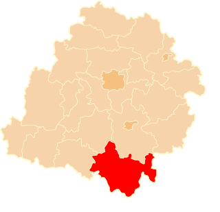
Antopol is a village in the administrative district of Gmina Kodrąb, within Radomsko County, Łódź Voivodeship, in central Poland. It lies approximately 7 kilometres (4 mi) east of Radomsko and 78 km (48 mi) south of the regional capital Łódź.
Feliksów is a village in the administrative district of Gmina Kodrąb, within Radomsko County, Łódź Voivodeship, in central Poland. It lies approximately 4 kilometres (2 mi) south-east of Kodrąb, 15 km (9 mi) east of Radomsko, and 80 km (50 mi) south of the regional capital Łódź.
Łagiewniki is a village in the administrative district of Gmina Kodrąb, within Radomsko County, Łódź Voivodeship, in central Poland. It lies approximately 9 kilometres (6 mi) east of Radomsko and 78 km (48 mi) south of the regional capital Łódź.
Rzejowice is a village in the administrative district of Gmina Kodrąb, within Radomsko County, Łódź Voivodeship, in central Poland. It lies approximately 18 kilometres (11 mi) east of Radomsko and 78 km (48 mi) south of the regional capital Łódź.
Teodorów Duży is a village in the administrative district of Gmina Kodrąb, within Radomsko County, Łódź Voivodeship, in central Poland. It lies approximately 11 kilometres (7 mi) east of Radomsko and 81 km (50 mi) south of the regional capital Łódź.
Zakrzew is a village in the administrative district of Gmina Kodrąb, within Radomsko County, Łódź Voivodeship, in central Poland. It lies approximately 10 kilometres (6 mi) east of Radomsko and 78 km (48 mi) south of the regional capital Łódź.
Stobiecko Szlacheckie is a village in the administrative district of Gmina Ładzice, within Radomsko County, Łódź Voivodeship, in central Poland. It lies approximately 5 kilometres (3 mi) north-east of Ładzice, 6 km (4 mi) north-west of Radomsko, and 76 km (47 mi) south of the regional capital Łódź.
Jaskółki is a village in the administrative district of Gmina Masłowice, within Radomsko County, Łódź Voivodeship, in central Poland. It lies approximately 27 kilometres (17 mi) east of Radomsko and 81 km (50 mi) south of the regional capital Łódź.
Korytno is a village in the administrative district of Gmina Masłowice, within Radomsko County, Łódź Voivodeship, in central Poland. It lies approximately 28 kilometres (17 mi) east of Radomsko and 80 km (50 mi) south of the regional capital Łódź.
Tworowice is a village in the administrative district of Gmina Masłowice, within Radomsko County, Łódź Voivodeship, in central Poland. It lies approximately 21 kilometres (13 mi) east of Radomsko and 79 km (49 mi) south of the regional capital Łódź.
Przyłanki is a village in the administrative district of Gmina Przedbórz, within Radomsko County, Łódź Voivodeship, in central Poland. It lies approximately 4 kilometres (2 mi) north-east of Przedbórz, 35 km (22 mi) east of Radomsko, and 83 km (52 mi) south-east of the regional capital Łódź.
Wola Przedborska is a village in the administrative district of Gmina Przedbórz, within Radomsko County, Łódź Voivodeship, in central Poland. It lies approximately 2 kilometres (1 mi) north of Przedbórz, 31 km (19 mi) east of Radomsko, and 82 km (51 mi) south of the regional capital Łódź.
Dąbrówka is a village in the administrative district of Gmina Radomsko, within Radomsko County, Łódź Voivodeship, in central Poland. It lies approximately 6 kilometres (4 mi) south-west of Radomsko and 84 km (52 mi) south of the regional capital Łódź.
Grzebień is a village in the administrative district of Gmina Radomsko, within Radomsko County, Łódź Voivodeship, in central Poland. It lies approximately 6 kilometres (4 mi) south-east of Radomsko and 84 km (52 mi) south of the regional capital Łódź.
Okrajszów is a village in the administrative district of Gmina Radomsko, within Radomsko County, Łódź Voivodeship, in central Poland. It lies approximately 5 kilometres (3 mi) north-east of Radomsko and 76 km (47 mi) south of the regional capital Łódź.
Strzałków is a village in the administrative district of Gmina Radomsko, within Radomsko County, Łódź Voivodeship, in central Poland. It lies approximately 4 kilometres (2 mi) south-east of Radomsko and 82 km (51 mi) south of the regional capital Łódź.
Borecznica is a village in the administrative district of Gmina Wielgomłyny, within Radomsko County, Łódź Voivodeship, in central Poland. It lies approximately 3 kilometres (2 mi) north-west of Wielgomłyny, 22 km (14 mi) east of Radomsko, and 86 km (53 mi) south of the regional capital Łódź.