
The Kingdom of Israel, also called the Northern Kingdom or the Kingdom of Samaria, was an Israelite kingdom that existed in the Southern Levant during the Iron Age. Its beginnings date back to the first half of the 10th century BCE. It controlled the areas of Samaria, Galilee and parts of Transjordan; the former two regions underwent a period in which a large number of new settlements were established shortly after the kingdom came into existence. It had four capital cities in succession: Shiloh, Shechem, Tirzah, and the city of Samaria. In the 9th century BCE, it was ruled by the Omride dynasty, whose political centre was the city of Samaria.

The Samaritans, often preferring to be called Israelite Samaritans, are an ethnoreligious group originating from the Hebrews and Israelites of the ancient Near East. They are indigenous to Samaria, a historical region of ancient Israel and Judah that comprises the northern half of what is today referred to as the West Bank. They are adherents of Samaritanism, an Abrahamic, monotheistic, and ethnic religion that developed alongside Judaism.

Samaria, the Hellenized form of the Hebrew name Shomron, is used as a historical and biblical name for the central region of the Land of Israel. It is bordered by Judea to the south and Galilee to the north. The region is known to the Palestinians in Arabic under two names, Samirah, and Mount Nablus.
The Judea and Samaria Area is an administrative division used by the State of Israel to refer to the entire West Bank, which has been occupied by Israel since 1967, but excludes East Jerusalem. Its area is split into 165 Palestinian "islands" that are under total or partial civil administration by the Palestinian National Authority (PNA), and a contiguous area containing 230 Israeli settlements into which Israeli law is "pipelined".

Ariel is an Israeli settlement organized as a city council in the central West Bank, part of the Israeli-occupied territories, approximately 20 kilometres (12 mi) east of the Green Line and 34 kilometres (21 mi) west of the Jordan border. Ariel was first established in 1978 and its population was 20,520 in 2022, composed of veteran and young Israelis, English-speaking immigrants, and immigrants from the former Soviet Union, with an additional influx of above 10,000 students from Ariel University. It is the fourth largest Israeli settlement in the West Bank, after Modi'in Illit, Beitar Illit, and Ma'ale Adumim.

Ariel University, previously a public college known as the Ariel University Center of Samaria, is an Israeli university located in the urban illegal Israeli settlement of Ariel in the West Bank.

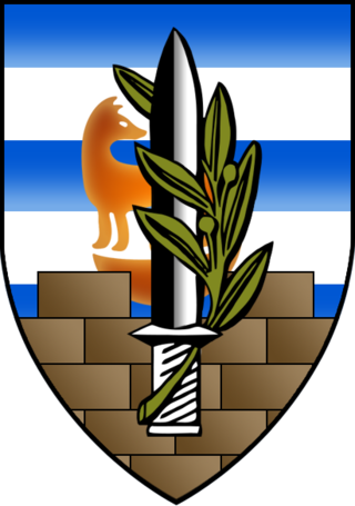
The Shomron Regional Council is an Israeli regional council in the northern portion of the Israeli-occupied West Bank. Thirty-five Israeli settlements fall under its jurisdiction. As of December 2020 the jurisdiction area of the council has a population of about 47,200 people. The main offices are located in the Barkan Industrial Park.
The Coordinator of Government Activities in the Territories is a unit in the Israeli Ministry of Defense tasked with overseeing civilian policy in the West Bank, as well as facilitating logistical coordination between Israel and the Gaza Strip. It operates in collaboration with Israeli governmental and defense officials. COGAT operates under the authority of Israel's Minister of Defense and is led by a major general who is part of the general staff of the IDF. Presently, Major General Ghassan Alian holds this position.

Sebastia is a Palestinian village of about 3,205 inhabitants, located in the Nablus Governorate of the State of Palestine, some 12 kilometers northwest of the city of Nablus.
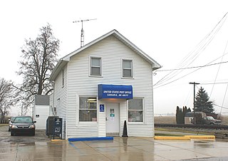
Samaria is an unincorporated community in Monroe County in the U.S. state of Michigan. The community is located within Bedford Township. As an unincorporated community, Samaria has no legally defined boundaries or population statistics of its own but does have its own post office with the 48177 ZIP Code.
Samaria is an historical province in the region of Palestine.

Judea or Judaea is a mountainous region of the Levant. Traditionally dominated by the city of Jerusalem, it is now part of Palestine and Israel. The name's usage is historic, having been used in antiquity and still into the present day; it originates from Yehudah, a Hebrew name. Yehudah was a son of Jacob, who was later given the name "Israel" and whose sons collectively headed the Twelve Tribes of Israel. Yehudah's progeny among the Israelites formed the Tribe of Judah, with whom the Kingdom of Judah is associated. Related nomenclature continued to be used under the rule of the Babylonians, the Persians, the Greeks, and the Romans. Under the Hasmoneans, the Herodians, and the Romans, the term was applied to an area larger than Judea of earlier periods. In 132 CE, the Roman province of Judaea was merged with Galilee to form the enlarged province of Syria Palaestina.

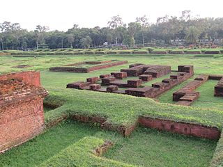
Samaria was the capital city of the Kingdom of Israel between c. 880 BCE and c. 720 BCE. It is the namesake of Samaria, a historical region bounded by Judea to the south and by Galilee to the north. After the Assyrian conquest of Israel, Samaria was annexed by the Neo-Assyrian Empire and continued as an administrative centre. It retained this status in the Neo-Babylonian Empire and the Achaemenid Persian Empire before being destroyed during the Wars of Alexander the Great. Later, under the hegemony of the Roman Republic and the subsequent Roman Empire, the city was rebuilt and expanded by the Jewish king Herod the Great, who also fortified it and renamed it "Sebastia" in honour of the Roman emperor Augustus.

Route 505 is a regional Israeli highway in the West Bank.
Pachim Dhuligaon is a village in Kamrup, situated in north bank of river Brahmaputra.
Pachia is a village in Kamrup, situated on the north bank of the river Brahmaputra.
Naitar is a village in Kamrup, situated in north bank of river Brahmaputra.
Nampara Majarkuri is a village in Kamrup, situated in north bank of river Brahmaputra.
The 1939 Palestine League was the seventh season of league football in the British Mandate for Palestine.
Comilla Sadar Dakshin Upazila is an upazila of Comilla District in Chattogram Division, Bangladesh.

