
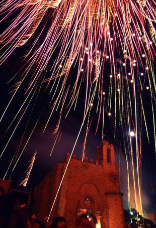
Hidalgo, officially the Free and Sovereign State of Hidalgo, is one of the 31 states which, along with Mexico City, constitute the 32 federal entities of Mexico. It is divided into 84 municipalities and its capital city is Pachuca de Soto. It is located in east-central Mexico and is bordered by San Luis Potosí and Veracruz on the north, Puebla on the east, Tlaxcala and State of Mexico on the south and Querétaro on the west.

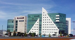
Pachuca, formally known as Pachuca de Soto, is the capital and largest city of the east-central Mexican state of Hidalgo, located in the south-central part of the state. Pachuca de Soto is also the name of the municipality for which the city serves as municipal seat. Pachuca is located about 90 kilometres (56 mi) north of Mexico City via Mexican Federal Highway 85.

Mineral del Monte, commonly called Real del Monte or El Real, is a small mining town, and one of the 84 municipalities of Hidalgo, in the State of Hidalgo in east-central Mexico.

A paste is a small pastry produced in the state of Hidalgo in central Mexico and in the surrounding area. They are stuffed with a variety of fillings including potatoes and ground beef, apples, pineapple, sweetened rice, or other typical Mexican ingredients, such as tinga and mole.

The Municipality of Pachuca de Soto, or Municipality of Pachuca, is one of the Municipalities of the state of Hidalgo, located in east-central Mexico.

Huasca de Ocampo is a town and municipality of the state of Hidalgo in central Mexico. It is located 34 km from Pachuca and 16 km from Real del Monte in the Pachuca Mountains. While the town itself is just within the mountain range, much of the municipal land is located in a valley that opens up to the east of the town. While one of the first haciendas to be established in Mexico is located here, economic development started with mining haciendas built by Pedro Romero de Terreros in the 18th century. By the mid 20th century, none of these haciendas were in existence, having been broken up into communal farm lands and some even fully or partially under lakes created by dams. While agriculture remains important economically, the area has been promoted as a tourism destination, especially for weekend visitors from Mexico City, with attractions such as canyons, traditional houses, old hacienda facilities and waterfalls.

Jilotepec de Molina Enríquez, known as Jilotepec de Abasolo until 1986, and commonly known as Jilotepec, is a city located in the northwest zone of the State of Mexico in Mexico. The name comes from Náhuatl, meaning "hill of corncobs". It is the municipal seat and largest city of the municipality of Jilotepec. It is located in hilly and forested terrain about an hour's drive from Mexico City and the state capital of Toluca, 40 minutes from San Juan del Río, 30 minutes from Tula and 20 minutes from Tepeji. The Mexico City–Querétaro highway and the new Transoceanic Freeways that unite the coasts of Mexico from Veracruz to Michoacán converge within its territory.
Atotonilco de Tula is one of the 84 municipalities of Hidalgo. It is located in the southwestern part of the state of Hidalgo in Mexico. The municipal seat is Atotonilco de Tula. The municipality is located at a southern pass leading out of the Mezquital Valley to 86 kilometers north of Mexico City and about 180 km northeast of the state capital of Pachuca de Soto. The name comes from Nahuatl and means "place of hot springs" and otomi language is Padehe. The municipality covers an area of 31 km².
Omitlán de Juárez is a town and one of the 84 municipalities of Hidalgo, in central-eastern Mexico. The municipality covers an area of 110.5 km².
San Agustín Tlaxiaca is a town and one of the 84 municipalities of Hidalgo, in central-eastern Mexico. The municipality covers an area of 354.6 km2.

Tenango de Doria is a town and one of the 84 municipalities of Hidalgo, in central-eastern Mexico. The municipality covers an area of 210.7 square kilometers (81.4 sq mi).
Yahualica is a town and one of the 84 municipalities of Hidalgo, in central-eastern Mexico. The municipality covers an area of 164.5 km².

El Chico National Park is a protected area in the State of Hidalgo, Mexico. It is one of the oldest protected areas in Mexico, as its foundation dates to 1898 when the then president of the republic, General Porfirio Díaz, by decree, created "Monte Vedado del Mineral del Chico". Since this date, the ancient conifer forests have been protected from the deforestation suffered in other parts of the country. Another decree followed in 1915 and still another by Presidential Agreement on 13 September 1922, which declared Monte Vedado to be cataloged as a forest reservation.

Francis Rule was a Cornish miner who moved to Mexico and became immensely wealthy by using pumping equipment to explore previously flooded and abandoned mines. He found and exploited rich seams of silver and use the funds to form various mining companies.
The Cornish-Mexican Cultural Society is a society that tries to advance awareness of the historical and modern links between Cornwall and Mexico’s “Little Cornwall”, the area of Pachuca and Real del Monte in the state of Hidalgo, Mexico.

The Pachuca metropolitan area is a metropolitan area located in the state of Hidalgo in Mexico. It consists of the municipalities of Pachuca, Mineral del Monte, Mineral de la Reforma, San Agustín Tlaxiaca, Epazoyucan, Zapotlán de Juárez and Zempoala.

The Comarca Minera Geopark is located in the center-south of the Mexican state of Hidalgo. It extends over nine municipalities: Atotonilco el Grande, Epazoyucan, Huasca de Ocampo, Mineral del Chico, Mineral de la Reforma, Mineral del Monte, Omitlán de Juárez, Pachuca de Soto and Singuilucan. These municipalities are articulated by a network of 31 geosites, elected because they express the geological history of the territory and highlight the relationship between mining and metallurgy, and the historical spaces and cultural development of the region. In addition, they are important for science and education and, mostly, have a significant landscape value.
Punta del Cobre Formation is a geologic formation of Early Cretaceous age cropping out in the interior of Atacama Region, Chile. The formation is of Early Cretaceous age. It is made of massive volcanic rocks, chiefly andesite, dacite, and volcaniclastic rocks representing "flows" and Volcanic breccia of basaltic andesitic and basaltic composition. The rocks of the formation belong to the calc-alkaline magma series. Rocks show intense hydrothermal alteration and hosts significant copper and gold deposits and lesser amounts of zinc and silver. The formation lies in a zone of small-scale mining that supplies the nearby Fundición de Paipote copper smelter. The copper and iron ores of the Dominga prospect are in part emplaced in Punta del Cobre Formation.
The economy of the state of Hidalgo is based on the free market, the most recent information places Hidalgo with a state Human Development Index of 0.723 Alto (2015). Hidalgo's gross domestic product was 276,784 million pesos; and contributes 1.7% to the national GDP.

The geography of the State of Hidalgo refers to the physical geography and human geography of Hidalgo, a state in central Mexico.