
The geography of France consists of a terrain that is mostly flat plains or gently rolling hills in the north and west and mountainous in the south and the east.

Dziennice is a village in the administrative district of Gmina Inowrocław, within Inowrocław County, Kuyavian-Pomeranian Voivodeship, in north-central Poland. It lies approximately 6 kilometres (4 mi) south-east of Inowrocław, 36 km (22 mi) south-west of Toruń, and 45 km (28 mi) south-east of Bydgoszcz.
Nowe Gierałty is a village in the administrative district of Gmina Szepietowo, within Wysokie Mazowieckie County, Podlaskie Voivodeship, in north-eastern Poland. It lies approximately 3 kilometres (2 mi) south-east of Szepietowo, 9 km (6 mi) south of Wysokie Mazowieckie, and 51 km (32 mi) south-west of the regional capital Białystok.
Kalinowo-Czosnowo is a village in the administrative district of Gmina Wysokie Mazowieckie, within Wysokie Mazowieckie County, Podlaskie Voivodeship, in north-eastern Poland. It lies approximately 6 kilometres (4 mi) north-east of Wysokie Mazowieckie and 45 km (28 mi) west of the regional capital Białystok.
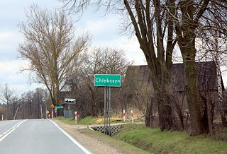
Chlebczyn is a village in the administrative district of Gmina Sarnaki, within Łosice County, Masovian Voivodeship, in east-central Poland. It lies approximately 2 kilometres (1 mi) north of Sarnaki, 18 km (11 mi) north-east of Łosice, and 129 km (80 mi) east of Warsaw.
Nowy Bartków is a village in the administrative district of Gmina Korczew, within Siedlce County, Masovian Voivodeship, in east-central Poland. It lies approximately 5 kilometres (3 mi) south-west of Korczew, 27 km (17 mi) north-east of Siedlce, and 107 km (66 mi) east of Warsaw.
Pióry Wielkie is a village in the administrative district of Gmina Mordy, within Siedlce County, Masovian Voivodeship, in east-central Poland. It lies approximately 9 kilometres (6 mi) south of Mordy, 20 km (12 mi) east of Siedlce, and 107 km (66 mi) east of Warsaw.
Księżopole-Budki is a village in the administrative district of Gmina Bielany, within Sokołów County, Masovian Voivodeship, in east-central Poland.
Patrykozy is a village in the administrative district of Gmina Bielany, within Sokołów County, Masovian Voivodeship, in east-central Poland.
Wańtuchy is a village in the administrative district of Gmina Bielany, within Sokołów County, Masovian Voivodeship, in east-central Poland. It lies approximately 4 kilometres (2 mi) west of Bielany, 9 km (6 mi) south of Sokołów Podlaski, and 83 km (52 mi) east of Warsaw.
Remiszew Duży is a village in the administrative district of Gmina Repki, within Sokołów County, Masovian Voivodeship, in east-central Poland. It lies approximately 7 kilometres (4 mi) south-east of Sokołów Podlaski and 93 km (58 mi) east of Warsaw.

Sawice-Bronisze is a village in the administrative district of Gmina Repki, within Sokołów County, Masovian Voivodeship, in east-central Poland.
Smuniew is a village in the administrative district of Gmina Repki, within Sokołów County, Masovian Voivodeship, in east-central Poland. It lies approximately 13 kilometres (8 mi) south-east of Sokołów Podlaski and 96 km (60 mi) east of Warsaw.
Wasilew Szlachecki is a village in the administrative district of Gmina Repki, within Sokołów County, Masovian Voivodeship, in east-central Poland. It lies approximately 21 kilometres (13 mi) east of Sokołów Podlaski and 108 km (67 mi) east of Warsaw.
Wyrozęby-Konaty is a village in the administrative district of Gmina Repki, within Sokołów County, Masovian Voivodeship, in east-central Poland.
Łazów is a village in the administrative district of Gmina Sterdyń, within Sokołów County, Masovian Voivodeship, in east-central Poland. It lies approximately 18 kilometres (11 mi) north-east of Sokołów Podlaski and 100 km (62 mi) east of Warsaw.
Łazówek is a village in the administrative district of Gmina Sterdyń, within Sokołów County, Masovian Voivodeship, in east-central Poland. It lies approximately 19 kilometres (12 mi) north-east of Sokołów Podlaski and 102 km (63 mi) east of Warsaw.
Półwiosek Lubstowski is a village in the administrative district of Gmina Ślesin, within Konin County, Greater Poland Voivodeship, in west-central Poland. It lies approximately 3 kilometres (2 mi) east of Ślesin, 18 km (11 mi) north of Konin, and 97 km (60 mi) east of the regional capital Poznań.
Olszewo is a village in the administrative district of Gmina Środa Wielkopolska, within Środa Wielkopolska County, Greater Poland Voivodeship, in west-central Poland. It lies approximately 4 kilometres (2 mi) south-east of Środa Wielkopolska and 35 km (22 mi) south-east of the regional capital Poznań.
Mariópolis is a municipality in the state of Paraná in the Southern Region of Brazil.


