Udumbanchola is a taluk in Idukki district of the Indian state of Kerala. This is in the high ranges. Nedumkandam is the major town and capital of Udumbanchola taluk. Mathikettan Shola National Park is located in Udumbanchola.
Kadannapalli is a census town in Kannur district of Kerala state, India.

Badiyadka officially known as "Badiadka" is a town and gram panchayat in the Kasaragod district, state of Kerala, India.

Karadka is a village, block panchayat and grama panchayat in Kasaragod district in the state of Kerala, India.
Karindalam is a village in Kasaragod district in the state of Kerala, India.
Kinanoor or Kinavoor is an ancient Village capital situated in Sahya Hill area of Kasaragod district in the state of Kerala, India.It is situated between Nileshwar and Parappa.
Vorkady is a Gram Panchayat in Kasaragod district in the state of Kerala, India.
Meenja is a grama Panchayat in Manjeshwaram Taluk of Kasaragod district in the state of Kerala, India. It consists of 7 revenue villages. Kaliyoor, Koliyoor, Talakala, Meenja, Kadambar, Moodambail and [Kuloor]
Edanad is a village in Manjeshwaram Taluk of Kasaragod district in Kerala, India.
Mugu is a village in Manjeshwaram Taluk of Kasaragod district in Kerala, India.
Parappa is a village and block panchayat in Vellarikundu taluk of Kasaragod district in the Indian state of Kerala.
Adoor is a village in Kasaragod district in the Indian state of Kerala. Adoor is located 38 km east of Kasaragod town and 7 km away from State Highway 55 or Cherkala-Jalsoor road.
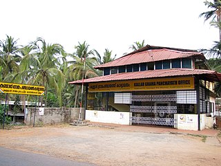
Kallar is a village in Kasaragod district in the Indian state of Kerala. Kallar is located on Kanhangad-Panathur road of 40 km south east of Kasaragod town and 27 km north east of Kanhangad.
Bare is a census town in Udma Grama Panchayat of Hosdurg taluk in Kasaragod district in Indian state of Kerala.
Bela is a village in Kasaragod taluk of Kasaragod district in Indian state of Kerala.
Kolthur is a village in Kasaragod taluk of Kasaragod district in Indian state of Kerala.
Belur is a village in Vellarikundu taluk of Kasaragod district in Kerala, India.
Perole is a census town and part of Nileshwaram Municipality in Hosdurg taluk of Kasaragod district in Kerala, India. Perole is located 1.5 km east of Nileshwaram town.
Thimiri is a village in Hosdurg taluk of Kasaragod district in Kerala state, India. Thimiri is located 3 km east of Cheruvathur on Cheruvathur-Cheemeni road.
Belur is a Village and a Grama Panchayat in Kasaragod district in the state of Kerala, India.
